Post by Corrine
Just five trail signs?! That’s it?!
That’s what it said in the rules of the Fairbanks Winter Trails Challenge. Isn’t that like age discrimination or something? OK, maybe that’s a bit unfair. After all, nobody is stopping us from getting all 20 trail signs. Well, except us.
As we have done several times in the past few years, we did the Fairbanks Trails Challenge. The summer and winter Trail Challenges are the brainstorm of Fairbanks Borough Parks and Rec Department. Department employees post signs on trails throughout the borough. The challenge is to find as many of the signs as you can before the challenge is over. The general challenge is to find at least 10 signs to win the “coveted Trailblazer Award,” but “Participants under the age of ten can find at least five signs to win the Junior Trailblazer Award, and seniors aged 60+ can find 5 to win the Sourdough Trailblazer Award!”
 |
| Showing off the antler arch at the Chena River Walk |
I’m 63 and Eric is 62. Were we ready to settle for the minimum five signs? Or even just 10 signs?
In the past we’ve tried to do ALL the signs…in one day. And we succeeded. But after they increased the number of signs in summer from 12 to 20, we had to adapt. In 2021 we did the summer trails challenge in 36 hours.
But to do a 20-sign Winter Trails Challenge in one day? In the cold and dark? On trails that can be soft and slow? Maybe we were too old for this. We started asking ourselves “What’s the point?”
 |
| Eric skis up the partially groomed 5km Ski Loop at Two Rivers |
A Reason to Strive
The trail challenges are a way to get people out exercising and exploring trails. We love those goals! We know all about the benefits. Having access to all these wonderful trails is one of the things we love most about Fairbanks. But we exercise regularly on trails anyway. And we’ve been on most of the trails featured in the challenges at least once. So, is there any real challenge for us?
Yes! For us the challenge is mental and physical. And to show that seniors can still be tough! Or, at least, tough-ish.
 |
| Corrine skis across an open area on the Chena Hot Springs Winter Trail |
Mental Challenge
The first part of the challenge is mental. I looked at the Trails Challenge Guide and decided we would have to adapt again. This time we tossed out the two trail signs that would require the most time: the Compeau and McKay Creek trails. Both would require 11 to 18 trail miles roundtrip with a lot of uphill effort. And the McKay Creek Trail sign would require a couple of hours of extra driving. And we plan to do these trails with other adventures later this winter. Were we being wimps? Probably, but at least we would be practical wimps. Maybe we aren’t as tough as we used to be, but we are wiser.
 |
| Eric skis along the Chena River on the River Park 4 km Nature Trail at Chena Lake |
Next was choosing when. I had to look at all our other plans, which limited the number of available days. And, since we are only tough-ish, we wanted a day that would have good trails and good weather. None of this frigid temps, slow trails stuff for us! Too late in the season and you might run into overflow or icy ski trails. Picky, picky, picky. Not long after beginning to ponder, I saw that Saturday, January 28, would work. That week we decided to go for it.
 |
| Corrine starts up the 5km Loop Trail at Two Rivers |
Figuring Logistics
Now, what mode or modes of transport would we use? Some of the trails in the challenge are ski-only, others are multi-use. So, ski and bike? But is dealing with the hassle of changing boots and carrying fatbikes worth it? We knew the trails might be soft from recent snowfalls. We decided to go for ski only. (And a little bit of walking.)
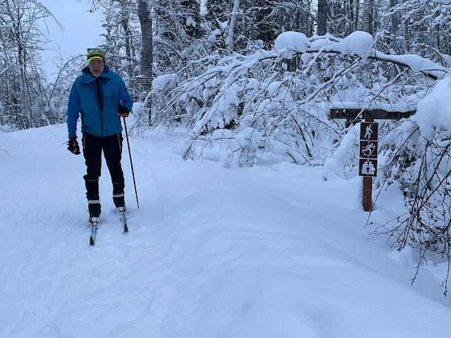 |
| Eric finishes up the Eagle Trail at Tanana Lakes |
But the mental challenge continues! Doing all (OK, almost all) the trails in a day requires lots of planning. Hours and hours. (Well, at least an hour!) Using Google Maps, I figured out the most efficient driving route. But then I had to take in other factors: the Big Dipper Arena and the gates at Tanana Lakes and Birch Hill recreation areas are open only during certain hours. Eric reminded me that a big ski-cross race on Saturday at Birch Hill Recreation Area was sure to draw lots of people. We wanted to avoid that. I finally figured out an efficient route that would work with all the limitations.
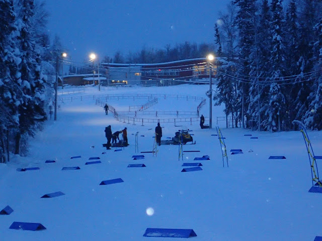 |
| We got to Birch Hill as they were setting up for the ski-cross races that would happen a little later |
But our senior brains were not done yet. Now we had to data mine. We had seen a few trail signs on other outings, but we hadn’t seen them all. Eric started to get more involved. We both scoured the Internet, especially Facebook and Strava posts, for clues on sign placements. We also read the Trails Challenge Guide descriptions for clues. We looked for shortcuts and the quickest trail routes to signs based on these clues. (For one of the signs in the Chena Lake Recreation Area, Eric figured out a possible shortcut based on the guide, a Facebook pic, and a summer bike ride we had taken in the area.) We wanted to save as much time on the trails as we could. Sure, we wanted to enjoy them, too, but we were on a mission! We were defending the honor of all tough-ish seniors! By the time we hit the road, we were pretty sure where most of the signs were.
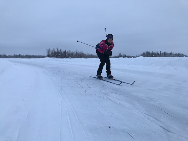 |
| Corrine hams it up on the Skate Loop at Tanana Lakes -I wished we had nordic skates |
Physical Challenge
Now for the big day. We decided to get on the road by 6 AM. We were pleasantly surprised to see the temperature around 12-15 degrees above zero. I packed a lot of warm clothes, but I’m happy to say, I didn’t need any of them. Throughout the day, it just kept getting warmer and warmer. Eric had to rewax with warmer kick wax as his skis were a little too slippy. Halfway through the day we had some very fine mist that froze to our clothes and car. Luckily, the roads and trails didn’t get too slippery, and we were able to finish without any major mishaps.
 |
| Skiing by headlamp on the Upper Eldorado Creek Trail |
We started with headlamps on the Eldorado Creek Trail, one of our neighborhood trails. Then it was off to the Skarland Trail sign (which was quick due to a shortcut we had figured out), then off to Pearl Creek trails and then Secret Trail (which we were able to do mostly on skis due to intel we had gathered). Next was Birch Hill, where they were still setting up for the race, and then Creamer’s Field (where we spent a bit too much time because we tried to outthink the challenge organizers), then Smith Lake and Tanana Lakes. Our two walking signs, Big Dipper and Chena River Walk took only a short time, then we had the long drive out to Chena River State Recreation Area (with a stop for snacks along the way). Then Two Rivers Ski Trails on the way back and out to Chena Lake Recreation Area.
 |
| Corrine skis by the barn at Creamer's Field on the East Farm Field Loop |
Here, Eric was quite pleased that his shortcut-on-paper worked out. First we nabbed the 4 km River Park sign. Then we continued on and using a dam right off the 5.5-Km Ski Trail in the River Park, we crossed over to the Mike Agbaba 12-Mile Loop, having to do only a little post-holing. (We saw no “No Trespassing” signs on the dam, so we figured it was OK.) The sign was where Eric had guessed it would be, based on a Facebook photo! That saved us a couple of hours of skiing. Yay! Of course, on the way back Eric figured it would be just as fast to finish the 5.5-km trail rather than head back on the 4-km trail. It wasn’t, but it was a pretty quick ski and fun to complete a loop.
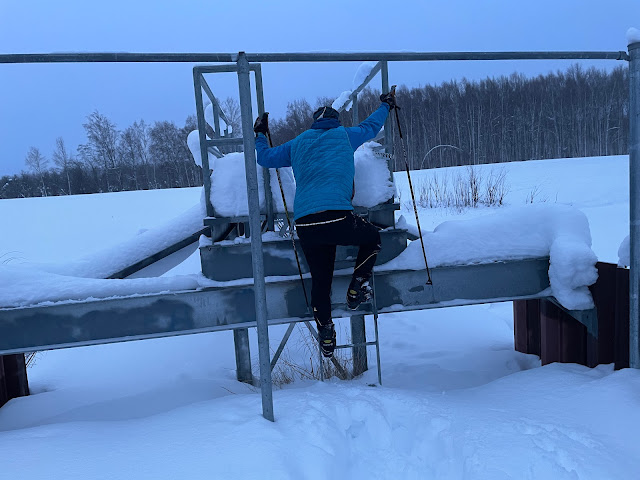 |
| We climbed up on the dam |
 |
| Post holed across it |
 |
| Then had to squeeze through the gates on the other side while balancing on a thin barrier |
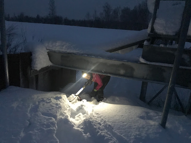 |
| On the way back, we crossed the lower part of the dam, ducking under these girders - much less scary |
Senior Moments
By this time, we were getting tired and it showed. We drove right by Salcha Elementary School in the dark and didn’t realize it until we had gone 15 miles too far! At the school, we didn’t carefully look over the guide description before taking off. We got out on the trail and couldn’t remember if the sign was on the 5km or 7.5km trail. Not a big deal if you’re fresh, but we were really tired by then. Fortunately, I remembered it was the Grizzly Loop, and a sign pointed us in the right direction. My senior brain still had some life left! When we got back to the parking lot, Eric realized he had forgotten to start his Garmin watch when we started skiing. Argh! Eric’s senior brain was mush!
 |
| Corrine zooms down the Grizzly Loop at Salcha |
We finished the day at the Beaver Springs Slough Nature Trail in North Pole. Had we been less tired (or less senior) we might have first checked the short loop the trail takes through 5th Avenue Park rather than skiing the whole rest of the trail and back before finding the sign about 50 yards from where we started! Ah, well. Even in our tired state, we enjoyed skiing the trail.
Senior Celebration
We finished the day in fine senior fashion by stopping for a quick meal at McDonalds in North Pole. (After a day of convenience store snacks, we were ready for “real-ish food”!) What a great day on the trails! Over the 16 hours we put in about 30 miles on the trails, almost all of it skiing, and about 250 miles of driving. We were tired but happy. We were glad we had left the bikes at home. The trails were soft from recent snows, but they had all been groomed or snowmachined fairly recently, making for many great ski outings!
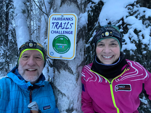
Selfies at each sign are no longer required for the trails challenge, but we took them anyway, including one at each sign with silly faces because it’s all about fun, right? At the last one though, we took a selfie while we shared a kiss. Because what could be more romantic than a tough-ish senior couple doing something ridiculous but fun?

