
Should I stay or should I go?
I rode back and forth through the small town of Quilcene, Washington, trying to decide. It was only 5:30 PM, plenty of daylight for more riding. I had gone only 60 miles that day, well below my minimum goal of 100 miles. But my legs were so tired, and it was so hot. Only the second day of my own Cross Washington Bikepacking Route race and I was agonizing over decisions.

Part of the problem was this: Could I find a place to sleep if I continued? I had no idea. Quilcene had a hotel. I cycled back to the hotel, changed my mind, turned around, rode out of town, then a half-mile up the road turned back to town again. Decisions, decisions!
Across Washington Off Pavement
The Cross Washington Mountain Bike Route (XWA), created by Troy Hopwood, crosses the state of Washington, west to east, mostly on gravel roads and trails (including over 50 miles of singletrack). It starts in La Push at the Pacific Ocean, ends at the Washington-Idaho border near Tekoa, and includes a ferry ride.

Troy organizes a Grand Depart in late May. I had planned on joining in, but this year, due to an extremely wet and cold spring, many passes were still under snow. Troy devised a low route just for such conditions. I didn’t savor the idea of pushing my bike for miles through rain and snow. Plus, I’d rather do the high route, which sounded much more scenic. Should I stay or should I go? I stayed home in May, opting to try the course a month later by doing an Individual Time Trial (ITT). I would have to ride by myself, but I should have better weather.

When I do bikepacking races, I normally schedule a week buffer to give me extra time to finish and recover. Unfortunately, due to work constraints I had only 7-8 days to do the more than 700-mile route. Still, I have done several bikepacking races and usually average 90-100 miles per day. It would be tight, but I could make it. . . I thought.
Day one – Life is Beautiful

Day one was beautiful. Uncommonly sunny for the Olympic Peninsula, but not too hot. I climbed through the Olympic National Forest on forest service roads. I was all alone amid blooming wildflowers and crystal-clear skies. After a quick lunch at the high point, I bombed downhill. Then something big and black ran out on the road and around the corner about 20 yards ahead. It took a second for me to realize it was a big black bear. I slowed and heard crashing in the brush but couldn’t see around the corner. Where had the bear gone? I stopped. Should I stay or should I go? I blew my whistle and waited a few minutes. When I didn’t hear anything more, I continued. Well, that was exciting! I saw more bear scat and descended slowly, not wanting another close encounter.

The route connects to the Olympic Discovery Trail (ODT), a flattish route across the north end of the Olympic Peninsula that includes some paved, multi-use trail. That trail was fun and fast! And amazingly devoid of people…until I got to Crescent Lake, where I found the weekend tourists. The last two miles along Crescent Lake I must have passed close to 100 people!
 |
| Along Crescent Lake |
I lost most of those people when the route turned onto the Olympic Adventure Trail (OAT), probably my favorite part of the entire route. The 20 miles of incredible buffed-out singletrack was slower than the ODT but was so fun and rideable!

 |
| Lots and lots of switchbacks on the OAT |
After the OAT, I was back on the ODT all the way into Port Angeles. Eric was staying with friends there and met me at McDonald’s, where I grabbed a quick dinner of “real food” before riding flat, paved trails to a hotel in Sequim. I had done 112 miles in 15 hours. Right on track.

Day 2 – This is Hard!


Day 2 sucked away my fun. It was hotter and with steeper climbs (like 9-13% grades). I climbed over 6000 feet in the first 30 miles! That was followed by about 10 miles of the singletrack Lower Big Quilcene Trail that was rooty, rocky, narrow and with steep drop offs. I had to walk at least half. When I got to Quilcene I was toast. I had gone less than 60 miles, but it had taken 12 hours. After a lot of “should I stay or should I go,” I finally spent the night at the hotel, planning to make up the lost miles later in the route.

 |
| Some of the more rideable portions of the Lower Big Quilcene Trail |
Day 3 – This Route is Amazing!

It was the right decision. The 45-mile portion from Quilcene to the ferry had a lot of climbing. I made much better time on rested legs in the cool of the morning than I would have the night before. Day 3 was another wonderful day. I got to ride more incredible singletrack before getting to the ferry, which I got to just as it was loading. Unfortunately, the ride was way too short. I barely had time for a snack before it was time to disembark into the Seattle metropolitan area.

I had been worried about this section. So much city to ride through! But I was truly amazed at what Troy put together. So many bike paths (Burke-Gilmore, Tolt-Pipeline, East Trail, Sammamish River Trail, PSE Trail) and so many green park areas. I was almost never on roads and never for very long. It was so fun! (Except for a mile long push up in Blythe Park. Ugh!)
 |
| On the Burke-Gilmore Trail |
 |
| See the trail climbing way off in the distance? Yes, we had to go up that! |


In Redmond the route follows paths through greenways in between subdivisions. I was on a trail very close to houses when I saw a black cat. Whoa! Not a cat, but a black bear cub! Oh, oh! Where was mom? I stopped, blew my whistle, and yelled. The cub, unfazed, sauntered into the woods. I waited a few minutes but never saw momma, so I went on. I had passed several families with children just minutes before. I assume (hope!) they know they live near wildlife here.
 |
| Fuzzy view of bear cub. You can see the posts just beyond the bear where the road and subdivision are at |
After 95 miles with a final two-mile gnarly downhill singletrack I ended up at the Tolt-McDonald campground where I set up my tent for the night. I hadn’t made up any distance, but I hadn’t lost any either. And it had been a super fun day.
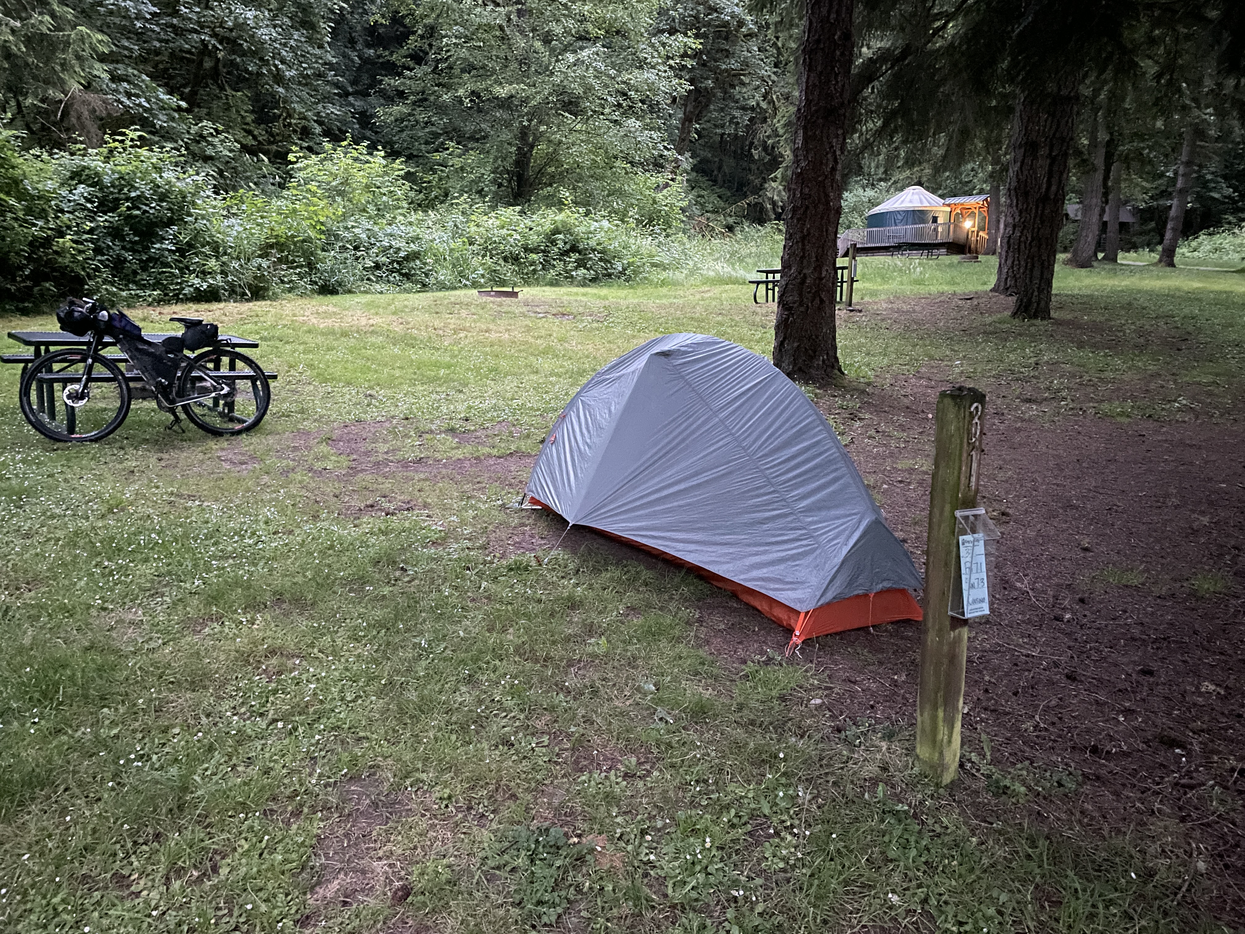 |
| Only night I ended up camping |
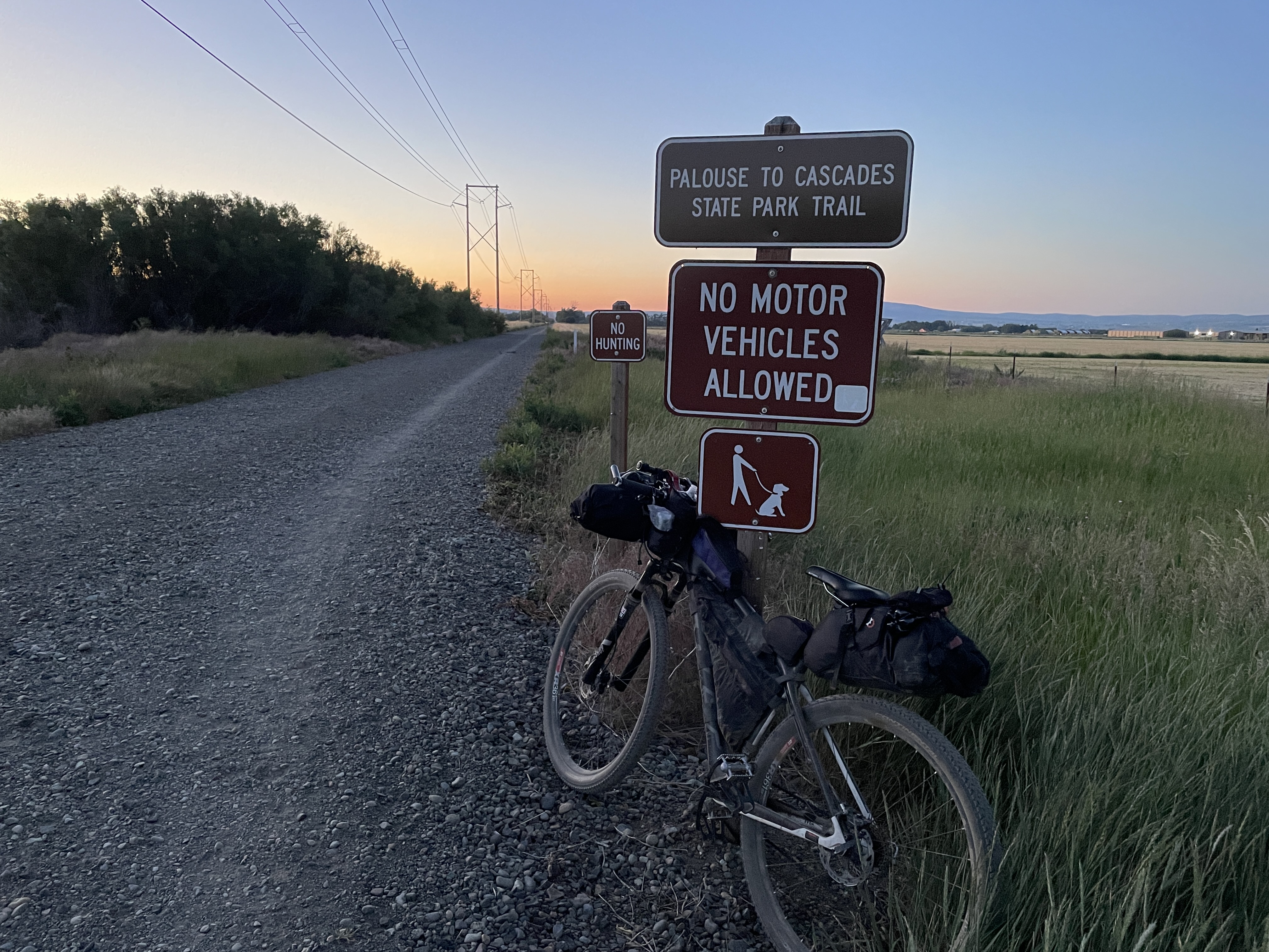
Day 4 – Not a Huge Fan of Rail Trails – But the Tunnel

From here, much of the route follows the Palouse-to-Cascades State Park Trail – a rail trail that follows the path of the old Chicago-Milwaukee-St. Paul-Pacific Railroad. Rail trail grades are gentle, but I forgot how bored I get climbing at a 2-4% grade for miles and miles. I prefer the variety of ups and downs. Unfortunately, the trail is also near I-90 so I could hear and see the highway for most of the way. The weather was misty and cloudy on the west side of the pass so the views weren’t as spectacular as they could be, but it was still beautiful with lots of greenery and waterfalls. I listened to an audiobook to help pass the miles.
 |
| I-90 just below the rail trail |

One nice thing about this rail trail is the 2.3-mile Snoqualmie Tunnel. I had been looking forward to biking through it. The tunnel was cold and dark and a little spooky, but my experience was different than I expected due to several groups of school kids that were starting through the tunnel just as I was. I quickly made my way through instead of savoring the experience. But it was still fun.

I rode out of the other side of the tunnel into the sun. I now had a 2% downhill grade all the way to Cle Elum. I got excited as I was hoping to meet some Strava friends, Brian and Janet. I had friended Brian on Strava after he won the 2017 Tour Divide. He and his wife do amazing bikepacking trips around the world. They are from California, and Brian has been intrigued with our Alaska fatbiking-on-snow adventures. They were on a three-week trip around Washington and Canada and their route lined up with mine, so we hoped to meet today. And we did, about halfway to Cle Elum. Brian was surprised that I stopped to chat for about 45 minutes – after all I’m supposedly racing – but I really wanted to meet them, and I’m always happy to have an excuse to stop. Hopefully, I can convince them to come do a White Mountains cabin trip in the in the spring. Finally, we said our goodbyes and I bombed down to Cle Elum, where Eric met me as I made a food stop at Safeway.

 |
| I stuff my face as I try to decide what to do next |
Now I had to make a decision I had been mulling over all day. Should I take the high road or the low road? The original XWA route (the high route) leaves Cle Elum, heading up into the Cascades. The low route heads through Ellensburg. Both end up in Wenatchee and are about 80 miles, but the high route has 11,000 feet of elevation gain compared to 7,000 for the low route. The high route would be more scenic, but I might not be able to finish the whole route with my time constraints. And I didn’t know the condition of the high route. Would it have a lot of downed trees? Washouts? The Grand Depart riders had taken the low route due to snow. And I hadn’t slept well the night before. The low route meant an easy 25 miles to Ellensburg and a hotel.

I decided finishing the race was more important, so I opted to do the lower route. I think it was the right decision. Eric later told me he did a mountain bike ride along the high route the next day and climbed 3000 feet in three miles. He said the views were spectacular, but I know I would have had to push my bike a lot. I probably wouldn’t have finished the whole route in time. I’ll have to come back and ride that section another time.
 |
Day 5 – This Race is Really Tough!

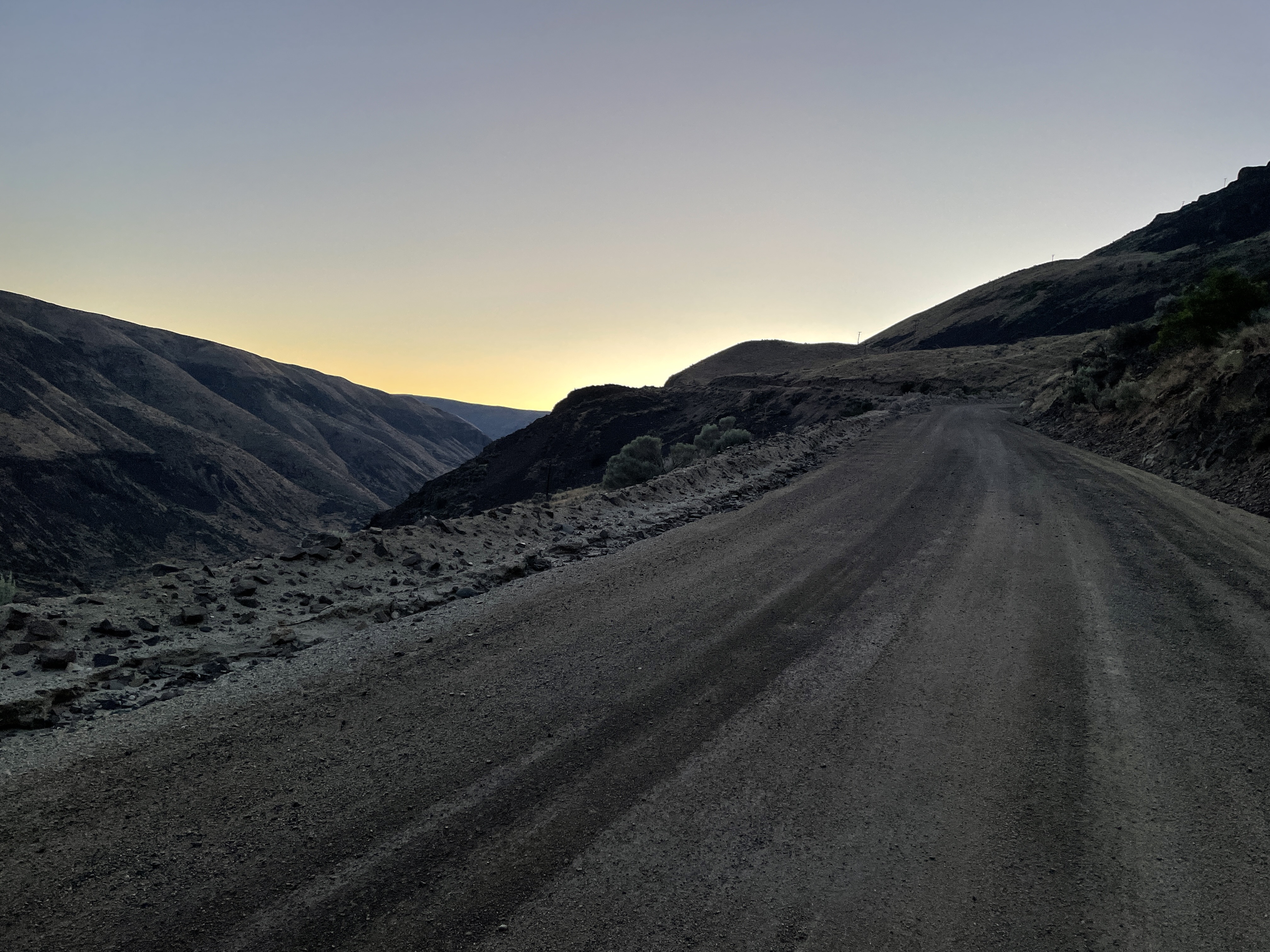
I hoped to make up time on day 5 but it was another really tough day. Come to think of it, just about every day on the XWA was tough! I got up early and was biking by 4:15 AM. It was supposed to be another scorcher, but I was shivering as I started. I checked my Garmin thermometer: only 40F. Brrr! I decided to savor the cold as I knew I would be hot later. I soon started the climb into the Colockum Wildlife Area. It was beautiful but tough. Lots of rocky and steep trail that I couldn’t ride up or down. Even though I was moving abysmally slow, I was enthralled by the views. I looked over to the west to see Mt Rainier and Mt St. Helens. I had no idea you could see them from here. And the wildflowers were in full bloom.
 |
| Mt. Rainier from the Colockum |
 |
| Wildflowers in full bloom - so many different species |

And as I started my final climb, I saw a herd of over 100 elk. They looked at me curiously and were bugling, which is really high-pitched. (How can such majestic animals make such a silly squeaky noise?) We were moving in the same general direction, so I got to watch them for a while. I had never seen such a huge herd of elk before.

I finally made it to Wenatchee, covering the 65 miles in 12 hours. I knew I should push on another 30-60 miles to make my 100 miles a day goal, but it was so hot – over 90F – and I had a big climb out of Wenatchee. And I was wiped out from the heat. Wouldn’t it be better to stop, sleep in a hotel, and bike when it was cooler? Should I stay or should I go?
 |
| Final descent to Wenatchee |
I used math to make my decision. I had 300 more miles to go, but after the big climb out of Wenatchee, the route was less hilly. If I could get to Othello in one day (130 miles), I could sleep a few hours in a hotel and make a 170-mile, 24-hour push to the finish. I had to finish by 6 AM Sunday morning to give Eric time to take my bike apart, drive back to Seattle, and still be able to make our plane flight home. I wouldn’t be able to shower, but I might be able to finish. Was I up for it? I decided to try.
Day 6 – Bikepacker to the Rescue!
I was biking by 3:15 AM on Day 6. I had the huge climb out of Wenatchee, where I got to see the sun rise, then lots of ups and downs on the Palouse. Then it got really hot. Ugh!
 |
| Biking past fields of wheat on the Palouse |
 |
| Following the tracks of previous bikers |
As I headed down into Douglas Creek canyon, I saw a van stuck in a mudhole in the narrow road. Out stepped 60-year-old Katherine with her two dogs. She had been stuck there for TWO DAYS! The area had no cell service, so she couldn’t call for help and no one had come by. She had plenty of food and water, as she had planned to camp, but she was starting to get worried. She was definitely happy to see me! She gave me her family’s information, so I could contact them when I could call.
 |
| Uh Oh! |

I biked another five miles out of the canyon, but still no cell service, so I stopped at the first house I came to. A sweet, older lady let me use her phone to call Katherine’s family. I gave them my cell number and we had several more calls and texts back and forth once I finally got into cell range to figure out where exactly Katherine was and how to get her rescued. I heard later that night that she had gotten out, but I never learned any more details. It was a great distraction, although I probably lost over an hour of time.
 |
| Even after getting out of the canyon, I didn't have cell service until I got to the top of road far off in the distance |
After that it was lots more hot riding. I had seen hardly anybody all day, but then I rode through the Grant County Sand Dunes and ORV Park just south of Moses Lake. On a Friday night. On a holiday weekend. What a zoo! RVs were parked side by side. Everybody had a motocross bike or dune buggy or four-wheeler and everyone was racing back and forth. It was like a scene out of Mad Max! I was the odd one out, and they seemed to look at me like I was an alien. I was very glad to get past there and back into the quiet of the Columbia National Wildlife Refuge.

I opted to not swim in the Carp Pond (inside joke for XWA racers), taking the slight hike-a-bike route around that swamp, but I ended up with hundreds of scratchy grass seeds embedded in my socks. I pulled some out before making my way through the Seep Lakes wildlife area, finally getting to Othello just after dark. Eric came out to greet me in the Seep Lakes area, as he had decided to spend the night in Othello, too.
 |
| Unlike the Kato's, I opted to go around and not through the Carp Pond! |
 |
| Sunset in the Seep Lakes area |
Day 7 – Can I Stay Motivated?
 |
| 1:30 AM selfie - I've been on the go for over 22 hours already |
I needed a few hours of sleep before the final push. After a quick shower and dinner, I slept a few hours but was back on the road by 3:15 AM. I had to ride 180 miles in 27 hours. Surely today would be an easier day?

Soon I was back on the Palouse-to-Cascades trail, but it was terrible. Several inches of loose pea gravel. I let some air out of my tires, which helped, but it was still horrible, slow, bumpy riding. And there were gates every few miles. I had to stop, lay down my bike, unlock the gate, take my bike through, and then relock the gate. Again and again and again. I was moving so slowly. Did I want to do this for another 120 miles just to say I finished? I almost had a meltdown, but I decided I wanted to finish, so I told my brain to shut up. I listened to an audiobook to distract me again.

 |
| Lots and lots of gates like these. Often it was hard to get the locks to work, too. |
Then I had a great idea. Maybe Eric could change our flights to later on Sunday or Monday morning! I had to be back at work on Tuesday morning, so we had the time. (I know, why didn’t I think of this earlier – I must have been brain dead from fatigue and heat!) I texted Eric, and he decided to meet me in Ritzville, one of the last places to resupply, to talk about it. At the same time, I had a text from my bikepacking friend, Linda, that she and her wife were headed to the Tri Cities and might meet me at Ritzville, too.
 |
| Linda and Constance meet me in Ritzville to cheer me on |
We all ended up at the Ritzville Love’s truck stop within five minutes of each other. It was a zoo there with holiday traffic and we added to it. I had to charge up my electronics, eat lunch, get food and water and try to figure out logistics. It was great to see Linda and Constance and Eric, but I sure wasn’t very efficient in my stop. Oh well, what’s a few more minutes?

Eric changed our tickets, so at least that pressure was off, but I still wanted to see if I could finish by Sunday morning in under 7 days. So, I said goodbye and took off into another really hot, afternoon. Luckily, I was off the rail trail, with its pea gravel and gates, and on better gravel roads for a while before getting back on the rail trail, which seemed better farther along. I missed a turn and had to backtrack two miles, but that was really my only navigation mistake. That turn took me off the rail trail and back on gravel roads with lots of big ups and downs.
 |
| Breeden Falls off the Palouse to Cascades Trail |
By 5 PM clouds started building all around me and I could hear the low rumble of thunder. It was still sunny above me, so I stopped for a quick bite to eat but started moving again wondering if I was going to get rained on. I still had a bit of climbing to do and made it up the last big climb just as it was getting dark. I bombed down to Pine City before the rain caught up to me. I got my rain gear on just in time for it to start raining and thundering and lightning. It was never too heavy or scary, but some of the thunder and lightning was fairly close. The worst moved off, but it continued to rain until I got to Rosalia, about 35 miles from the finish, at 2:30 AM. I found the city park, napped in the heated bathroom for 20 minutes, and tried to eat something – I had lost my appetite in the last half of the day. Finally, I got back on my bike, ready for the final push to Tekoa. The rain had stopped, but thunder and lightning continued off toward the east until about 7 AM. My own private July 4th celebration courtesy of Mother Nature!

The Finish

The first 10 miles out of Rosalia, I moved fast. The rail trail had improved, and I had a tailwind, but then things slowed. I had to walk through some muddy areas, and the tailwind turned into a headwind. But I continued to make pretty good time. I knew I was going to finish, and maybe I could still finish in under 7 days. I crossed the Tekoa Trestle at around 5:30 AM. But Troy doesn’t make the last park of the route easy. Tekoa is only about a mile from the Idaho border, but the route follows the rail trail northeast to the border and then south along a road along the border before finally turning back to Tekoa. So, I had another 10 miles to do.

 |
| View from the Tekoa Trestle |
Could I ride that in an hour? Maybe under perfect conditions, but the rain overnight was enough to turn half of the final miles to a mud pit. It’s mud that sticks to your bike and keeps you from turning the cranks. I had to drag my bike through the roadside grass. I knew I would finish, but that mud killed my hope of doing it in under 7 days. Oh well, nothing to do but embrace the suck and keep walking.


Just as I was about to turn south on the border road at the Idaho border, I saw somebody in a truck waiting for me. It was John Heaton. He is a biker and farmer who lives in the area and has started coming out to meet most of the XWA riders. I wasn’t sure I would see him as it was about 7 AM on a Sunday morning, but there he was, smiling and cheering me on and taking my photo! He made me feel like a rock star!
 |
| John Heaton |
After that I just had to ride the border road back to the end. I hoped for an easy few miles. But no, the XWA was not done with me. Nobody had warned me about the huge rolling hills that I still had to get over. Down and then up and then down and then up, over and over again. Even after turning back west toward Tekoa, there were still a few more rollers to get over. I was able to bike up most of them, but my legs were tired. I occasionally had to get off and walk.
 |
| State Line Road with lots of rollers |
Finally—finally!--I was over the last one and down into Tekoa. Both Eric and John were there to capture the moment and cheer me on. I did it. According to Strava, it took me 7 days, 1 hour and 30 minutes to ride 745 miles with 48,000 feet of climbing. Not my hoped-for goal, but I’ll take it.


As we flew home the next morning, I kept thinking about the race. It was an amazing course and was 99% rideable even for somebody like me who isn’t great at technical riding. I got to see and experience so much of what Washington has to offer. Having that time limit hanging over my head made for a more stressful ride, but it did keep me motivated. And it allowed me to once again see that I can do more than I think I can. We all can. But next time (if there is one), I’ll be sure to add more buffer time to my vacation.
Next time? Did I say that? Hmm. Should I stay or should I…?
 |
| I try and fail to get my bike up above my head! |
Wow, great job on the race and great write up! The photos really show the full spectrum of the course. That OAT trail looks especially fun. But, wow, you sure had your work cut out for you between the climbs and time constraints and the heat!
ReplyDeleteLove the sad faces contrasted with the happy faces, even in the same day- it shows the reality of bike packing so well!
Thanks again for sharing your journey with us, and congrats on an amazing race!! Your last day was epic- and that mud!
Haha! Thanks Andrea! Definitely highs and lows when bikepack racing!
DeleteThis last comment was from me. Not sure why it published as anonymous!
DeleteGreat write-up, Corinne, and even better accomplishment. Thanks!
ReplyDeleteCongrats to you and your crew! You are so tough. And a kindred soul to Fairbanks' own Ev Wenrick. One of his catch phrases (and also yours): "It's always right to go."
ReplyDeleteGreat report. It was fun to see the spectrum of photos in one post — illustrates the diversity of the route. Congrats again!
ReplyDeleteThanks, Jill. You would love this route - Except maybe not the far east portion!
DeleteGreat effort and report!
ReplyDeleteThanks, Doug. It was challenging but fun!
DeleteSimply amazing! What an inspiration!
ReplyDeleteThanks, Patrice!
Delete