Sunday, October 27, 2019

New Non-Motorized Trail in Chena Rec Area Ready for Use

Story written for the November 2019 Interior Trails Newsletter

The Mastodon Trail, the newest trail in the Chena River State Recreation Area, is open and ready for use.
The non-motorized trail will be groomed and maintained by the Division of Parks and Outdoor Recreation, including during the winter.
      “The plan is to routinely drag a tire and cut out blow downs over the winter,” Superintendent Brooks Ludwig wrote in an email. “With all the fire scars we anticipate a lot of trees falling into the trail.”
      Much of the trail goes through recently fire-scarred land. As of October 26, it was mostly cleared of fallen trees, but a few covered or partially covered the trail near its far end. The trail has incredible views due to the burns.
      “Mastodon Trail stays high contouring the hillside offering many scenic views of the valley and surrounding hills,” Jon Underwood, the contractor who built the trail, wrote in an October 11 post on the Alaska State Parks Facebook page.
Corrine riding the ridge on the way to the Nugget Creek Cabin. 
Eric arriving at the Nugget Creek Cabin.
Corrine walking her bike down a section that Eric foolishly tried to ride.
The last mile or so to the cabin had quite a bit of tree-fall.

      The Fairbanks Daily News-Miner recently had a story on the trail: https://tinyurl.com/y53pljbh
      The trail, which begins at mile 38.6 Chena Hot Springs Road, is about 13 miles long and ends at the Nugget Creek Cabin. Previously that cabin had been accessible only via the South Fork Winter Trail or the little-known and difficult Mist Creek Trail. Now the cabin will be accessible year-round. (See more on the cabin at: https://tinyurl.com/y2yuxrg9.) State Parks is partnering with The Folk School Fairbanks to build a new cabin that will be placed near the old cabin, but a little higher on the hillside. The old cabin is slowing sinking and will eventually be torn down, but for a while there should be two cabins available there. The News-Miner also had a story on the cabin project: http://tinyurl.com/y6e4z2vq

      Winter trail users should be aware that the trail has some icy spots about a quarter-mile on either side of the bridge over Mastadon Creek, at about 3 miles.

      One of the challenges for state parks will be to educate motorized users that the trail is for non-motorized use only. The trail is in a section of the recreation area designated for non-motorized use and the funds used to build the trail require that it remain non-motorized. The recreation area has several motorized trails, including the winter-only South Fork Winter Trail, which also accesses the Nugget Creek Cabin. Most other motorized trails are north of Chena Hot Springs Road.
      The addition of the trail adds a new possibility for non-motorized winter users. By connecting the Mastodon Trail and the South Fork and Chena Hot Springs winter trails, a loop of about 30 miles can be created, though it includes a couple of short road sections to connect trailheads. An even longer loop could be made by adding the Stiles Creek Trail.


Monday, September 23, 2019

Caribou Creek Cabin Trip (Nabesna Road, Wrangell-St. Elias National Park and Preserve)

Awesome weekend with Michael Mathers and Sam Bishop. We hiked into the Caribou Creek Cabin off the Nabesna Road in Wrangell St. Elias. The cabin is only 3 miles from the road on a good trail. We spent Sunday doing a circumnavigation of the ridge surrounding the cabin. Awesome weather, awesome views. Absolutely amazing weekend. On the way home we stopped at the Eagle Trail State Recreation Site and hiked to another gorgeous overlook. We live in an incredible state!


The Caribou Creek Trailhead.


The first part of this 3-mile trail is easy peasy. The trail had been damaged by ATV use, so 
the park service is armoring it with gravel.

You cross Caribou Creek after a couple of miles. 


A muddier portion of the trail. 


The cabin sits at brushline in the Caribou Creek valley.

Corrine snuck up behind Sam and gave him a start!

View from the outhouse!

An evening hike was steep! But most everything around the cabin is steep.
(See the ridge behind? We went up that the next morning.)
The next morning we headed up the ridge to the west of the cabin. 
Attaining the ridge-line made things a little easier.
The weather was gorgeous!
Ridge hiking in Alaska is a favored activity!
We eventually stopped for lunch and a rest.
Friends, hiking, and great views! What could be better?!
How about a dose of silliness?!
A flat spot on the ridge.
And then the final descent to the cabin. (See it way down there?)


Saturday, September 14, 2019

Biking the Back Way to Hutlinana Hot Springs


Who knew you could bike to Hutlinana Hot Springs?! I always thought it was a hike through boggy trails or a ski in the winter.  

Our friend Brian told us there was a back way to get in on old mining roads and that it was bikeable. He sent us a GPX track. Eric and I decided to find out if it really was bikeable with a quick overnight micro-adventure.  We left home Saturday afternoon and got home Sunday by dinner time. 

It WAS all bikeable. There were several creek crossings but only 2 that I had to walk. I did walk down and up one steep loose gravelly section but otherwise it was 11 bikeable miles to the hot springs with 1400 feet elevation gain. Great trail, great weather, awesome hot springs. 

Nice four-wheeler trail. Colors a bit past prime but sunny skies both days.

There were some steep areas but all doable, 
even on a loaded bike. This was near the start.

Riding through a burn area

Pushing up a steep section


Bikeable stream crossing

More bikeable stream crossings. We criss-crossed this stream 3 times!


Next to last stream crossing on the way to the hot springs. 
This one was a bit too deep to try and ride. About knee deep. And cold!


Last stream crossing.  You can see the hot springs and it's full of leaves.  I stepped in to warm up my feet immediately after crossing the stream.

After a soak and dinner we went for a hike.  We followed the other trail for a ways and then bushwhacked uphill to get a view.


Nice views from up high but there was some bushwhacking 

I did have a little adventure later that night.  I was sitting in the hot springs alone after dark watching the moon rise and warming up to go to bed. Eric was already in the tent and didn't want to soak one more time.  While I was enjoying my soak, I heard some splashing in the creek.  It was dark so I couldn't see anything but it sounded like something fairly big.  I started yelling thinking it was probably a moose.  Instead a black bear came running out of the creek, literally 5 FEET FROM ME and headed up the hill. He stopped somewhere uphill of me and started growling. I had no idea how close or far he was from me.

And of course I had left the bear spray at the tent! I yelled for Eric and he came, but by then the bear had continued up and over the hill. I felt a little vulnerable sitting naked in a hot spring in the dark with no bear spray!  I grabbed some rocks to throw just in case the bear came back wanting to share the hot springs with me.  Luckily he didn't.  I think the bear was just as startled as I was.  That was pretty much our only wildlife sighting except for lots of grouse.

Nice camp site. I'm walking toward the hot springs pool.

The next morning we woke up to temperatures below freezing.
A bit of frost on everything!

It was a bit chilly crossing the streams in sandals but we quickly warmed up once we started biking. It didn't take too long to get back to our car. Then just 3 hours to get back home.

Eric about to get cold feet crossing the creek

Nice trails for biking

I would totally recommend this bike adventure to anybody wanting a quick get away to an amazing hot springs.  Note - we did have to clean out the hot springs of algae and leaves before soaking.

The white line is the Elliott Highway. We started just up the turnoff to Eureka. 


Friday, August 2, 2019

Circle-Fairbanks Historic Trail Inspires One Long Push on Bikes

This story ran in the Fairbanks Daily News-Miner.


By Eric Troyer

We could blame Felix Pedro. Or Otto Nielson. Or Jon Underwood.

Surely someone needs to be blamed for the sheer exhaustion my wife, Corrine Leistikow, and I recently endured when we neared the end of biking the Circle-Fairbanks Historic Trail.

The trail runs about 60 miles between Twelvemile Summit on the Steese Highway and the Fairbanks Creek Road near Cleary Summit. Some portions are great on a bike. Especially the 10 miles or so on either end. Lots of good trail along alpine ridges with expansive scenery. There are some hike-a-bike sections, but mostly those two end portions are fine for mountain biking.


Corrine on a very bike-able section toward the end. 
The middle 40 miles are a mixed bag. Some fun biking, but lots and lots of steep, difficult hike-a-bike—both up and down. Corrine and I did the trail in one long push that took 20 hours and 55 minutes. That’s an average speed of less than 3 mph on a bike. Slow, slow, slow. This trail was not built for mountain bikers.


A swampy part in the middle section. Definitely not built for mountain biking!
And for that we could blame Felix Pedro and Otto Nielson. Felix, of course, discovered gold in July 1902 near E.T. Barnette’s trading post, which eventually became Fairbanks. Later that year miners in the Birch Creek area heard about the strike and came on over. According to an Alaska Department of Natural Resources brochure on the trail (no longer in print): “One of the miners, Otto Nielson, described the marking of the trail in his journal as follows: ‘On September 2 we pulled into Pedro Creek. We followed the ridge from Eagle Summit to Pedro Dome, blazing a trail through the low saddles. This same trail was used for years afterwards.’”


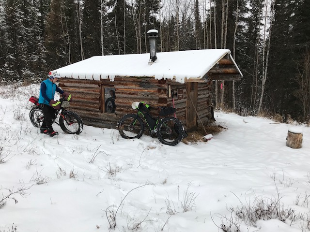
Remnants of a more recent mining camp. A miner is still active in the area.
Heck, that same trail is still used more than a century later. Now it’s used mostly by hunters and recreationalists (including crazy mountain bikers). The Steese Highway, finished in 1928, replaced the trail as the main transportation route between Circle and Fairbanks.

The modern trail diverges in a few places, but it generally follows the historic route. It’s definitely not built to modern standards. Those miners just wanted to get from point A to point B as quickly as possible. They didn’t have much use for things like switchbacks or mild gradients. We pushed our bikes up a lot of the hills. We walked our bikes down some of the steeper, rockier hills. Up. Down. Up. Down. At trip’s end, our GPS units showed nearly 11,000 feet of elevation gain.


We walked several steep, rocky downhills like this one.
We could blame Jon Underwood for our little adventure. Shortly after I moved to Fairbanks in 1989 I bought a copy of the “Fairbanks Mountain Bike trail guide” that Jon published about the same time. It’s long out of print, but I have a copy that I look at occasionally. Over the years I’ve done almost all of the rides on the map. I even helped incorporate the first few miles of the Circle-Fairbanks Historic Trail into the Fairbanks Cycle Club’s Tuesday Night Mountain Bike Ride schedule. But the allure of doing the whole historic trail never left me.

My “mistake” was introducing the idea to Corrine. She is training for a 700-kilometer (434-mile) bike race in Canada. Earlier this summer she suggested we do the historic trail and I said yes without even thinking. So, maybe I could blame Corrine. But the trail had been on my bucket list for too long. And, besides, if you think too much you don’t do crazy things.

Our conversations about the trip flirted with the idea that a 5-mph pace is slow for a bike ride, so maybe we could do the whole 60-mile trail in 12 hours. But we couldn’t completely dismiss Jon’s entry about the trail. He and Roman Dial biked it in 19 hours, which included 15 miles of Roman having to hike and coast after his rear derailleur broke. Corrine and I finally decided it would take us between 12 and 24 hours. We held out hope for 12 but packed food for 24.

We picked the weekend of July 20-21. We were both free and the weather looked great. Cloudy, cool, and no forecasted thunderstorms (something to avoid on long ridge outings). We got up early and were on the trail by 8:30 a.m. The weather was cool (mid-50s) and breezy, but we warmed in a hurry, especially after a long hike-a-bike section about two miles in. But, oh, what fantastic alpine scenery!

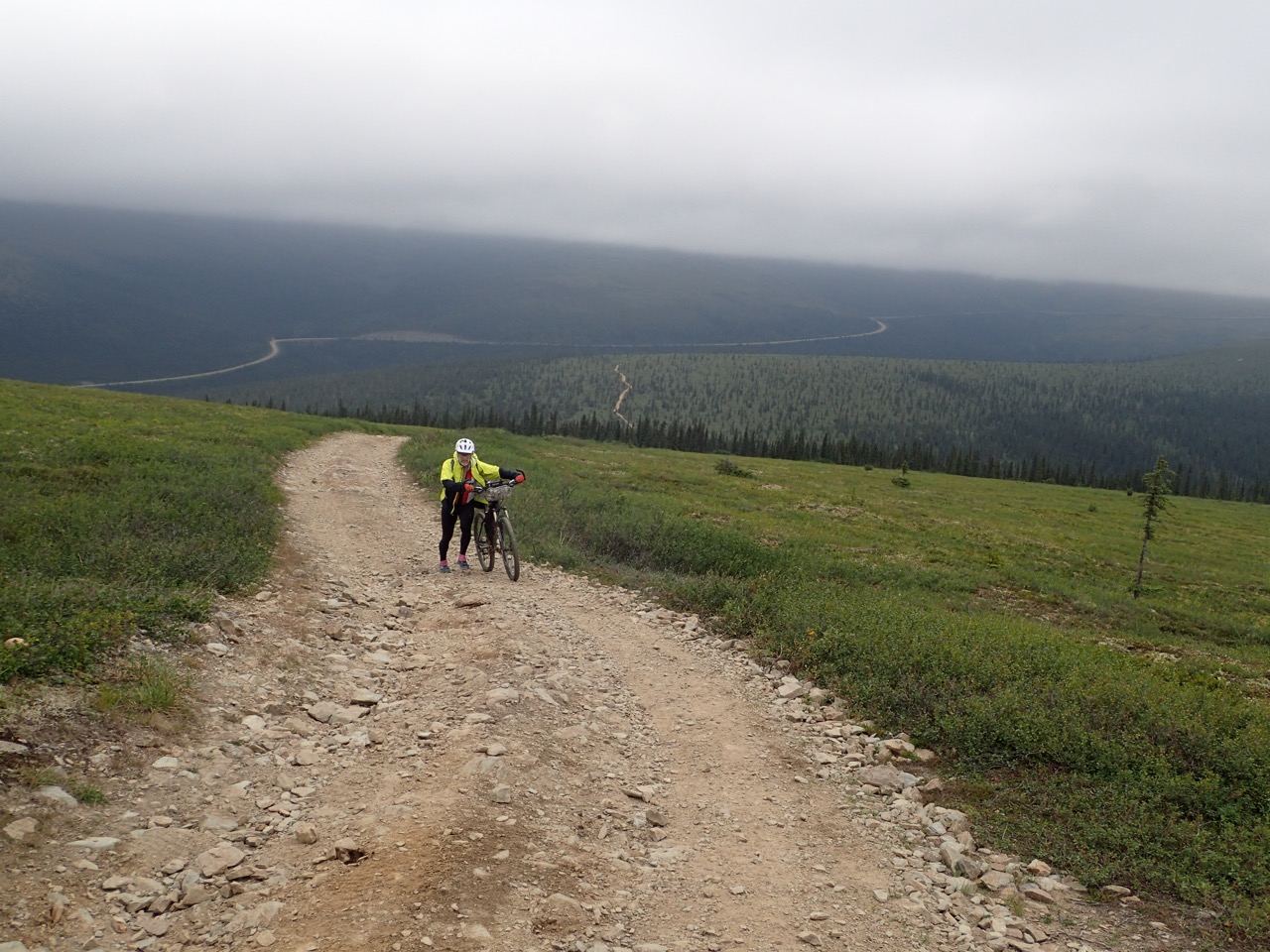
Toward the beginning, Eric pushes up a long hill into alpine country. The Steese Highway curves away in the background.
After about 9 miles the historic trail diverged from the main trail. Fortunately, we had a GPS track from friend Brian Accola, who drove the trail as part of an Arctic Offroad outing a couple of years ago. That track was really useful. There are several intersections with other trails along the route and sometimes the historic trail is not at all obvious. (Maybe we could blame Brian. We might have given up without his track.)


Corrine navigates a less obvious portion of the trail.
About 15 miles in we dropped down from the ridgeline to cross Pool Creek, where we filled up on water. Then it was another long push to the top of the next ridge before we could ride again. From there it was a mix of riding and hike-a-bike (up and down) with too much of the latter. Fortunately, we had really nice views most of the time.

Corrine crosses Pool Creek. 
Several miles and many hours later we descended into the Sorrels Creek drainage. I knew the historic trail stayed on the ridges, but we dutifully followed Brian’s GPS track. No point in getting lost 20 miles from the end.

Brian later told me in an email that his group had searched for the historic trail: “We dropped into Sorrels Creek as we never could find the alleged route over Twin Buttes. It is there but may not connect and is evidently rough.”

Even Jon Underwood called that section of the historic trail “virtually unridable” in his guide. Corrine and I don’t regret missing that section. At that point we were too sleep-deprived and exhausted to be purists. And we could bike much of the route we followed.

It was in this section that Corrine succinctly evaluated our trip: “I’m really glad we’re doing this. I’ll be really glad when we’re done. And we never have to do this again!”

We had to bike through the night. Navigating mudholes in the dark was pure fun!
Eventually, we hooked up to the ridgeline again. After a few more miles, we went around Coffee Dome and descended to a saddle where a mining road between Fairbanks and Kokomo creeks bisects the trail.

“Yes!” I yelled, when I recognized the intersection, where the Tuesday Night Ride meets the trail. Being on familiar trail was comforting. I knew there was one more long hike-a-bike and one really rocky descent, but the rest was easily bikeable. Less than two hours later we pulled into the clearing that serves as a parking lot. Done! At just shy of 21 hours, we were far from the hoped-for 12 hours, but less than our worst-case scenario of 24 hours.

That’s when we could fully embrace the “blame” for such a ridiculous endeavor. It was all ours and we were proud of it!

Celebrating at the finish. (The sign that had been there for years was gone.)

For a map of the Circle-Fairbanks Historic Trail see: http://tinyurl.com/y5asq9fs


For those interested in more history about the trail see Ray Bonnell’s 2015 News-Miner column here: http://tinyurl.com/k8o5dmq

Friday, July 26, 2019

New Denali Highway Trails Create a Loop of Spectacular Scenery (plus more Denali Highway fun)

This story ran in the Fairbanks Daily News-Miner


Corrine bikes up a hill as we leave the Sevenmile Lake valley.
By Eric Troyer

As we biked to the top of the little rise, the view of the Sevenmile Lake valley spread out before us. Gorgeous!

But it didn’t take our breath away. We had already been biking through miles of stunning scenery. You know it’s a good trip when spectacular scenery just becomes part of, well, the scenery.


Lupine were a treat along the Maclaren Summit Trail.
My wife, Corrine Leistikow, and I were in the middle of biking a great new trail/road loop on the Denali Highway. The loop is about 27 miles long with about 6 miles of that on the Denali Highway. None of it has boring views.

We started at the Glacier Gap Trailhead (Mile 30.5, Denali Highway) and biked the highway to the Maclaren Summit Trailhead (Mile 36.7, Denali Highway). That portion of the highway has expansive views of the Amphitheater Mountains to the north and the many lakes lying between the mountains and the road. The highway is gravel there but has little traffic, so dust wasn’t a problem despite the sunny day. We did have to expend some effort, as the biking was generally uphill, but it was easy to distract yourself by looking north.


Corrine biking the Denali Highway with the Amphitheater Mountains in the background.
At Maclaren Summit we headed north on the Maclaren Summit Trail. Finished in 2015, the trail winds along a wide bench past numerous lakes. It has a lot of ups and downs, but nothing overly long or steep. The trail is rocky in a few places, but a lot of it is fairly smooth. And the scenery, of course, is spectacular. If you travel north on the trail you have constant views of the Alaska Range. Quite a treat.


The Maclaren Summit Trail passes numerous lakes. 
Along the way we saw ptarmigan, a swan, and golden plovers (including some plover chicks) and lots of wildflowers. Anyone not interested in doing the whole loop, should consider doing this trail as an out-and-back. It’s the easiest section of trail and well worth the effort.

When we reached the rise overlooking Sevenmile Lake, we started descending toward the lake. An extension of the trail does go all the way to the lake, but we followed a connector that runs along the southern shore of the lake. This is the newest section of trail in the loop.


Descending toward Sevenmile Lake is a visual treat.
Since 2007 the state Division of Mining, Land and Water has been putting in trails from the Denali Highway to Sevenmile Lake. The trails replace some old trails that were built in boggy lowlands. Glacier Gap Trail, the first built of the new trails, starts from the highway, crosses Rock Creek, goes past Glacier Gap Lake and then through the Amphitheater Mountains to Sevenmile Lake. A side trail reaches down to Glacier Gap Lake. The division then put in Maclaren Summit Trail. Finally, the connector along Sevenmile Lake was finished just last year, making the loop possible. All the trails were built by Fairbanks-based Happy Trails, Inc, and designed to be sustainable, which should minimize their maintenance.

As motorized, multi-use trails, they are open to many uses, including biking, hiking, and ATVs. However, they weren’t busy when we biked the loop on a sunny weekend in late June. We saw just two mountain bikers, and two groups on ATVs, one group of four and one of two.

The connector trail along Sevenmile Lake is more challenging than the Maclaren Summit Trail. Sections of the connector trail are quite rocky and have several short, steep hills. And you can’t avoid getting wet feet while crossing the stream that comes out of Houseblock Valley. Still, most of it was rideable. And beautiful, of course. How could it not be? Sevenmile Lake sits at the base of the Alaska Range. What a treat! (Did I say that already?)


The creek coming out of Houseblock Valley was about knee-deep and cold!
About halfway down the lake the trail meets Glacier Gap Trail, where a very short extension goes down to the lake. This would have been a good place for a lunch, but we stopped a little earlier with a higher view of the lake.

The Glacier Gap Trail goes through a valley that grows steeper the farther south you go. The trail here can be really rocky in places, and we often walked our bikes, but the scenery was—you guessed it—outstanding!  And just as we began to realize that the views weren’t as expansive as they had been, we came around a corner to see Glacier Gap Lake before us. We had more stream crossings through that section, and then the trail climbs the hillside high above the lake. By that time, we were getting pretty tired. Still, as before, the impressive scenery provided a good distraction.


Corrine pedals through Glacier Gap toward Glacier Gap Lake. 
Then we were finally rewarded with some long downhills. We had fun swooping down the winding trail toward Rock Creek. That stream crossing is the longest—about 150 feet or so—but it’s only thigh deep at most and the current isn’t strong. Then it was just another quarter-mile or so to the trailhead and our car.

The loop, with a lunch break, took us about 5 hours and 40 minutes. I had my full suspension bike and was glad for it in places, but Corrine rode her hardtail and did fine. We were both tuckered out at the end, but content from indulging in so much remarkable scenery.

After crossing Rock Creek, Corrine climbs a hill less than a mile from the Glacier Gap Trailhead. 
A GPS track of our ride. 

Other things we did while on the Denali Highway

Corrine spent Saturday biking a long section of the Denali Highway.
(See the smoke in the background? Lots of that in Fairbanks at the time. We avoided most of that on the Denali.)

She saw wildlife along the way.

And, of course, gorgeous scenery.


While Corrine biked on the highway, Eric biked to Landmark Gap Lake.
And did some hiking on a ridge along Upper Tangle Lake...

...and on a ridge along Lower Tangle Lake.