Sunday, June 28, 2020

Straight Line to Circle


The forecast looked good for the weekend, so I decided to do another long ride. My plan was to bike to Circle, camp overnight, then bike home.  Eric was going to do a hike up Mastodon Dome and would meet me with the camping gear, so I didn’t have to carry it.  I’m such a wimp sometimes!  I thought this ride would be easier than the Manley Hot Springs Ride since it has a couple of thousand feet less elevation gain, but it wasn’t.  It actually felt a little harder.  The biking time was 30 minutes less but the overall time about the same.  Maybe it was because my legs were tired from bike commuting this week?  Maybe I was stopping more to smell the roses (literally)?  However you look at it, it’s a fairly big ride to do in one day.  155 miles with 9390 feet elevation gain.

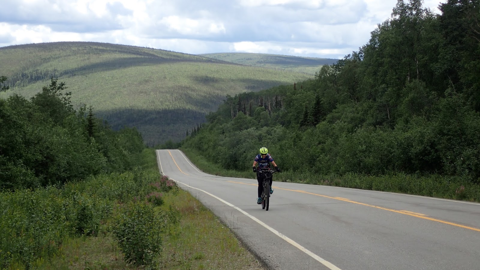
This ride has 3 big climbs, otherwise it’s mostly rolling hills and flats.  80 miles of pavement, then 75 miles of gravel, mostly really good gravel until past Central. Not too much traffic. I didn’t see much wildlife.  One fox on the road, several grouse, including one male who puffed up his cheeks and bellowed at me before flying off and a cute little baby porcupine.
Fox on the road.  I've been seeing lots of fox this summer.

This grouse thought it was hiding by just sitting on the road!
Cute baby porcupine.  Where's your mama?

I started off early at 6 AM and made quick work of getting up the first climb to Cleary Summit. This was the climb I did 20 times on my Everest attempt.  I was slow but steady up it and kept thinking that maybe I need to come back and actually finish an Everest attempt.  I was only cold and nauseated.  I wasn’t in danger.  Maybe I could get my nutrition better fine-tuned?  I mused on that a bit. Always sounds like a good idea when you aren’t cold and tired and nauseated.
View from just over Cleary Summit

After that, it’s a nice downhill and then flat to rolling hills trending uphill. I thought about all the times I’ve ridden this part of the road in time trials and Tour of Fairbanks stage races. Lots of good memories.  I also spent a lot of time plotting how Eric and I would do the Summer Trails Challenge this year.  We started a tradition of doing them all in one day, but this year would be harder since there are 20 trails, and some involve a lot of driving to get to the trailheads.  We hope to do that challenge this next Friday, weather permitting.  I think I have it figured out how we might accomplish this goal. Stay tuned for a post about that!
Poker Flats Rocket Range

Chatanika River

Rolling hills

Once I hit the gravel, it was just a few miles up to Twelvemile Summit.  I stopped briefly, descended and then made the long climb up to Eagle Summit.   I love this area.   Above tree line, great views, lots of great hiking.  I kept noticing long stem roses along the road.   Were they markers of some sort?  Had they fallen out of somebody’s truck?  Were they marking where people had been killed on the road?  Who knows but it gave me something else to ponder over.  I picked one up and attached it to my bike for a while.  Eric had left our car at Eagle Summit for his hike, so I stopped and had a snack before continuing.  Lots of cars and people out on this gorgeous day.  I looked to see if Eric was coming down the trail (it was 3:30 and I figured he would be finishing up soon) but didn’t see him.  Then I had a very fast and fun descent all the way down to Central.
Twelvemile Summit

Views from Eagle Summit

Eagle Summit - Wind keeping the bugs down

More views from Eagle Summit

I stopped at the little store in Central, then stopped to see my patient who lives right behind the store.  As I came back from visiting her, I saw Eric who had finished his hike.  He was going to head to Circle and set up our campsite. It was only 35 miles and should be mostly downhill. I could be there in a couple of hours.
Old mining gear in Central at the museum

Those last 35 miles were the worst of the ride.  The scenery wasn’t as nice, and the road had totally degenerated with loose gravel and washboard. I kept switching sides of the road to find a good line.  There was a lot more uphill then I expected, too. And I swear, I had more cars pass me, kicking up dust, between Central and Circle than I had all the rest of the day.  What was up with that?  We found out that there were 2 funeral parties going on in Circle that night and the place was totally packed with people.  Once I finished, we decided not to camp as there really wasn’t a campground and we would probably not get any sleep with the parties going on.  The funeral explained all the roses on the road, too.  Probably somebody was carrying floral arrangements in their truck and these fell out along the way.
Not happy about the loose washboard gravel.  Ready to be done!

Nice view of Birch Creek
I made it to Circle!

After I made it to the Yukon River, we turned around and drove back to Central, hoping that maybe the store, which served food was still open.  It closes at 8 PM and we got there at 9 but they were still open, and the owners said they could make us dinner.  Score!  Hot burgers and fries instead of freeze-dried food.  They stayed open another hour and talked with us as we ate dinner.  It ends up, we know a few of the same people and had fun talking about them, the Yukon Quest and the fact that somebody bought Circle Hot Springs and wants to reopen it.  I love small towns and family run places!
Yukon  River

By the time we finished dinner, we decided to just drive the 2 hours home instead of camping somewhere.  We arrived home just after midnight, stopping for the sunset at Cleary Summit.  It was another great day to be out in the Alaska Interior.


Midnight sunset on Cleary Summit

Sunday, June 21, 2020

Solstice bike ride


I had planned on biking to Circle over Solstice weekend, but the weather was pretty iffy, and I decided I didn’t want a wet, muddy ride.  (Spoiler alert – I got one anyway!) So, I decided to do a long bike ride with lots of elevation gain closer to home. I love the bike from the top of Murphy Dome to the Chatanika River and back, and I decided to do that starting from home.  I had done the ride a couple of years ago while training for the Tour Divide.  It’s a perfect training ride for anybody considering biking the Great Divide Mountain Bike Route or racing the Tour Divide.  The terrain is very similar. Long uphills and downhills on gravel roads that are good to chunky.  

 I didn’t get a super early start, but I figured I’d be home by dinner.  I decided to head up Cache Creek Rd to Sherman and make my way up Murphy Dome that way.  More interesting and less traffic.  The bottom part of Cache Creek was super muddy due to recent rains but improved the further I climbed.  Near the top I saw a fox kit that was very curious about me.  By the time I hit Murphy Dome Rd again my legs were tired.  I contemplated just biking to the top of the Dome and then heading home.  Did I really want to drop all the way down to the river and climb back up?
I biked all the way to the top of Murphy Dome before descending to the Chatanika River

Why was I doing a long bike ride with tons of elevation anyway?  I’m not going to be able to do the Trans South Dakota in mid-July and I’m not even sure if the Dirty Kanza will happen in September.  So why am I training?  I think about this a lot.  Why do I like to do all day bike rides instead of just 2-4 hour rides?  Is it that I like to feel strong?  Is it for bragging rights that I’m so tough?  Is it so that I can eat whatever I want without worrying about my weight?  I know that a lot of long-distance athletes use exercise as a way to deal with depression or anxiety.  But fortunately, I am not plagued by either of those.  I think I just really like to be physically active out in nature.  Moving in the natural environment makes me happy and content.  Much happier than checking chores off my to-do list.   Studies have backed up this feeling that being out in nature is good for us.  And I feel a sense of personal accomplishment when doing something tough and challenging.  

Enough navel gazing, time to ride the ridge and drop down to the Chatanika River.  It’s such a great ride. The road is in fairly good shape with some wet spots and chunky areas but all very bikeable.  Definitely doable on a gravel bike. There are great views while riding along the ridge and even as you drop down to the river. The road was a little wetter down low but all in all, it was a really fun descent.
Great views while riding the ridge.  Looking down into the Minto Flats

Somebody had built a stone couch and chairs around a fire pit

Near the river I saw a groundhog scurry across the road. It was too fast to get a photo. I ate a quick lunch at the river while watching a man and his son load their boat to work on a building project at their cabin 12 miles upriver. Then I turned around to start the long grind back up to the ridge and Murphy Dome Road.  And a long grind it was.  It was hot and sunny with no breaks. I just got into a lower gear and kept turning the pedals.  As I was nearing the high point, I noticed the build up of ominous dark clouds approaching from the north and heard a lot of low rumbling thunder.  I could look over and see that Murphy Dome was getting dumped on.  I decided to stop and see what the storm was going to do.  Could I avoid the rain?  Or at least the thunder and lightning? It seemed to be moving more south and I was headed a bit to the northwest.  
Ominous clouds ahead!

After about 15 minutes, I decided to keep going knowing that I would probably hit the tail end of the storm.  And I did. About 3 miles from Murphy Dome Road the rain started. I put on my rain gear and kept riding as I got wet.  I had a teeny bit of hail but no lightning. It continued to rain for about an hour which made for a very, very muddy, gritty descent on the gravel part of Murphy Dome Road. Dirt was flying everywhere.  I could barely see out of my glasses which also weren’t doing that good a job of keeping the grit out of my eyes, either.  I regrouped when I hit the pavement, cleaned my glasses so I could see, and called Eric who was going to pick up Thai food for dinner.  And then headed for home.  The 800-foot climb up our road was a lot slower than usual due to tired legs but I made it home before more rain started!  I washed the grit off my bike, then off myself before enjoying a good Thai dinner with my feet up.
Pretty muddy after descending the gravel part of Murphy Dome Rd.
A great day for a fun ride.  80 miles, 8500 feet elevation gain. 


Monday, June 8, 2020

Biking from Home to Manley Hot Springs


Last year Eric and I had done a bike ride to Hutlinana Hot Springs from Eureka.  When out there I realized that I had never been all the way to Manley Hot Springs at the end of the Elliott Highway.  We didn’t have time to check out Manley, but I wanted to go back. Since then, I kept thinking that it would be fun to ride all the way to the end of the road.  It’s lightly traveled past the Dalton Highway.  Lots of ups and downs, expansive views.  It seemed like it would be a great bike ride.

I checked out Google Maps and it was 155 miles from my house.  Hmm, I should be able to do that in a long day.  I could bike out one day then bike back the next.  It would be a good training weekend.

I decided I should do it this year. I’m still training for the 350-mile DKXL (although I’m guessing there is less than a 50% chance that the race will occur or that I’ll be able to go), but why not go for a long bike ride anyway?  Back in March, I had discussed my possible plan with some patients of mine that have a cabin in Manley, and they offered their cabin for me to stay in.  There was no reason not to go.

The weather looked good for the weekend.  Not too windy, chance of afternoon thunderstorms, not too hot or too cold.  I talked Eric into driving out.  He could go for an exploration hike on the way and then meet me out in Manley.   That way I wouldn’t have to carry my sleep or cooking gear and would only need to carry food for one day.  And I would have a bail out if I needed or wanted it.  (Spoiler alert – I did want it.  My legs were more tired than I expected and halfway there, I decided I would let Eric drive me home.  I knew I wasn’t going to want to get up at 5 AM Sunday morning and then have even more climbing on the way back with a headwind.  And get home at 8 or 9 PM and have to get up early the next day for work.  I shouldn’t have given myself that option! I wimped out.  Oh well, I'm not losing sleep over that!)
Quick stop at the Colorado Creek Trail head
Great views pretty much all day

It was a great ride.  I started right from home at 6 AM.  The clouds started building by mid-morning and all day I was surrounded by rain showers and thunderstorms.  Amazingly, I had only about 5 minutes of sprinkles, not even enough to put a jacket on.  I could see dark clouds coming toward me and could hear thunder but then I would move just out of reach and the storm would go in front or behind me.  Never on me!  And a lot of the day I had a tail wind. It was my lucky day.  Eric drove through several heavy rain showers on his way out and even had to hide under a tree for 10 minutes during his hike. I biked over wet roads with puddles, but I stayed dry.  Woohoo!

Dramatic skies all day with billowing clouds
Storm clouds to the right
Storm clouds to the left

Storm clouds straight ahead


For anybody thinking of doing this ride, there is a LOT of climbing.  My Strava said 11,500 feet of climbing.   The first half is paved, and the second half is a really good gravel road.  I could have taken my commuter bike.  The only chunky rough gravel was in the last 10 miles before Manley. I took my mountain bike because it’s comfortable, all of my bags fit on it for carrying gear,  and I wasn’t sure what the road would be like.  But a gravel bike would be perfect.

Traffic was light even before the turn off for the Dalton Highway.  Only a few big trucks went by.  And once I turned off on to the gravel, it was really quiet.  Maybe one car every hour. It was a really pleasant ride.  I didn’t see much wildlife except for a beaver in a beaver pond before Wickersham Dome.
Cresting one of many hills

Turning onto the gravel road.  Half way there!

Unfortunately the Roadhouse was closed and up for sale
There are plenty of places to get water along the way.  You pass a road side spring near Grapefruit Rocks, between mile 35 and 40 (I didn’t notice the exact mileage), Globe Creek at about the same distance, W. Fork Tolovana River at around mile 70 after the turnoff onto the gravel section, and Hutlinana Creek before Eureka at around mile 125.  Unfortunately, the Manley Roadhouse is not currently open and there was a sign up that it is for sale.  There is a gas station in town but it’s only open M-F 12-4 PM so plan to be self-sufficient!

The ride took me 13.5 hours including stops to eat and rest.  The bugs were bad enough when I stopped that I needed bug dope but weren’t a problem while moving.  I don’t know if the hot springs were actually open.  I went by the sign for them but didn’t stop.  At that point, I wanted to get to town so I could either eat at the Roadhouse – no dice since it wasn’t open – or eat my freeze-dried meal. After that, I just wanted to go to bed!  I’ll have to see if the hot springs themselves are open the next time I head out there.

Eric takes my picture as I make it to the cabin triumphant that I finished.

Since I had decided not to bike back, we were able to sleep in, have a leisurely breakfast and drive back home.  I would highly recommend doing this ride sometime. Breaking it up into 2 days might be more pleasant but I like to go long.  Plus, it was a great training ride, even if I only rode one way.

Monday, June 1, 2020

Cache Creek Exploration


Once I got back from Denali, I still had a couple of extra days off work. I asked Eric if he had time and wanted to do a little day adventure together. He didn’t hesitate.  He was ready to drop his writing and home duties and do something fun.  We had both wanted to explore Cache Creek Road as neither of us had ever been all the way back on it. We were both hoping there was some way to do a loop, but Eric had scoured satellite maps and didn’t think there was.  It would still be fun to see where the road ended.  So, Monday morning we drove up Murphy Dome Road to Cache Creek Road and started.

It was a glorious morning for a bike ride.  The road started as a good gravel road with some soft spots but easily bikeable. Once we got past the turnaround point for the Cache Creek Run, the road got a little more eroded. We passed a large vehicle brushing, but that was the only vehicle we saw on the road.
Good gravel road to begin with
Some erosion on the road
A few people live back on Cache Creek Rd. We didn't trespass!
We crossed Cache Creek on a one lane bridge.  We followed a fox for a while on the road until it realized we were behind it.  It immediately took off when it saw us.  The road meandered down and up and back around to cross Cache Creek a second time.  This time there was no bridge and there was a beaver dam.  Eric asked if I wanted to continue as it would mean wet feet.  Of course I wanted to continue.  We had to see how far the road went.
1st crossing of Cache Creek

Fox on the road
2nd crossing of Cache Creek.  Got wet feet but worth it!

Beaver Dam

The road continued to be more eroded and soon became a fun double track. We had to duck under some trees and walk our bikes over some very eroded and muddy areas.  We started climbing again in the direction of Murphy Dome.  Maybe we could do a loop!
Maneuvering under trees
Fun riding!
Murphy Dome way off in the distance.  Would we get there?

We passed a decrepit old cabin on a trailer.  It looked like it hadn’t been used in ages.  It was in a cleared area and we thought the trail might end there but it continued on, getting even rougher.  We continued to climb for another mile or two until the double track just ended. What?  In the middle of nowhere. No great views.  Just in the middle of some woods.  That was disappointing.
Little cabin on a trailer

But then Eric looked around and saw what looked like a very, very rough, barely there ATV trail.  We looked at each other.  Should we turn around?  No way!  We both wanted to keep going.   Thus, we started an approximately 2-mile hike-a-bike. We had to climb over some trees, around others, walk through some swampy areas, pushing uphill the entire time.  It was hot and buggy! At times the trail almost totally disappeared but we would find it again.
hike-a-bike

 We came across a bear baiting station and after that the ATV trail got better.  Bikeable if we had been going downhill.  Whoever used the bear baiting station had come down from above.  We now knew that it was going to hook up somewhere on Murphy Dome.  We pushed for about another mile before the trail leveled out and we could finally ride.  We still had to ride through thick alders that sometimes stopped us in our tracks before we finally hit Murphy Dome Road.  Success!  We found a way to make the ride a loop!  Yay!  We high-fived and kissed.  
Bear baiting station

More hike-a-bike


Pushing through alders

Should we continue up to the top of Murphy Dome?  We were so close. We could see the radar station on top and I knew it was only about a mile.  Heck, yes, we both wanted to summit. And it looked like we had time before the dark clouds that were building would get there. Nope.  About 1/2 mile from the top a small hailstorm started pelting us.  We got to the top, added some layers and headed back down. There was just enough rain to make the road wet and we got coated in mud on the way back down.  Other than that, it was smooth sailing all the way back to the truck.
Getting pelted by hail

We made it.  Now for some warm layers for the way down.

4 hours, 25.3 miles, 3400 feet elevation gain.  Another fun mini-adventure together.  It’s great that we can still find new places to explore in our back yard.