
Post by Corrine
We had already biked 30 miles from Chicken, and it had been hillier than we expected. We were wet and cold. We hadn’t donned our raingear as it was supposed to be sunny. Surely the rain would stop. But it hadn’t. In fact, it started raining harder and the wind was picking up, too.

Eric, driving car support, had passed us earlier when the weather was better on his way to Eagle. We didn’t have any way to contact him, so we didn’t even consider getting bailed out. Nothing to do but slog on. We kept biking.
A little while later, just as we were cresting another hill, I looked up and saw Eric driving toward us in the car.
“I finished hiking Steele Creek Dome and thought I would come back and check on you,” he said. “The weather is pretty crappy. Do you want a ride?”
Decisions, decisions.
Best Laid Plans…are Made to be Changed
Earlier this summer I noticed on Strava that friends had biked the Taylor Highway. This remote 150-mile gravel road, open only in the summer, goes from Tetlin Junction, just past Tok, to the town of Eagle on the Yukon River. Neither Eric nor I had ever been all the way to Eagle, and we wanted to see it.

At about the same time, my friend, Nikki, had explored the area with her husband in their camper. She reached out to me about biking it. We were both free Labor Day weekend and Eric was willing to be our sag wagon (he would hike and explore while we biked the road). So, we decided to take two days to bike from Tok to Eagle and then use the rest of the weekend to do whatever we felt like doing. And we agreed to not go if the weather looked terrible. We wanted a fun, but challenging ride. No suffering this trip! As the weekend approached the weather forecast looked OK. Not great, but not horrible. We decided to go.

Friday morning, we left Fairbanks bright and early. Nikki checked her phone and gave us the updated forecast.
“Only 10% chance of rain today and it’s supposed to be sunny in Eagle. But then greater than 50% chance of rain the next couple of days.”
I knew that she really wanted to bike the portion between Eagle and Jack Wade Junction, where the road forks, with the Taylor Highway going to Eagle and the Top of the World Highway going to Dawson. Eric and I had been to Dawson before, but never on that portion of the Taylor Highway. We wanted to see it in good weather. After musing it over for a few minutes I suggested a new plan.
“We could drive a little farther to Chicken and bike from there to Eagle today. We would get a slightly later start but we could do it. I really don’t want to bike the best part of the road in the rain. I want to see the views.”

However, Eric had hoped to hike Mt. Fairplay, which was before Chicken. He wouldn’t be able to hike “Mt. Foreplay” if we continued to Chicken. (For some reason I kept messing up and calling the mountain Mt. Foreplay, much to the amusement of Nikki and Eric.)
Eric was fine with changing his plans.
“Today I can hike the Mosquito Fork Dredge Trail just past Chicken and then hike up Steele Creek Dome. We might be able to do ‘Mt. Foreplay’ together on the way back.”
“You guys can hike that by yourselves!” Nikki cried out. (My Freudian slip led to a lot of ribbing and bad jokes all weekend.)
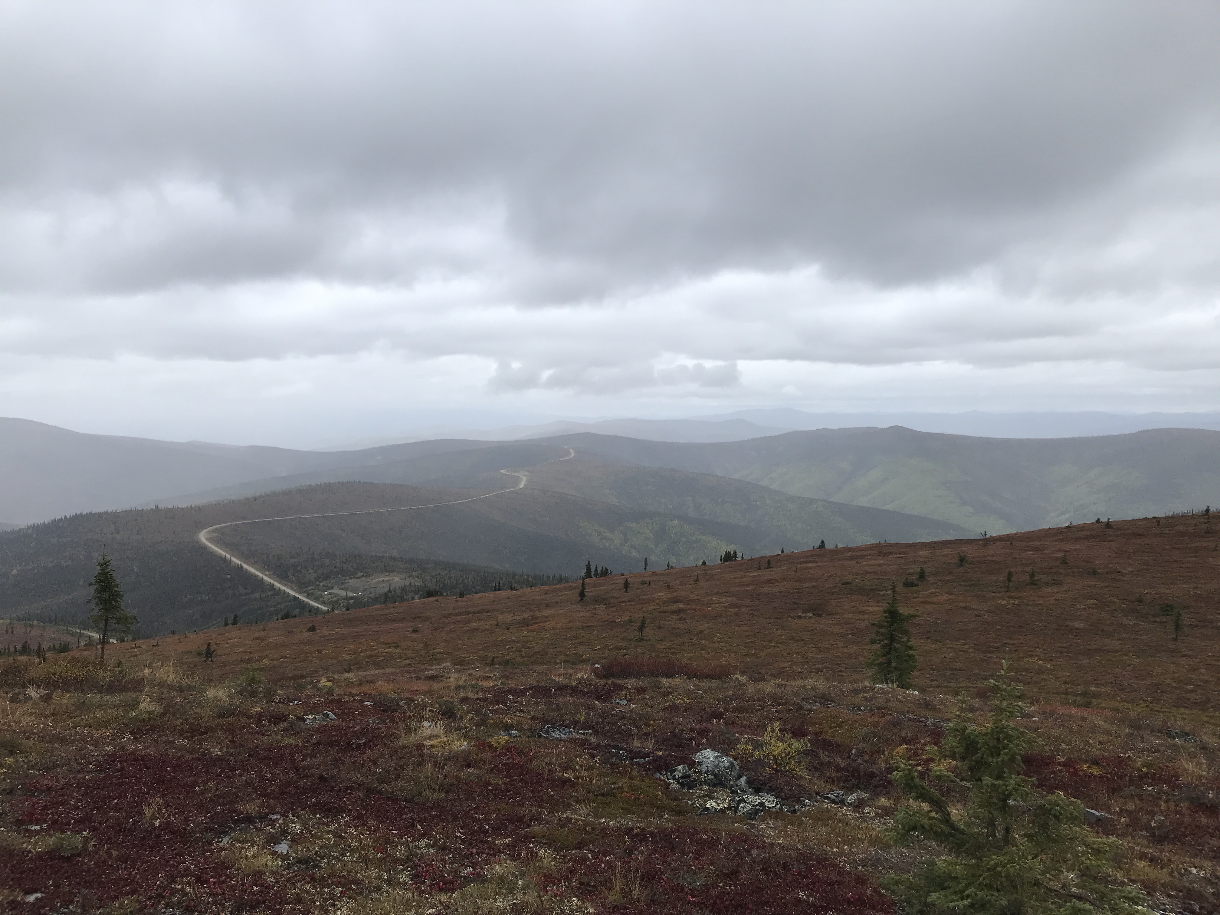 |
| View of Taylor Highway from Steel Creek Dome - from Eric's hike |
Nikki was all in for the change in plans. Everyone was flexible to make for the best Type 1 adventure. While in Tok, Nikki was able to switch our hotel reservation in Eagle. We gassed up and then drove another 75 miles to Chicken to start our bike adventure.
 |
| Starting from the chicken in Chicken |
Finally…on our Bikes!

Right away we had a lot of climbing to do, but Nikki and I were in high spirits. We had been wanting to do a fun adventure together and it was finally happening! It would be a big bike ride but no sufferfest. After doing the short Mosquito Fork Dredge Trail Eric passed us near Walker Fork Campground. He checked in to make sure we were OK. Everything was fine.

A little while later, just 20 miles into our ride, it started misting. Then it started drizzling. Then it was actually raining. We kept going, climbing and climbing. We didn’t stop to put on raingear as we kept expecting it to stop raining. It was supposed to be sunny, dammit! We stayed warm since we were climbing but our clothes were soaked.

After 30 miles we finally came to the fork where we turned left to get to Eagle. It was already 4 PM and we still had another 65 miles to go. Somehow, I thought Eagle wasn’t quite that far away. Ugh! We put our heads down and climbed. If the rain didn’t let up, it was going to be a long sufferfest to Eagle.
When Eric appeared and offered us the ride, I was all for it, but I wasn’t sure Nikki would want to wimp out. She was surprised I was willing to accept a ride, but she was happy for the lift, too. This was supposed to be a type 1 fun weekend. No unnecessary suffering needed. Once again, we remained flexible and changed plans mid-stream.
Of course, the weather improved the farther north we went but we were still glad we had changed plans. We would have had to bike part of the road in the dark and would have arrived in Eagle really late.
 |
| Not a bad place to spend a night |
New Plans…Not so New Weather
 |
| View of the Yukon River from the deck of our hotel room in Eagle |
After dinner we walked around Eagle while discussing the next day’s plan. We didn’t have internet or cell service so we couldn’t check the weather. Eric’s very basic InReach weather report just said cloudy. We decided that if the weather looked decent in the morning, Nikki and I would bike back to Walker Fork Campground (80 miles away). Eric planned to go on the Eagle historical walking tour in the morning and then go hiking at American Summit. He would get to the campground before us and have our campsite set up and hot drinks waiting for us when we arrived. (Well, maybe not that last part, but we could dream, right?)
 |
| Riverside Hotel where we spent the night in Eagle |
We started out early the next morning under cloudy and cool conditions. But within less than an hour, it was drizzling again. This time we were smarter and put on our rain gear right away. Of course, then it stopped raining. This was pretty much the way it went all day. Raingear on. Raingear off. Repeat, repeat, repeat. Except for one period after Nikki said she was tired of putting on, then taking off rain gear. Then it just rained pretty much straight for a long stretch of time. Be careful what you wish for!
 |
| A soggy snack on top of American Summit |
 |
| Crossing the Forty Mile bridge after a brief lunch stop - yes, it's raining again |
After a while the gravel road got pretty wet, and we ended up kicking up mud on every descent. Nikki had mudguards on her bike which made a huge difference but even she had to put on her sunglasses just to keep the mud out of her eyes. We laughed at how dirty we were getting.
 |
| Yes, we got a little muddy on the downhills! |
 |
| Having mudguards on your bike makes a huge difference. Notice Nikki's leg compared to mine. |
Worth Doing…Even in Some Rain

Despite all this, we had an amazing day. The clouds were high, and the views were incredible. The fall colors were prime, and the clouds and rain really made the colors pop. Photos don’t do it justice, but I kept taking pictures anyway. Fall is definitely the time to bike this road.

The road is in good shape for a remote road only open in the summer. It is narrow in places and has lots of tight swoopy curves, fun to do on a bike. There are also a LOT of hills. We knew that biking south would mean more elevation gain. And there was! Over 8000 feet of climbing from Eagle to the campground.

There were hunters (it’s caribou and moose season right now) at all the pullouts, but the traffic was pretty minimal compared to biking near Fairbanks. Most drivers were very courteous, slowing down as they passed us. They probably thought we were crazy for biking in this weather on this road.
At Jack Wade Junction, we turned right and knew it was only 15 downhill miles to the Walker Fork Campground. The sun finally came out, too. We were a little surprised Eric hadn’t passed us yet, but I just figured he was having a great time hiking at the summit and totally forgot about the time. As we got closer to the campground, I started getting a little more worried that Eric still hadn’t pass us. Did he have a car problem? Did he get injured? Eric had all the camping gear, so we needed him. Just as I was thinking about alternative plans, he passed by.
 |
| The sun finally came out at the end of our ride |
Eric had spent two-and-a-half hours on the walking tour, as he enjoyed talking to the guide and was the only one on the tour. He then had a good hike on American Summit. He had his eyes set on a no-name peak marked 4410 elevation on the maps, but as he got closer he started doing the math. He realized he would never climb that peak and beat us back to the campground. In fact, he might be late already. He booked it back to the car. We were glad he made that decision. He got to the campground about 20 minutes before us and even had hot drinks waiting for us when we arrived. He is quite the guy!!
 |
| View from Eric's hike toward peak 4410 on American Summit |
 |
| We made it to the campground - 80 miles with 8000 feet elevation gain in 10 hours |
Another Day…Another New Plan
 |
| Not a bad campsite at Walker Fork Campground |
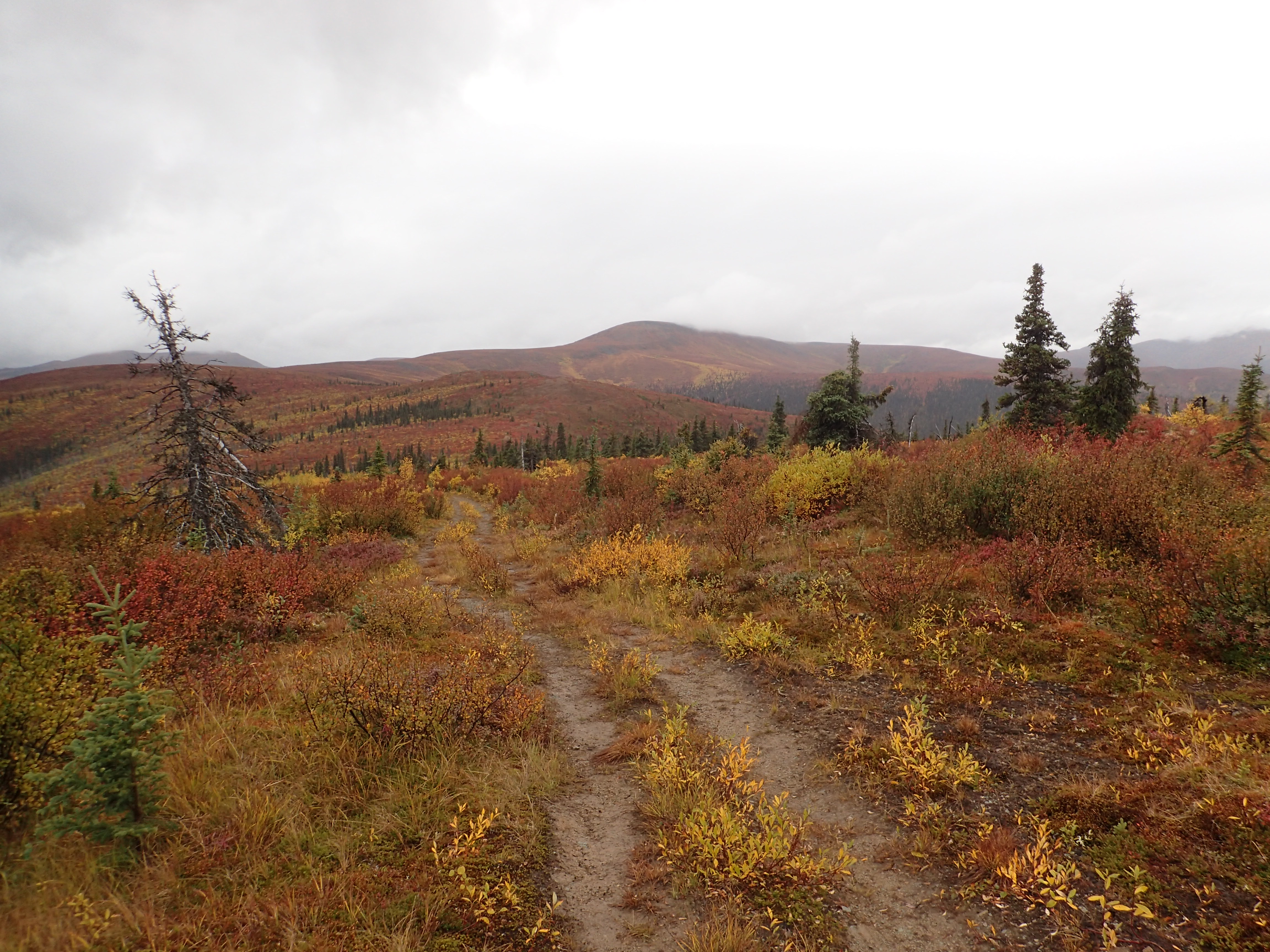
After dinner, we walked around camp, talking about what to do the next day. Neither Nikki nor I cared that much about biking the entire Taylor Highway (and we had already biked the portion from Chicken the day before). Eric was totally flexible. We decided to hike up Mt. Foreplay…uh…Mt. Fairplay! That is, if the weather was decent and the cloud cover high.

It rained a bit overnight but remained only cloudy as we got up, broke camp, and drove to the Mr. Fairplay pullout. There was no trail after the first half mile, so we just made our way up following caribou trails when possible. It’s all above tree line, so the hiking was good. We finally topped out on a false summit and realized that we would have to drop down before climbing the last bigger hill to the summit. Ugh! It was windy and chilly but there was no discussion. We all wanted to get to the true summit.

It was even windier and colder up on top, but we had great views, and we were able to shelter behind a communications structure to eat lunch before heading back down by another route. We only got a little bit of mist so lucked out on the weather as Mt. Fairplay’s summit socked in after we left, and on the drive home we got rained on several times.
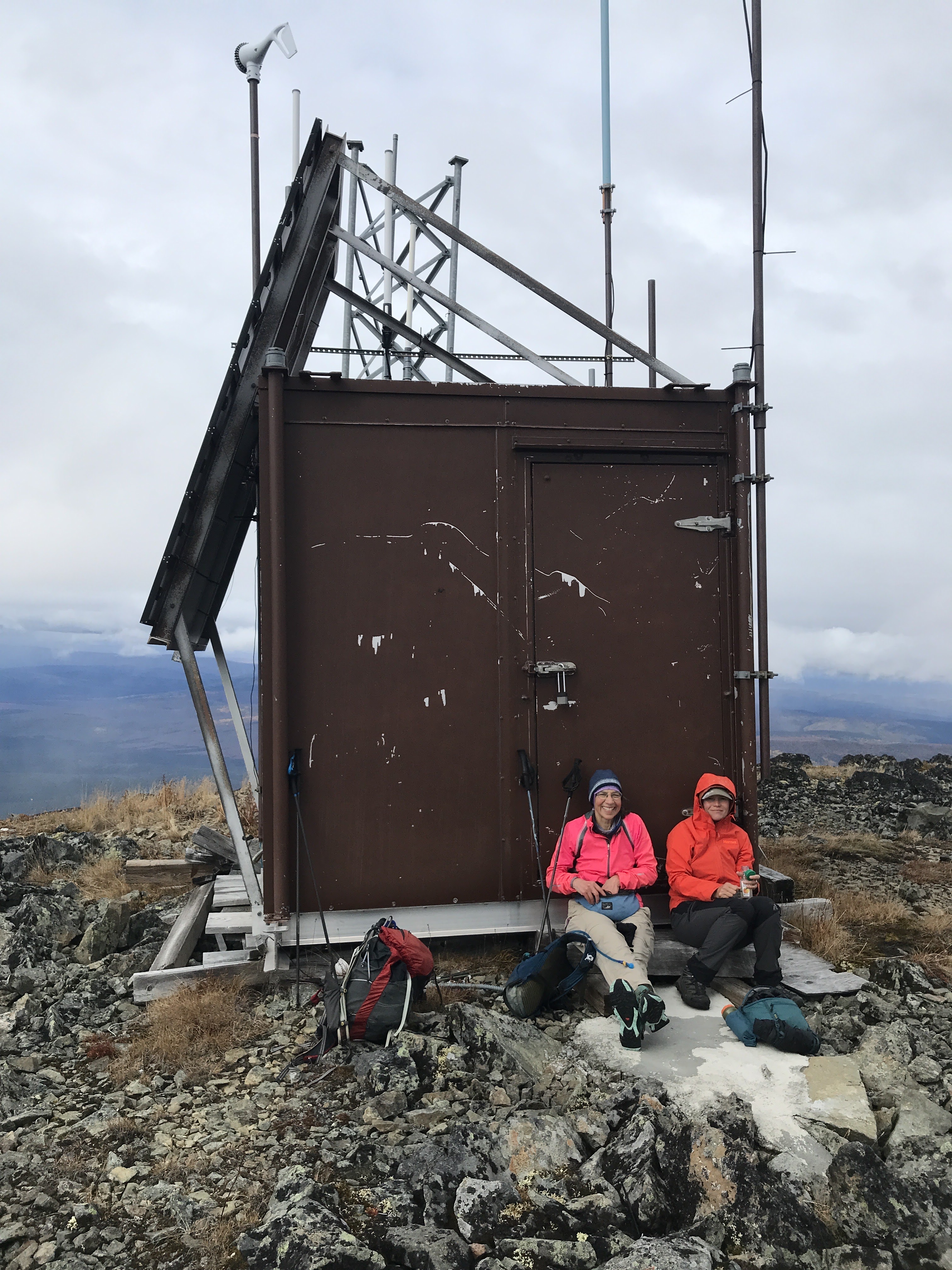 |
| Sheltering from the wind |
 |
| Obligate selfie on top. It was cold and windy. |
It was great doing a trip in which everyone was so flexible with the plans. It made for a much more fun trip. Nikki and I got to have a beautiful, challenging day on the bike, we got to see a new town, Eric did some exploring, and we all got to summit a new peak. All while laughing and enjoying each other’s company. What better way to spend a weekend!
 |
| We all show how flexible we can be! |
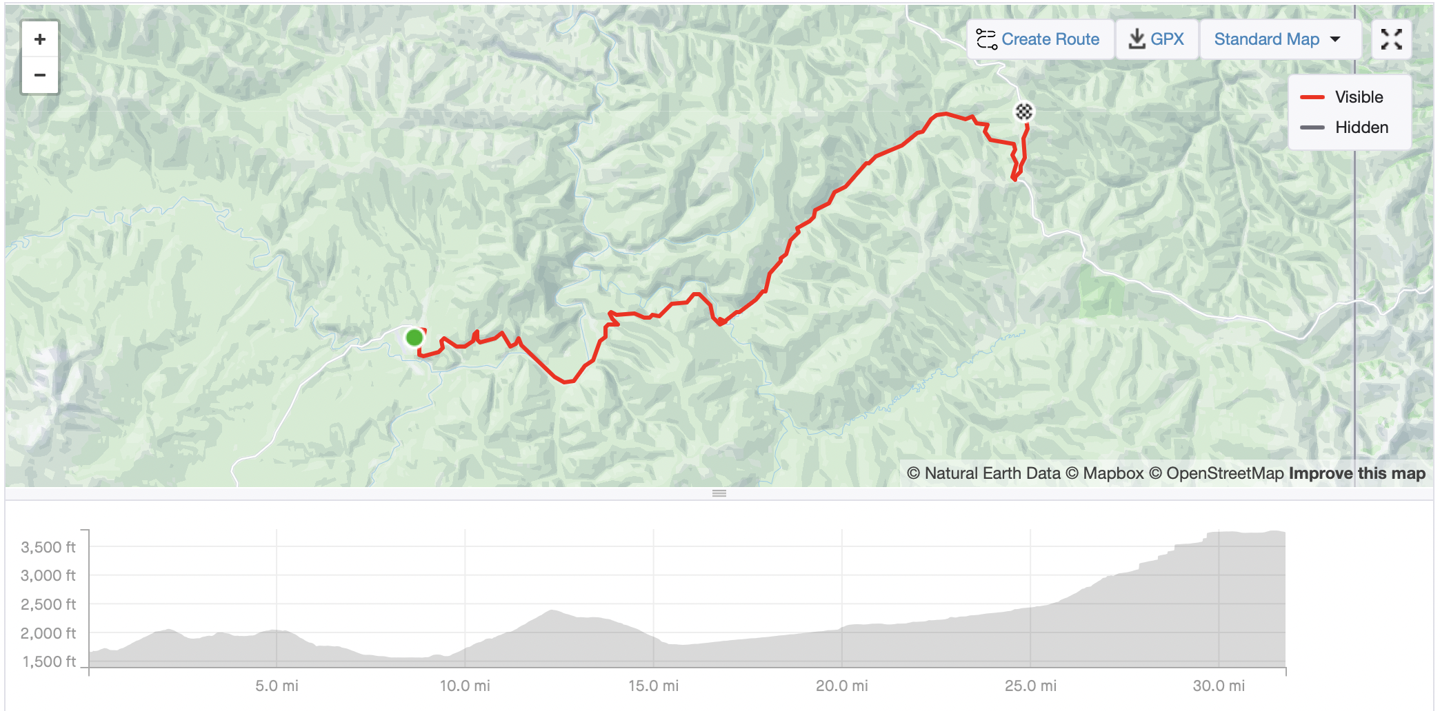 |
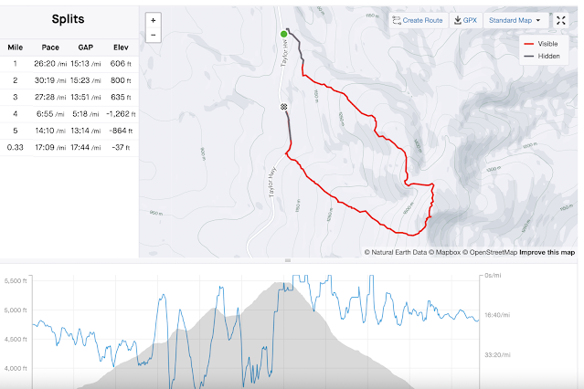
| Day 1- 32 miles with 3600 feet elevation gain |
 |
| Day 2 - 80 miles with 8000 feet elevation gain |
 |
| Day 3- 5.3 miles with 2400 feet elevation - Nikki had over 6 miles since she ran back on the road for our car. |
 |
| Mosquito Fork Dredge Trail (Official BLM trail just outside of Chicken.) |
 |
| Steele Creek Dome (Short hike up a four-wheeler trail not too far past the Jack Wade Junction.) |
 |
| Almost 4410 (Hike along a four-wheeler trail off American Summit. Kyle Jolie mentions 4410 in "Outside in the Interior" under Wallcutt Mountain in Appendix A and in More Adventurous? under Mount Fairplay.) |
What a wonderful adventure!!! What’s next?? ;-)
ReplyDeleteWhat a fun weekend! It’s smoke season down hear putting a damper on weekend riding plans.
ReplyDeleteI definitely would take cool and rainy over smoky any day.
DeleteA few years back, after a Forty Mile float, we road from the bridge back to Walker Fork Campground. Don’t know how I made it up that hill! On a smallish downhill, a strap caught in my wheel, and I was pitched into the bushes; I may have passed out for awhile. It was a wonderful ride from Wade Junction down, though.
ReplyDeleteit certainly sounds like you had an adventure. But yes, those hills are long especially the last one before Wade Junction! It just never ends.
DeleteFun trip! Someday I need to visit Alaska in September, which is becoming one of the worst months in the Mountain West. Daily rain and tundra color sounds so wonderful compared to widespread wildfire and 100 degrees.
ReplyDeleteYou are welcome to come visit any time.
DeleteWhat a great looking weekend. Mt Foreplay, haha!
ReplyDeleteI need to drive up from Haines and ride that route!
ReplyDelete