Post by Eric
“Well, we’re out of the creek bottom. The pushing should be a little easier now.”
Those are not words you want to say – or hear – on a bike trip. I’m glad my wife is a forgiving person.
It started simple enough. Corrine and I decided to bike the 14-Mile Trail off the top of Murphy Dome (aka Murphy Dome Road Extension). More road than trail, we’ve done the 14-Mile several times. Typically, we ride the 14 miles of mostly downhill to the Chatanika River, then ride back up. Being more road than trail, it’s more Corrine’s kind of ride, but I was game to do it for the exercise and to revisit the area.
I kind of wanted to explore a real trail off that road. I thought I could use it to make for a good Tuesday Night MTB Ride, which I co-lead. But I knew Corrine probably wouldn’t like the trail, since parts of it are rough. I’d have to explore that another time.
Innocuous Start
We started on the 14-Mile Trail (I’ll just call it a road) under mostly cloudy skies but no rain. A nice day for the weather we’d been having. We rode the ridge part of the road, stopping to take in the view at a good spot a couple miles in.
 |
| Happy times! Corrine on the 14-Mile Trail with Murphy Dome in the background. |
About six miles in a four-wheeler trail takes off to a High Spot. It’s near where the road begins a long descent. I was kind of focused on that descent, so I was surprised when Corrine turned onto the four-wheeler trail. She wanted to go to the High Spot. I was game, even though the steep and rocky trail would be a hike-a-bike. But it’s short and in a few minutes, we were at the top. Absolutely gorgeous views of the Minto Flats from High Spot! Better than from atop Murphy Dome.
 |
| One of the most awesome viewpoints with Minto Flats in the background. |
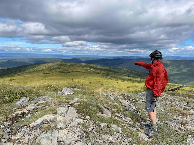
A four-wheeler trail drops off High Spot, but after a short way it goes through a boggy saddle. Corrine and I had tried that trail (I’ll call it High Spot Trail) years before and bailed out to the road because that part was too boggy. I wanted to explore that one, too, as it gets better after the boggy part, but it was another trail (I’ll call it Creek Bottom Trail) that I really wanted to explore because I recalled that a branch of that one emptied out on the road lower down.
 |
| Eric points out the boggy saddle trail. Beware that pointing finger! |
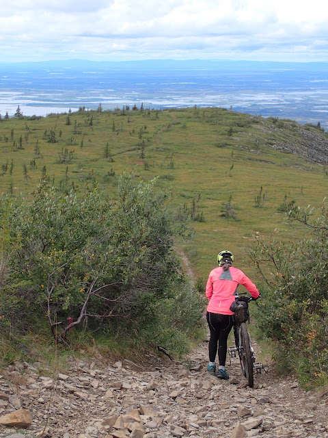
I was ready to head back down to the road, but Corrine wanted to explore more of the 4-wheeler trail atop High Spot. I was game. One branch (Creek Bottom Trail) goes to another viewpoint and then makes a short, but steep and rocky descent. Corrine would want to turn around there.
The Adventure Begins
We went to the viewpoint, took photos, and then Corrine said we should go down! I was confused but a bit excited. This is the trail I wanted to explore!
“Are you sure?” I asked.
“I’m going to walk down this part, but it looks OK down there,” she said.
Yee-haw!
 |
| Descending the first part of Creek Bottom Trail. |
I told Corrine that the trail branches farther down. I once had followed the left branch a ways, but finally had to turn around. It probably goes on for miles. The other branch, I said, kicks out onto the road lower down. We could ride the trail down and the road back up. Corrine liked that idea. She’s adventurous.
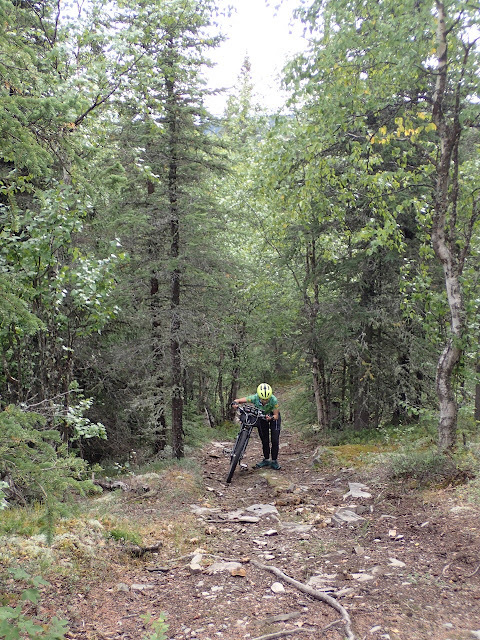
As it descends, the trail gets rocky, rooty, and often steep. It’s challenging riding. I rode most of it, having a great time. Now it was more my kind of ride! Corrine mostly walked her bike and quickly tired of that. But knowing that the trail emptied onto the road helped.
 |
| Some nasty roots on the descent. Eric walked these, too. |
We kept descending. I saw a few spots that I remembered, giving me confidence in my memory. Corrine worried that we were descending too far, but I assured her things were fine.
“We should come out onto the road soon.”
When I said that a second time, she pointed that out. But I was confident. We kept descending. After all, things looked familiar.
Until they didn’t. The trail went into a tussocky creek bottom that I didn’t remember. I admitted as much to Corrine. By this point she wasn’t surprised. She had less confidence in my memory. (My track record about such things is a bit spotty.) The mosquitoes, which had been getting bad, were worse down there. Fun.
 |
| Eric realizing he screwed up. But Corrine's still in good spirits! |
We had descended about three miles, so the thought of pushing our bikes back up was not exciting. Maybe this trail came out on a different spot on the road? We had no way to navigate. We had no cell connection for our phone apps. I hadn’t brought my Garmin inReach Explorer. Why would I? All we were going to do was ride the 14-Mile Trail, which is really just a road.
Admitting Defeat
We pushed through the tussocky, slightly swampy trail for a bit until we got to a more open area. I scoped what I could, then admitted that I didn’t think the trail was going to come out on the road any time soon, if at all. It was time to tuck our tails and turn around. Corrine didn’t argue. And she didn’t yell at me! She was a bit grumpy – so was I – but she is game for adventure and knows that Type 2 fun makes for the best stories. That’s one of the reasons I love her!
We started back. When we finally turned out of the creek bottom to the long uphill, I made that comment about the pushing getting a bit easier. It wasn’t that much easier, but it was better than being in the creek bottom.
 |
| And now back up what we came down. |
Pushing uphill stirred more memories. Yep, I had done that before. On this trail. Then, while pushing, I remembered I had found a lesser-used trail that branched off. And that’s the one that led to the road. Right? I probably missed it while descending since I was concentrating on the technical trail. But I wondered if I did find the side trail, would Corrine be game to try it? I would leave it up to her. I had already led her astray once. I wasn’t going to push it, so to speak.
.jpg) |
| Finally! The last uphill on Creek Bottom Trail! |
I never did see that side trail. We pushed most of those three uphill miles, riding for only short periods. Things did get better. As we got higher, it got breezier, and the skeeters got fewer and fewer. Finally, we pushed up the steep, rocky trail to the viewpoint. Yay! From here every uphill would be rideable! Corrine did have to walk down the rocky, steep part of High Spot Trail, but after that we were out on the road!
We got back to our truck after another half-hour. We both commented that our arms were tired. Not your typical bike trip complaint. What a nice little Type 2 adventure!
 |
| Corrine, happy to be on the 14-Mile Trail road again! |
Ready to Try Again
Back at home, I looked at our route on the Strava satellite map. Creek Bottom Trail heads out toward Minto Flats, far away from the 14-Mile Trail. And there is no side trail. Actually, it’s the trail that descends from High Spot and goes through the boggy saddle that connects to the road! Now I remember!
I need to go up there again and make that connection. Do you want to join me? Trust me. I did this trail once years ago. I know where it goes!
 |
| Near the top left of the photo you can faintly see where the road goes. We were quite a ways away. |

I want to find that high spot. So it's after 6 miles of descent? but before you get to the river. Why am I asking you for directions?!!
ReplyDeleteKaren, you go in about 6 miles on the road (you can actually drive it). You are on the ridge and haven't started the long descent to Chatanika yet. It's an obvious 4 wheeler track off to the left and it's only about 1/2 mile hike to the high spot. There are some nice view spots to the right, also before you get to this spot. It's beautiful and well worth the drive.
DeleteHey, I know right where I am when I'm looking at a map! Usually. Here's a Google Maps link to that high spot. https://goo.gl/maps/dXCd4wCK6a8B92397
DeleteI'm in no shape to do anything this ambitious, but I would like to ride out there one day and find out where that finally ends up.
ReplyDelete(spoiler alert: it ends in a bog, probably)
It definitely ends in a bog!
Delete