Sunday, September 19, 2021

Tofty Road to the Yukon River and Back


Post by Corrine

Tofty Road?  Never heard of it. Where and what is it?  These are the comments I get from people when I mention this road.  There isn’t a lot of information about it on the web, so I decided to do this blog post after biking it.


The Tofty Road (Road to Tanana) was put in by the Department of Transportation so that residents of Tanana, a village of about 250 people near the confluence of the Yukon and Tanana rivers, would have an easier way to get to Fairbanks. It begins in Manley Hot Springs (a small town 150 miles from Fairbanks) and ends 50 miles away at the Yukon River, not at the village itself. The terminus is 6 miles upstream of Tanana and on the opposite bank.  In the summer, villagers use boats to access the road. In winter they put in an ice road.

The village of Tanana is at the base and to the left of the dark green hill.

The road opened to the public 6 years ago and I remember thinking it might be fun to bike. Then earlier this summer some friends of mine did an epic trip, biking from Fairbanks up the Dalton Highway to the Yukon River, packrafting down the Yukon, then biking out the Tofty Road and back home.  They said the road was good biking with a few stream crossings.  One, Sullivan Creek, was at least knee deep.  But this fall, new culverts were put in on Sullivan Creek fixing that problem.  Hearing that and seeing that the weather looked to be sunny (although cold) this weekend, I decided to go on one more micro adventure.

New culvert to divert water under instead of across the road

I left Fairbanks Friday afternoon for the 3 hour drive to Manley. See my previous post about biking this highway.  https://notquiteoverthehillcorrineanderic.blogspot.com/2020/06/biking-from-home-to-manley-hot-springs.html It was a gorgeous drive with fall colors still glowing.  I planned to camp in Manley but when I got to the campground, it was just a gravel parking lot with some grassy areas with picnic tables by the Hot Springs Slough.  It was right off the main road as you come into town.  It would be okay in an RV but not so great for tent camping.  

Fall colors still glowing on the Elliot

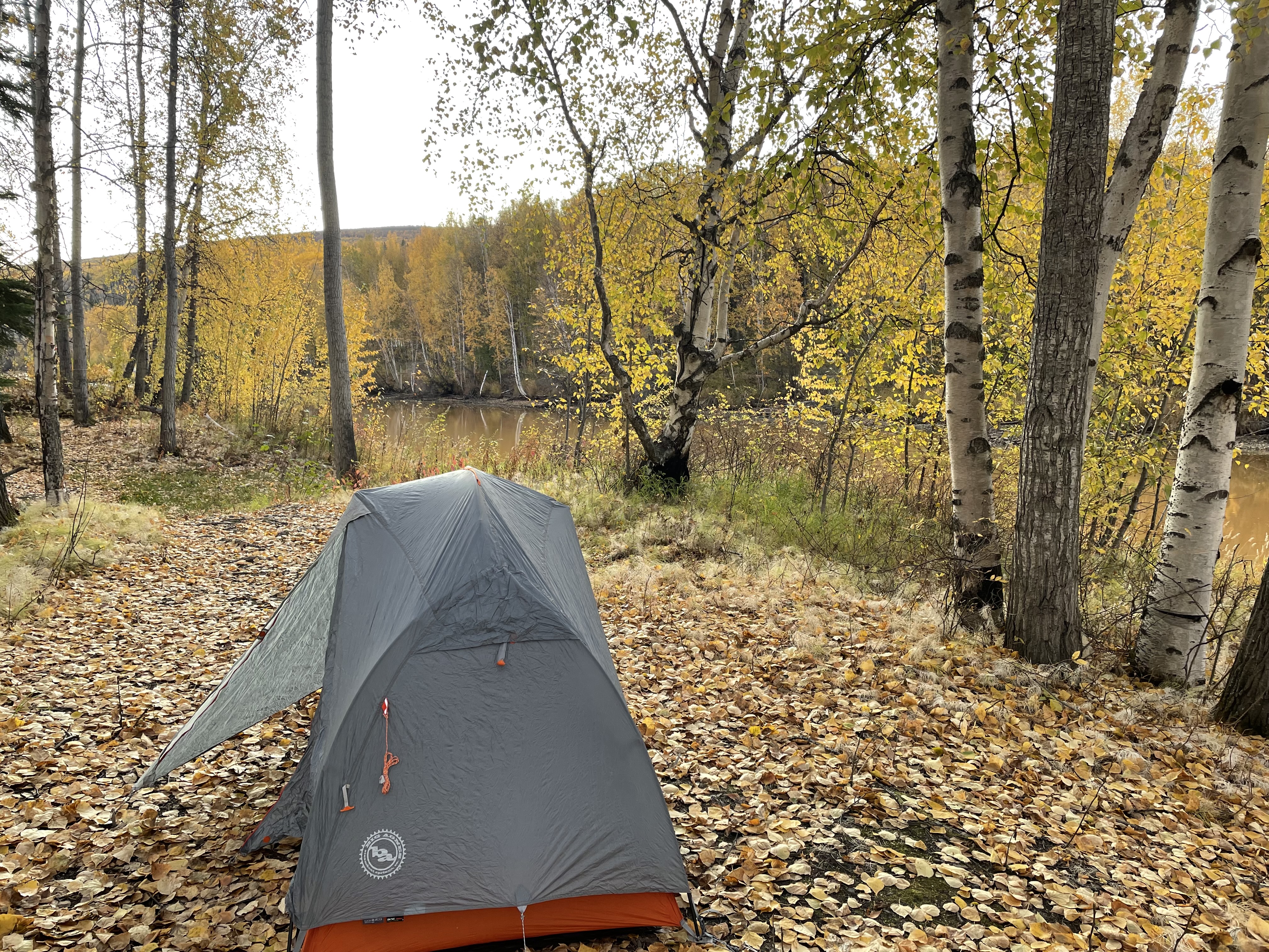
So, I drove down to the Tanana River to see if I could find someplace better to camp, but that parking lot was filled with vehicles and boat trailers. There was no place to set up camp plus it’s private Native land so I headed back to town to set up camp by the slough.  I was able to put up my tent in some trees for a slight bit more privacy.  

Tanana River

View from my campsite.  The slough was really that color.

About 200 yards to the left was a house, but I could pretend I had privacy in the trees.

I got up early the next morning and was biking by 7:30 AM after eating breakfast and breaking camp.  It was only about 25 degrees but the sun was shining and there was just a bit of a breeze.   The temperature never got above 40 degrees all day and the wind picked up a little in the afternoon.  I was never cold (except my toes for the first few hours) but I was never really warm, either.  

Headband, wool hat, neck warmer, thermal bike pants and shirt, windbreaker, rain jacket and rain pants, waterproof socks and toewarmers.  Almost warm enough!

Sunrise a few miles in on the road

The road is good gravel with a few potholes that weren’t a problem to avoid on my bike.  I’m not sure how often the road is graded but it was in excellent shape the day I was there and it could have been navigated with a low clearance 2-wheel drive car.  I think it would be a little muddy and slippery after rain, but I didn’t have to worry about that.  It’s pretty narrow for 2 cars but there is plenty of room for cars to pass bikers.  And plenty of pull outs, too. There are no services anywhere on the road, so you need to be self-sufficient.  There are plenty of creek crossings so water is not a concern.


A lot of the road passes through both Doyon and Tozitna lands, so you can’t really explore on side trails since these are private.  It would be great to bikepack to the river and camp, but this isn’t an option as the land around the river is Native-owned with no trespassing and no place to really camp.  You can access the river, but out of town people must park their rigs about 1/2 mile up from the river and once that lot is full, you are out of luck. I talked to a Native patrolman who said he has turned people back.  The lot looked pretty full when I checked it out on my way back, but it is hunting season. There is a parking lot closer to the river where the people of Tanana keep their vehicles, but others aren’t allowed to use it, although the patrolman said it was okay for me to eat lunch there.  

Yukon River

Parking lot for non-Tanana people.  Pretty  full.  All of these people were out on the Yukon River.

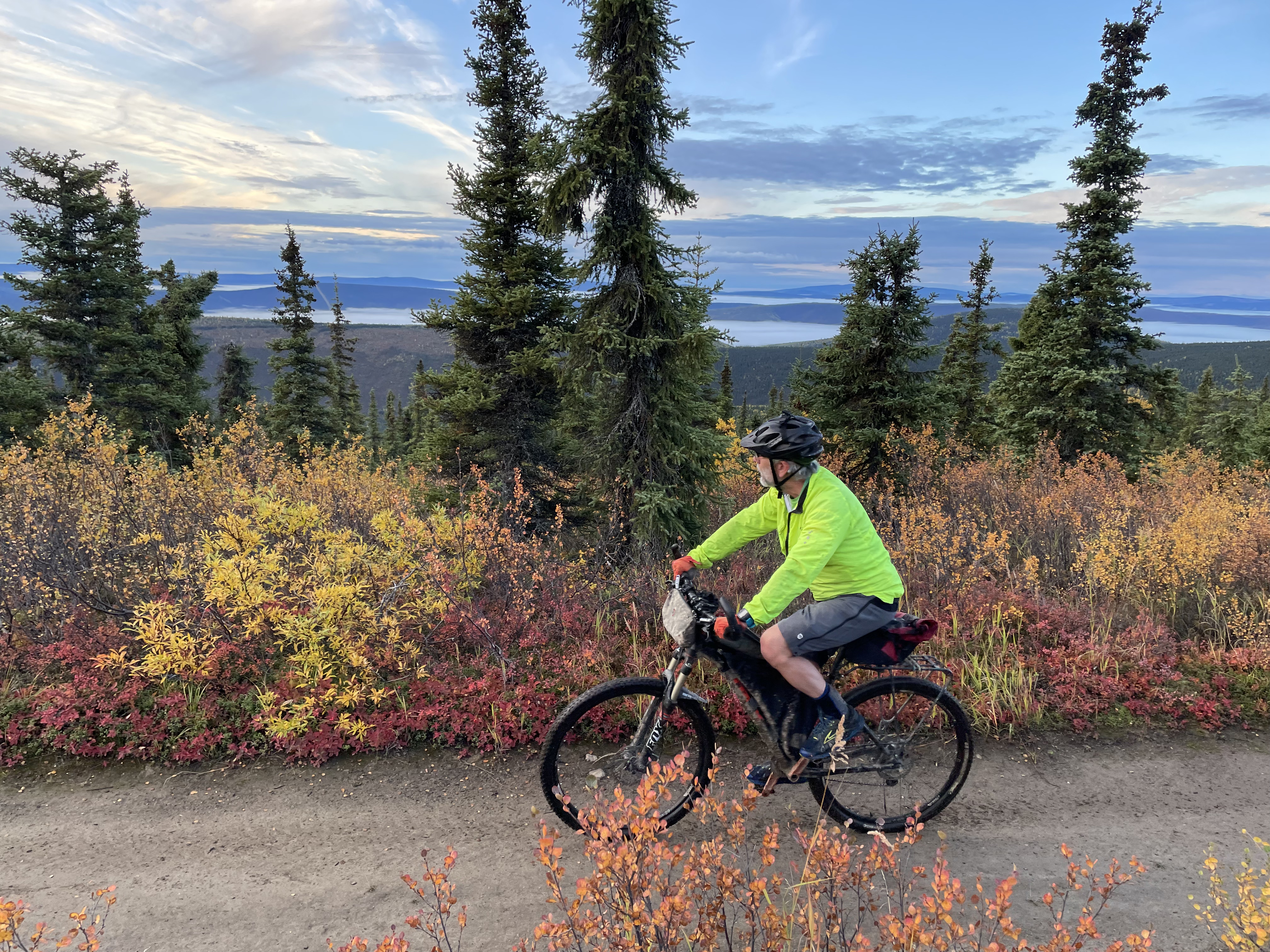
The road is mostly rolling hills.  There are some fairly steep grades of 12-13% but most are more like 6-8%.  Almost every climb is less than a mile except the climbs out of Boulder Creek and the climb back up from the Yukon River on the way back.  So, lots and lots of short little climbs and short fun downhills.  I ended up with over 10,000 feet of climbing for the 100 miles.  I biked through forested areas that would open to views of mountains in the distance.  I had glimpses of the Yukon River 20 miles before I got there.  I biked through a large burn area.  It wasn’t the incredible mountain vistas of the Denali Highway or Denali Park Road, but it was very nice.  The fall colors were a bit past prime but still lots of yellows in the birches and aspens.


The road had very little traffic.  I think I saw maybe 20 vehicles all day (and some of them were probably the same people driving back and forth.  Everyone was in camo and driving either a white or red truck looking for moose, so hard to tell apart.) There were also a few people from Tanana making their way to or from Fairbanks.  But most of the time, I was all alone.  A few people would stop and marvel that I was out there biking. Of course, when I told one guy that I had only biked from Manley and not Fairbanks, he did say I was a wimp!  

Some distant views of mountains

There were a few trailers with 4 wheelers parked where people had set up hunting camps. I came up on one after a short steep pitch.  A guy congratulated me on making it up the steep climb then invited me to sit by his fire for a bit to warm up.  I only had 15 miles left and plenty of daylight so when he also offered me a Dr. Pepper, I gladly accepted.  PJ was quite the character.  He was camping with his “boys” who had to go to work Monday but he was planning on spending 2 weeks out there.  They were looking for moose but hadn’t seen any yet, although they had bagged a lot of grouse.  (I couldn’t believe how many grouse I had seen earlier in the day, pretty much a covey every quarter mile.  I almost hit a few of them!)  He told me he was now 60 and that at that age, hunting and trapping and fishing licenses were free so he was spending a lot of time doing just that.  He used to own the McLaren River Lodge on the Denali Highway but sold it a couple of years ago.   He had just finished putting in a rustic outhouse, and I got to be the first one to try it out!  It was quite nice and better than squatting in the bushes!  He offered to drive me back to Manley but I said no, I wanted to get my whole 100 mile ride in. Plus, I had done most of the hard work already.  

PJ holds court while one of the "boys" splits wood

Rustic outhouse with a view. Notice the roof to keep off the rain

I thought I would see a lot more wildlife since this is a pretty remote area with minimal traffic but maybe all the hunters scared them away.  I saw lots and lots of grouse, one mink or ermine that crossed the road and I did see some ravens harassing a juvenile bald eagle. That was pretty cool.  I did have one wildlife sighting about a half a mile from the end.  I was bombing downhill when I heard some thrashing to the right of me and l looked over to see a cow moose on an almost collision course with me on the road.  I yelped and she veered off to the side instead of coming out on the road. I stopped to take a quick picture, but I couldn’t tell if she was mad or not, so I booked it out of there and back to my car. 


All in all, it took me just under 11.5 hours including stops to go the 100 miles.  It was a good but chilly day on the bike.  I think this road would make an awesome gravel bike race if you could figure out the logistics with DOT and the Native corporations.  Might have to think about that for the future.  It’s definitely worth biking.  And I heard that the Manley Hot Springs Lodge will be reopening next summer, too!


Saturday, September 11, 2021

Decisions, Decisions - A Microadventure in the Nome Creek Valley


Post by Corrine

I stopped briefly to take stock of my situation while hiking off trail near the Quartz Creek Trail. Should I continue up to the high point?  Those are some dark clouds coming in and I can see showers off to my left.  I’ll probably get wet if I continue and I only brought a light rain jacket.  But will I be disappointed if I turn around before I get there?  And if I continue, will I have time to bike all the way to Ophir Creek as I had planned?  What to do?  Keep going or turn back? 

Dark clouds looming as I climb to the high point in the distance

I was faced with this and many more decisions as I set off on a microadventure yesterday. Earlier in the week I had decided that I wanted to return to the Nome Creek valley as it’s such a beautiful place in the fall.  Eric and I were there a week ago finishing up our Trails Challenge in 36 Hours.  I wanted to have more time in the area.  I decided to bike 10 miles on the US Creek Road to the Quartz Creek trailhead, then hike 2 miles up the trail to a high point.  Then turn around and head back.  About 4-5 hours round trip. I asked a couple of friends if they wanted to come along and although there was some interest, nobody could make it on the day that looked to have the best weather.  

Fall colors are so beautiful right now

First decision.  Go when the weather is better by myself or wait and go with friends?  I decided to go by myself as I’m happy to go on adventures alone and I wanted good weather.  This adventure was all about type 1 fun. After that decision was made, I started wondering if I should do an overnight and take my bikepacking gear.  I was torn.  It would be great to camp out.  But the weather forecast was for rain Friday night.  And it would mean a lot more prep and packing.  Was I up for it?


I don’t like that I’m such a fair-weather adventurer.  I’m fine if the weather looks good but then turns bad when I’m out there but it’s hard for me to motivate if the weather forecast is marginal.  It’s usually never as bad as you think it might be, but still I have changed or cancelled plans due to the weather forecast.  Maybe I just don’t like to suffer as much as I get older?  


I also don’t like that sometimes the effort to get out the door stops me from going.  I have a very busy stressful job.  Although I only see patients 4 days a week, those days are non-stop from 6 in the morning until 5 or later at night.  It’s often hard to come home after an 11–12-hour day and immediately start packing for a quick overnight trip.  Usually, I just want to sit down and zone out. We have outdoor gear organized to get out the door quickly, but it can still seem like a chore.  Usually, I can overcome this inertia but lately it’s been harder.  I just want my down time to be relaxing.  I’m always happy once I’m out on the trail but it’s not always easy to get there. 


Sigh. . . what to do?  I decided that if the weather looked good, I would camp.  So, I checked several weather forecasts. They all said the same. 20% chance of showers on Friday but rain likely overnight.  Not good for camping.  So did I just make the decision not to camp?  Nope.  I obsessively checked the weather forecast every 2 hours up until the time I left thinking it might change.  But surprise, it didn’t.  So, I left the camping gear home.  But then I still fussed about my decision on the drive out. Should I just have packed and brought everything along? Would I be sorry that the decision was made?  What if it ends up not raining?  Would I be mad at myself?  Do other people fuss this much about trip decisions?


Despite my self doubt, it was a beautiful drive to the trailhead.  The fall colors along the Steese Highway were just about at their peak and the sun was shining.  I got  my bike out and slowly made my way up the first 4 miles of US Creek Road.  It’s a steady 8-10% grade but my legs were fresh, so it wasn’t too bad.  I came across an ATV trail off to the right.  What to do?  It took me about a second to decide to check it out.  That’s one nice thing about doing trips by yourself.   You can change plans on a whim and nobody objects.  Today was all about exploring so I turned right and rode about 1/2 mile up a steep and rocky trail to a nice look out.  Well worth the extra grind.


Just before crossing Nome Creek there was an unimproved road to the right.  Once again, it was an easy decision to change my plans and check it out. I turned around when the road crossed the creek because I didn’t want wet feet.  I headed back to the main road and then biked the 4 miles to Nome Creek Campground. We used to take our kids camping here until it got overrun by 4-wheelers who would race up and down the road all night. But it was nice and quiet today as most of the hunters were camped back by the river and not in the campground itself.  

Nome Creek

I locked my bike at the Quartz Creek trailhead and headed up the steep and rocky trail for a mile.  I had planned to go left up the ATV trail to a high point but when I got there, I saw I could go right off trail to a different high point.  What to do?  I decided to explore the off-trail option.  I had been thinking about biking the 12 extra miles down to Ophir Campground after my hike, but I didn’t have to do that.  There was nobody to chastise me for changing plans again.  

Quartz Creek Trail - dark clouds already starting to build

Hiking off trail on tundra is slower but I didn’t mind.   Once I got to what I thought was the high point, there was another higher point not that far ahead.  So I kept going.  I had planned on turning around at 2 miles, but at 3 miles I still wasn’t at the highest point.  That’s when I stopped to decide what to do.  I ended up continuing, and as I was making my way up the last hill, the wind picked up, it started raining and then hailing.  I was so close.  I put on my rain jacket and kept climbing. I had planned to eat lunch at the high point, but once I got there, I just took a couple of photos and quickly headed down.  

Wind and rain and hail - what's not to like about that?

I got wet and cold hiking down.  I knew I would still have 10 miles of biking to get back to my car, but I had one more layer of clothes packed on my bike, and I also had dry clothes in the car.  So all was good even if I couldn’t move my fingers and my butt was frozen with just a thin layer of lycra covering it.  By the time I got back down to the trailhead, though, the rain had stopped.  I put on my extra layer and started warming up. Hmm, maybe I should go ahead and bike to Ophir Creek before heading back to the car.  It was only 5 PM.  I should have just enough daylight (I did not bring a light as I didn’t think I would be gone that long) to make it.

View of Nome Creek along the road to Ophir Creek Campground

So once again, I changed my mind and made the decision to ride the rest of the road.  I decided to ride for an hour before turning around or until it started raining again. I even made the decision to check out another ATV trail down to the creek.  I didn’t quite make my hour turn around (I couldn’t stop when I was just a mile from the campground) but it didn’t start raining again until I got back to US Creek Road. I stayed warm climbing for 3 miles but did get a little chilled bombing the last miles back down to my car.


All in all, it was a great little microadventure.  I was able to keep changing the plan as I went, depending on how I felt in the moment.  That’s one great thing about being out on an adventure by yourself with no set plan.  And the only decision I regretted?   I should have thrown my camping gear in the car.  That way I could have car camped after finishing.  Oh well, it was also nice to get home, take a shower and sleep in a warm bed, too.

Bike portion of the microadventure.  52.5 miles, 4100 feet elevation gain

Hike portion - 6.6 miles, 1900 feet elevation gain


Sunday, September 5, 2021

2021 Summer Trails Challenge in 36 hours


Post by Corrine

We came around a corner and saw another long puddle that filled Quartz Creek Trail. Eric looked at it and shrugged his shoulders. 

“I’m just going to bike through it,” he said. 

In just a few feet, though, he was splashing through every pedal rotation as the puddle was at least a couple of feet deep. 

My feet were still dry, so I decided to walk my bike around the puddle, which required a bushwhack through dwarf birch and around black spruce. 


“We should just leave our bikes here and hike,” I argued. 

“But the trail might get better,” Eric said. “Let’s try a little farther.” 

The trail never did get better. If it wasn’t puddles, it was sections filled with huge rocks. And my feet eventually got wet. 


Why were we putting ourselves through this misery? To do the Fairbanks Summer Trails Challenge! The sign on the Quartz Creek Trail was the second-to-last sign we had to get. We weren’t going to give up on it! Fortunately, the sign was “only” 6 miles in on the trail, which is 17 miles long. We were so happy to finally see the sign. We took a selfie, ate a snack, and then turned around for another 6 miles of puddles, rock gardens, and hike-a-bike steep sections. Well, I guess it is called a trails “challenge.” 

The Trails Challenge

On the Flicker Trail at Tanana Lakes Recreation Area

Each year, the Fairbanks North Star Borough Parks and Recreation Department puts on a summer and winter trails challenge. Parks employees put up signs on trails in the Interior, and the goal is to take a selfie at each sign and post it on social media. If you get a minimum number of signs, you get a “Trailblazer Award” and are eligible for prizes. (Here’s a link to the Trails Challenge page: https://tinyurl.com/4chnx2xx.)

On the Sunnyside Trail at Birch Hill.

The challenge is a great way to get people outside and has been hugely successful with more people taking on the challenge each year. We’ve been on most of the trails in the Interior, so we try to take the challenge to another level. The last couple of years we have done all the trails in one day (though we did miss the one last winter). Were we ready to do that again? 

Early in the summer, we were either too busy on weekends or I was tapering for a race, or the weather was not conducive to being out all day, so it didn’t seem like our Trails Challenge was going to happen. I never even got around to registering us. 

Between Sunnyside and Relay Loop trails at Birch Hill

Last Minute Decision for Some Craziness

Fast forward to Labor Day weekend. I had four days off and we wanted to do something bigger than a couple of day hikes. Except the weather wasn’t cooperating. The whole state was going to be rainy. North or south of the Alaska range didn’t seem to matter, none of it was looking promising. The best weather seemed to be nearer to Fairbanks. We threw out some suggestions to each other. Pinnell? Mt. Healy? What about the Trails Challenge over two days? We decided to see what the weather was like Friday morning, my first day off. 

On  the Wickersham Creek Trail

I woke at 7 AM and the local weather forecast was pretty good. I said to Eric, “Let’s do the Trails Challenge.” He, of course, said yes. Luckily, I had printed the Trails Guide earlier, just in case. I looked at the list of trails while eating breakfast to figure out the most efficient order to do them. Eric tried to find a little intel online about some of the signs. We quickly threw some clothes and snacks in the car, and we were out the door by 8:30 AM. I am usually way more methodical about planning our adventures, but what the heck. The sun was shining, and daylight was burning.

On the Ester Dome Single Track

The Challenge of This Challenge

We’ve done the Trails Challenge in a Day before, but we knew this one would be tougher to complete than in past years. This Trails Challenge required more miles on trails and more driving than in the past. And we usually do the Trails Challenge in a Day around solstice, so we had less daylight in early September. But on the upside, there would be no bugs! 

On the Eagle Trail at Tanana Lakes

We started with the closer trails and then saved the ones further out until the end. We got to 17 of the 20 trails by midnight on Friday. The last three were farther out the Elliott and the Steese highways north of town. We didn’t want to bike or hike them in the dark (the point of the challenge is to see the trails) but did we want to sleep in our car? We hadn’t packed sleeping bags or pads and didn’t have a lot of warm clothes. We also needed gas, and everything was closed until morning. Also, after finishing the Chena Dome Trail and driving back to the Steese Highway, we were only seven miles from home. We decided to go home and sleep until it got light. So, not quite a Trails Challenge in a Day, but still a big challenge. 

Hiking down the Chena Dome Trail in the dark at 11 PM

We got to bed at 1:30 AM and set the alarm for 6 AM. After four-and-a-half hours of sleep and 30 minutes to eat breakfast, we were back out the door. We thought we would be done by early afternoon, but we had to drive a lot to get to the final three trails and they took longer than expected, especially Quartz Creek Trail. But we managed to finish and be back home by 8 PM, just under 36 hours of when we started.

Climbing down from Tabletop Mountain

We were tired and dirty but satisfied. We had biked 68 miles, hiked 10 miles, and climbed over 12,000 feet. We had driven 400 miles to reach all the trailheads. Our actual time on the trails was 18.5 hours. And we had great weather! We got sprinkled on the first afternoon and had a brief shower on day two, but mostly it was warm (45-65F) and partly sunny. The fall colors were prime in the higher country. It was a great way to spend a couple of days in the Interior.

On the Quartz Creek Trail

The Trail Ratings

We decided to rate the trails by superlatives. You will have to check out the trails yourself to see if you agree with our assessments.

Easiest Trail: Chena River bike path in town. 

Flat, paved, and along the river. I ride part of this bike path every time I commute to work.


Hardest Trail: Quartz Creek Trail

By far, this was the most challenging trail to do on a bike. Steep, rocky and with lots of puddles and water. Lots of hike-a-bike. I think there was maybe a total of one mile that wasn’t extremely challenging to bike. The rocky areas were relentless. Glad our bikes held up!


Rootiest Trail: Secret Trail

I thought this would be the most difficult trail for me, but Quartz Creek was even harder. Eric loves riding downhill on bumpy, rooty trails. Me, not so much. Luckily, the trail is only about a mile long.


Most Fun Trail: Chena Lake Gravel Bike Path

This category was hard to decide, and Eric and I debated it for a time since all the trails are fun. But we chose this one for two reasons. First, neither of us had ever been on this bike path. Much of it meanders next to the lake and along a slough. It’s flat and easy and wide enough to bike and chat. Second, we did some extra miles going further down a gravel access road all the way to the Chena River to a small dam. Not sure why the dam is there. To keep the Chena River out of the slough and the lake? We love exploring and finding new areas. 


Not really sure why this dam was built here

Eric having fun on this fun trail

Most Surprising Trail: Beaver Springs Nature Trail

Neither of us had been on this trail before. Eric had heard of it but knew little about it. The trail is short, but we were happily surprised at one point to look up and see Santa Claus’s rear end! Part of this trail runs along a slough behind the Santa Claus House and the huge statue of Santa.


Most Directionally Challenging Trail: Chena River Loop Trail

Last summer, when we were supposed to do a different trail in the Chena River Park area, we ended up doing this loop twice before we realized we were on the wrong trail. This year, we started down the Nature Trail before realizing it was the wrong trail. We figured it out and found the River Loop Trail and the Trails Challenge sign. Then we continued the loop, but we accidentally started around the loop again before realizing our mistake. We are usually not that directionally challenged. We just can’t seem to get our directions right on the River Park trails! 


Shortest Trail: Cranberry Trail

This trail is in our backyard. We only walked 1/4 mile to get to the trail sign by a side trail. The whole trail is 3 miles, but we felt no need to do that for the Trails Challenge. We’ve done it lots of times already. 

Our first trail sign of the day right near home


Longest Trail: By distance, Compeau Trail. By time, Quartz Creek Trail. 

The Compeau Trail is 23 miles round trip to the sign, but we were able to do it in 3 hours. In comparison, the Quartz Creek Trail is only 12 miles round trip, but it took us over 4 hours to do.

Eric having fun on the Compeau Trail

Finally almost to the trail sign on the Quartz Creek Trail

Most Scenic Trail: Quartz Creek Trail

Although this trail was challenging, it was by far the most scenic. A lot of the trail is above tree line with expansive views of the mountains all around. And this weekend, the fall colors were at their peak. It was stunningly beautiful. We highly recommend this trail, although we would recommend hiking unless you like challenging mountain biking terrain. It’s motorized so you can also take an ATV. 


Favorite Trail: Compeau Trail

Love, love, love this trail. Lots of climbing but on good grades that are very bikeable. And then wonderful, swoopy downhills that even I can almost just let loose on. The trail itself is in great shape with minimal rocks, mud, and ruts. And beautiful vistas through the trees, up high where the trail opens up. 


Best Animal Sighting: Skarland 9 Mile Loop

We saw several animals: a porcupine on Compeau, sheep on Quartz Creek, a loon and osprey on Chena Lake, and a moose and fox while driving. But the best animal sighting was the musk ox at the Musk Ox Farm. He was right up next to the fence where we parked. He kept grunting and walking back and forth while messing with the cables with his horns. He was so close we could smell him. I was glad for the double fence! Usually, the musk oxen are way off in the distance, so it was fun to see one up close. 


The Trails Challenge is a great way to find out about and experience local trails. Every time we do the challenge, we feel thankful for living in such an amazing area. 

One more of the Quartz Creek Trail because it was so beautiful

Our Past Trails Challenge in a Day Write Ups

Summer 2020: https://notquiteoverthehillcorrineanderic.blogspot.com/2020/07/misadventures-on-dawn-to-dusk-summer.html

Winter 2020: https://notquiteoverthehillcorrineanderic.blogspot.com/2020/02/winter-trails-challenge-in-day-2020.html

Summer 2019: https://notquiteoverthehillcorrineanderic.blogspot.com/2019/07/doing-summer-trails-challenge-in-one.html


P.S. During our four-hour nap in the middle of our 2021 Trails Challenge, Eric had a strange dream. It was about the Mellick Effect, which is the observed phenomenon that studies about how competitive trails challenges affect the behavior of competitors in said challenges. Unfortunately, the alarm rang before Eric could read the conclusion of the study.