Tofty Road? Never heard of it. Where and what is it? These are the comments I get from people when I mention this road. There isn’t a lot of information about it on the web, so I decided to do this blog post after biking it.
The Tofty Road (Road to Tanana) was put in by the Department of Transportation so that residents of Tanana, a village of about 250 people near the confluence of the Yukon and Tanana rivers, would have an easier way to get to Fairbanks. It begins in Manley Hot Springs (a small town 150 miles from Fairbanks) and ends 50 miles away at the Yukon River, not at the village itself. The terminus is 6 miles upstream of Tanana and on the opposite bank. In the summer, villagers use boats to access the road. In winter they put in an ice road.
 |
| The village of Tanana is at the base and to the left of the dark green hill. |
The road opened to the public 6 years ago and I remember thinking it might be fun to bike. Then earlier this summer some friends of mine did an epic trip, biking from Fairbanks up the Dalton Highway to the Yukon River, packrafting down the Yukon, then biking out the Tofty Road and back home. They said the road was good biking with a few stream crossings. One, Sullivan Creek, was at least knee deep. But this fall, new culverts were put in on Sullivan Creek fixing that problem. Hearing that and seeing that the weather looked to be sunny (although cold) this weekend, I decided to go on one more micro adventure.
 |
| New culvert to divert water under instead of across the road |
I left Fairbanks Friday afternoon for the 3 hour drive to Manley. See my previous post about biking this highway.
https://notquiteoverthehillcorrineanderic.blogspot.com/2020/06/biking-from-home-to-manley-hot-springs.html It was a gorgeous drive with fall colors still glowing. I planned to camp in Manley but when I got to the campground, it was just a gravel parking lot with some grassy areas with picnic tables by the Hot Springs Slough. It was right off the main road as you come into town. It would be okay in an RV but not so great for tent camping.
 |
| Fall colors still glowing on the Elliot |
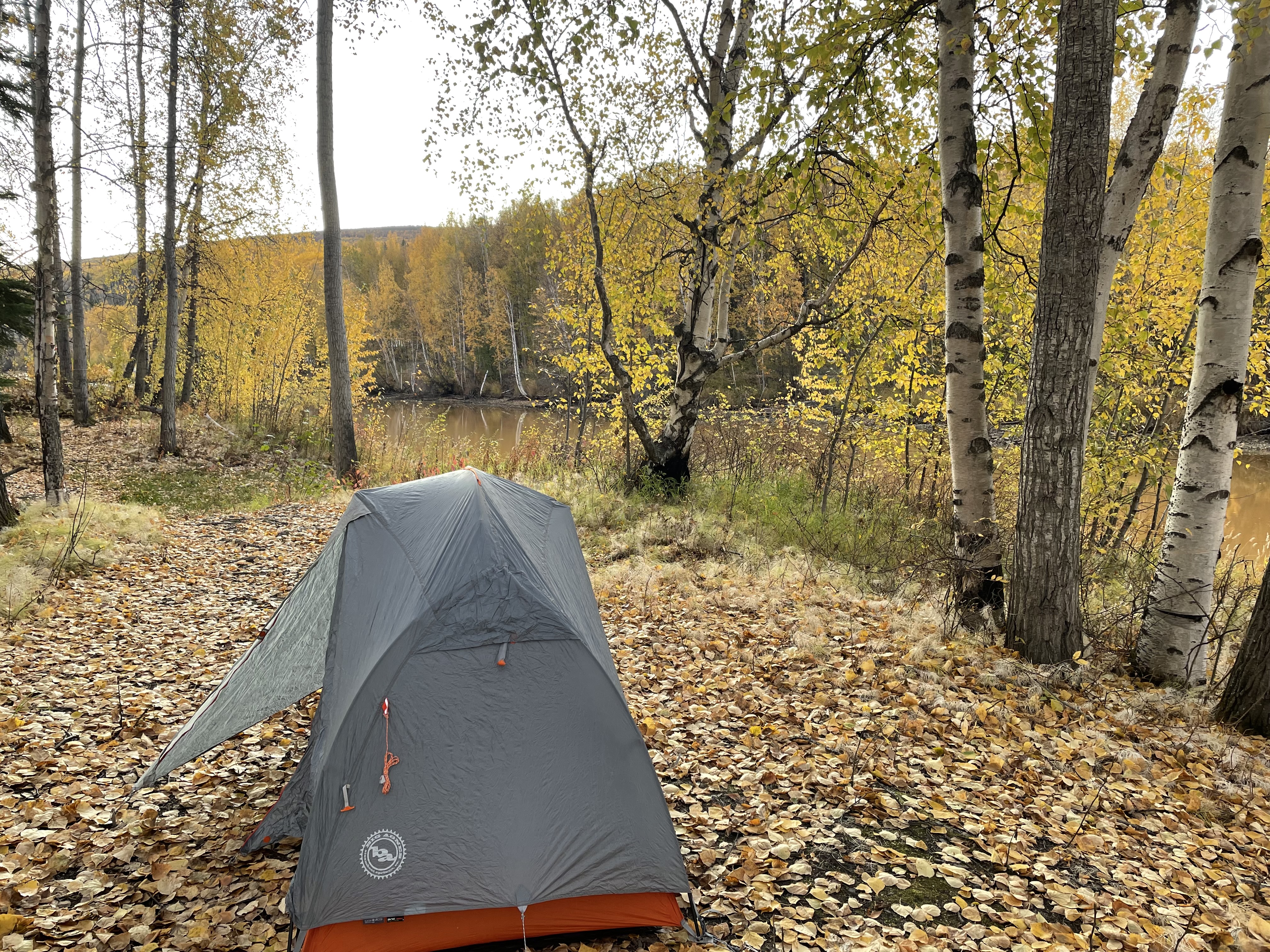
So, I drove down to the Tanana River to see if I could find someplace better to camp, but that parking lot was filled with vehicles and boat trailers. There was no place to set up camp plus it’s private Native land so I headed back to town to set up camp by the slough. I was able to put up my tent in some trees for a slight bit more privacy.
 |
| Tanana River |
 |
| View from my campsite. The slough was really that color. |
 |
| About 200 yards to the left was a house, but I could pretend I had privacy in the trees. |
I got up early the next morning and was biking by 7:30 AM after eating breakfast and breaking camp. It was only about 25 degrees but the sun was shining and there was just a bit of a breeze. The temperature never got above 40 degrees all day and the wind picked up a little in the afternoon. I was never cold (except my toes for the first few hours) but I was never really warm, either.
 |
| Headband, wool hat, neck warmer, thermal bike pants and shirt, windbreaker, rain jacket and rain pants, waterproof socks and toewarmers. Almost warm enough! |
 |
| Sunrise a few miles in on the road |
The road is good gravel with a few potholes that weren’t a problem to avoid on my bike. I’m not sure how often the road is graded but it was in excellent shape the day I was there and it could have been navigated with a low clearance 2-wheel drive car. I think it would be a little muddy and slippery after rain, but I didn’t have to worry about that. It’s pretty narrow for 2 cars but there is plenty of room for cars to pass bikers. And plenty of pull outs, too. There are no services anywhere on the road, so you need to be self-sufficient. There are plenty of creek crossings so water is not a concern.

A lot of the road passes through both Doyon and Tozitna lands, so you can’t really explore on side trails since these are private. It would be great to bikepack to the river and camp, but this isn’t an option as the land around the river is Native-owned with no trespassing and no place to really camp. You can access the river, but out of town people must park their rigs about 1/2 mile up from the river and once that lot is full, you are out of luck. I talked to a Native patrolman who said he has turned people back. The lot looked pretty full when I checked it out on my way back, but it is hunting season. There is a parking lot closer to the river where the people of Tanana keep their vehicles, but others aren’t allowed to use it, although the patrolman said it was okay for me to eat lunch there.
 |
| Yukon River |
 |
| Parking lot for non-Tanana people. Pretty full. All of these people were out on the Yukon River. |
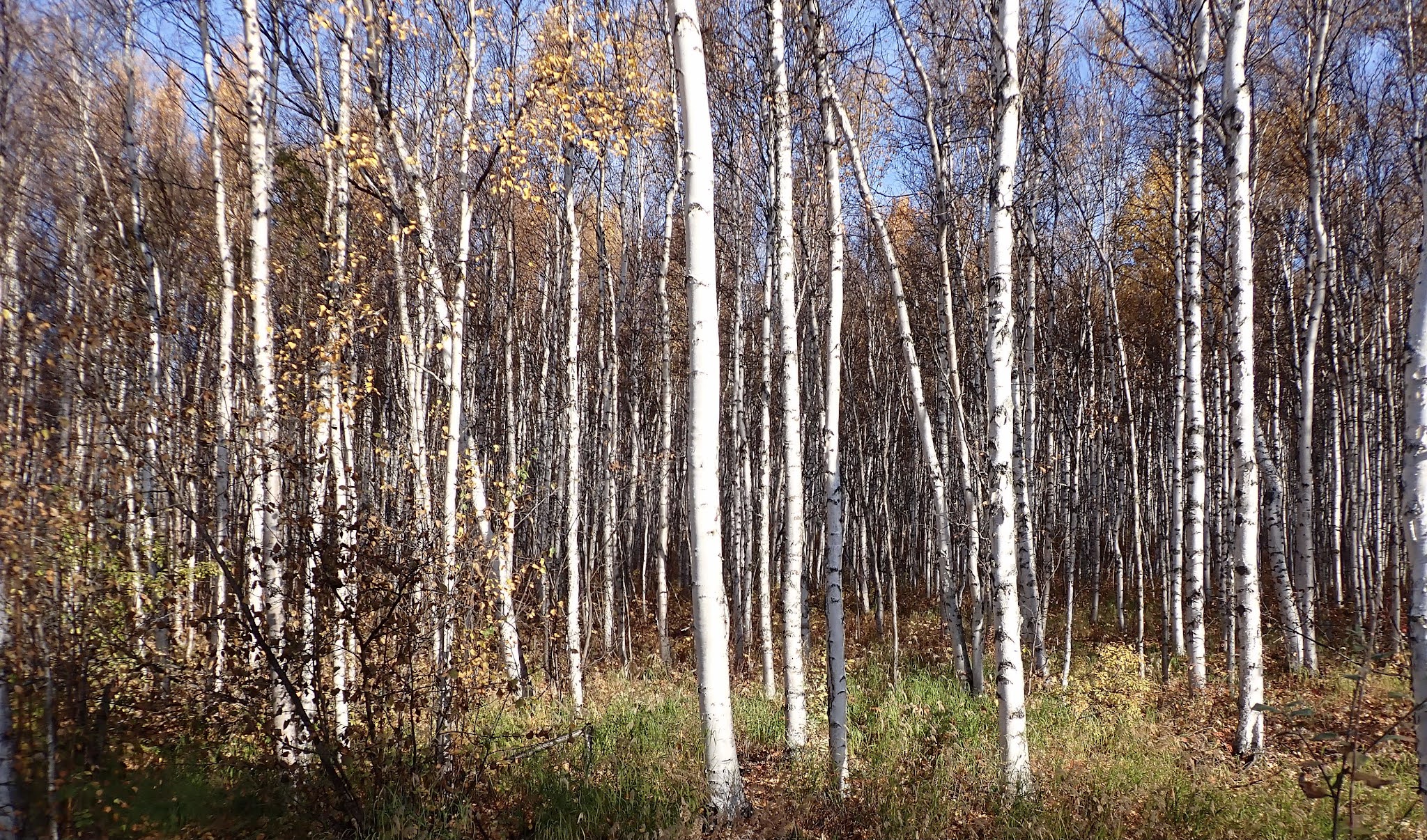
The road is mostly rolling hills. There are some fairly steep grades of 12-13% but most are more like 6-8%. Almost every climb is less than a mile except the climbs out of Boulder Creek and the climb back up from the Yukon River on the way back. So, lots and lots of short little climbs and short fun downhills. I ended up with over 10,000 feet of climbing for the 100 miles. I biked through forested areas that would open to views of mountains in the distance. I had glimpses of the Yukon River 20 miles before I got there. I biked through a large burn area. It wasn’t the incredible mountain vistas of the Denali Highway or Denali Park Road, but it was very nice. The fall colors were a bit past prime but still lots of yellows in the birches and aspens.

The road had very little traffic. I think I saw maybe 20 vehicles all day (and some of them were probably the same people driving back and forth. Everyone was in camo and driving either a white or red truck looking for moose, so hard to tell apart.) There were also a few people from Tanana making their way to or from Fairbanks. But most of the time, I was all alone. A few people would stop and marvel that I was out there biking. Of course, when I told one guy that I had only biked from Manley and not Fairbanks, he did say I was a wimp!
 |
| Some distant views of mountains |
There were a few trailers with 4 wheelers parked where people had set up hunting camps. I came up on one after a short steep pitch. A guy congratulated me on making it up the steep climb then invited me to sit by his fire for a bit to warm up. I only had 15 miles left and plenty of daylight so when he also offered me a Dr. Pepper, I gladly accepted. PJ was quite the character. He was camping with his “boys” who had to go to work Monday but he was planning on spending 2 weeks out there. They were looking for moose but hadn’t seen any yet, although they had bagged a lot of grouse. (I couldn’t believe how many grouse I had seen earlier in the day, pretty much a covey every quarter mile. I almost hit a few of them!) He told me he was now 60 and that at that age, hunting and trapping and fishing licenses were free so he was spending a lot of time doing just that. He used to own the McLaren River Lodge on the Denali Highway but sold it a couple of years ago. He had just finished putting in a rustic outhouse, and I got to be the first one to try it out! It was quite nice and better than squatting in the bushes! He offered to drive me back to Manley but I said no, I wanted to get my whole 100 mile ride in. Plus, I had done most of the hard work already.
 |
| PJ holds court while one of the "boys" splits wood |
 |
| Rustic outhouse with a view. Notice the roof to keep off the rain |
I thought I would see a lot more wildlife since this is a pretty remote area with minimal traffic but maybe all the hunters scared them away. I saw lots and lots of grouse, one mink or ermine that crossed the road and I did see some ravens harassing a juvenile bald eagle. That was pretty cool. I did have one wildlife sighting about a half a mile from the end. I was bombing downhill when I heard some thrashing to the right of me and l looked over to see a cow moose on an almost collision course with me on the road. I yelped and she veered off to the side instead of coming out on the road. I stopped to take a quick picture, but I couldn’t tell if she was mad or not, so I booked it out of there and back to my car.

All in all, it took me just under 11.5 hours including stops to go the 100 miles. It was a good but chilly day on the bike. I think this road would make an awesome gravel bike race if you could figure out the logistics with DOT and the Native corporations. Might have to think about that for the future. It’s definitely worth biking. And I heard that the Manley Hot Springs Lodge will be reopening next summer, too!


Looks like a very nice Fall ride, Corrine. And you're right, there is a nasty gleam in the eyes of that cow moose. She probably assumed you were a hunter.
ReplyDeleteThis comment has been removed by the author.
ReplyDeleteThis comment has been removed by the author.
ReplyDeleteThis was an awesome post. I never knew this road existed, either. Looks like a beautiful place in the fall colors. What a great ride!
ReplyDeleteThis comment has been removed by a blog administrator.
ReplyDelete