Saturday, May 23, 2020

Satisfying Curiosity in the Donnelly Training Area


The views from atop Donnelly Dome are spectacular. But they are tantalizing, too. 

Corrine and I have been on top of the dome, just south of Delta Junction, several times. How can you not hike it? Its there every time you drive south on the Richardson Highway. Though dwarfed by the nearby Alaska Range, the dome dominates the Delta River plain out of which it rises. Its steep-but-not-dangerous flanks call to be hiked. It’s a fun, relatively short hike, and a popular destination for interior residents.


From atop the dome you can see a variety of trails, gravel roads, and lakes, all begging to be explored. For a variety or reasons, we had never been to most of them. For one, much of the land around the dome is in the Donnelly Training Area of Fort Greely. At first we didn’t know if civilians were allowed. If so, how do you get permission? We never bothered to find out. That area has lots of other adventures. (Check it out: www.salchadeltaswcd.org/trails/.) 


This spring, curiosity overcame inertia. I checked out the military recreation website (https://usartrak.isportsman.net/) and learned that getting a permit was relatively easy. We decided to make a full day of climbing the dome and exploring the gravel roads west of the Richardson Highway by bike. Getting a good road map for the area was a bit tricky, but I printed out several maps I found online (and then forgot them at home). Fortunately, I also downloaded a GPS-enabled PDF map from the website to my phone. (The fishing map has a good road map. Google Maps works well but doesn’t include off-limits areas.)


We left Fairbanks at about 8 a.m. on a Saturday in mid-May and arrived at the dome a couple hours later. We decided to hike the southern approach, since the northern side still had snow and probably mud. 


We were happy to get climbing and warm up, since temperatures were in the low 40s. The climb is a thigh-burner, but you get great views quickly. Every time I’ve climbed the southern side I’ve looked down on a 4WD trail that heads east from the Richardson Highway past Jarvis Creek and on toward Granite Mountain. And every time I’ve said I should bike that trail at least to Jarvis Creek. I pitched the idea to Corrine and she was game. 


“This trip is about exploring,” she said. 


A pasque flower on the flanks of Donnelly Dome. 

In less than an hour, we crested the gentle upper slope that leads to the top of the dome and were greeted with a chilly breeze. Fortunately, the forecast called for warmer temperatures later. At the summit we put on more layers and looked down on the roads we planned to bike, eager to explore. 


Requisite selfie from atop the dome!

We also had to chase away a bold ground squirrel that had almost no fear of humans. It came out of a human-built rock wall and nibbled on Corrine’s pack after she put it down. Later, the little bugger started checking out Corrine’s shoes, when she was still in them! 


This ground squirrel certainly didn't fear humans!

After a short break, we headed back down. By then the chilly breeze wrapped around that side of the dome. Brrr. The forecast had called for temps in the high 50s and we were looking forward to that. 

Donnelly Dome hike map
(At the base of the dome, we took a different route back to the car
to see what it was like: brushier and longer, but doable)


Back at the car, already two other cars were in the small pullout. We drove about a half-mile north on the Rich, parked at the beginning of the 4WD trail that headed toward Jarvis Creek, and started biking. Finally, I’d get to see where this trail went! 

We quickly ran into a small creek crossing that was bikeable but left us with wet feet. (A minor casualty of exploring.) The trail has a few forks. One ended at Ober Creek, a tributary of Jarvis. The main trail toward Jarvis Creek crossed a wet, muddy area, so we left that for a drier day later in the summer. 


We tried to find a way around to keep our feet dry, but no luck.

We headed north on yet another trail, which paralleled the Richardson Highway. It took us out into a flat plain dominated by Donnelly Dome. Eventually we hit a road that headed out to the Rich. Just off the highway a signboard has recreation information from the military. The map showed a whole maze of trails and roads off to the east. Another day. We wanted to check out those gravel roads west of the highway.


After about a quarter-mile north on the Rich, we turned west onto Dome Road, which also has a recreation signboard. While the east side of the highway is flat, the west side is hilly. Dome Road, a gravel road, quickly starts climbing and heads toward the northern side of Donnelly Dome.


Corrine bikes Dome Road toward Donnelly Dome. 

We followed it past the parking area for the dome’s northern approach and under the Trans-Alaska Pipeline to where Dome Road ends at Old Rich, another gravel road. After consulting the map on my phone, we headed north and down, down, down toward an area with several small lakes, planning to eat a late lunch at one. We stopped on the descent to put on more layers. Where were those warmer temps?! On the way down a group of four caribou, all dressed in coats of tan and white, crossed the road in front of us. 


Eric bikes under the Trans-Alaska Pipeline

We turned on to Windy Ridge Road and soon hit the area with lakes, which are stocked with fish. We rode to Nickel Lake, where we put on more layers and had a peaceful, though chilly, lakeside lunch. We talked about how that area would have been nice to visit when our kids were young. Lakes for fishing and canoeing, trails to explore, low-traffic roads for biking. 


Corrine bundled up for lunch.

After lunch we rode further on Windy Ridge to where it overlooks the flats bordering the Delta River. We could see more lakes, but it was almost 4 p.m. With more time we could have done a nice gravel road loop: Windy Ridge to Meadow Lakes Road to the Old Rich, connecting the last two with less than a mile of the Richardson Highway.


Tempting to ride farther, but we were running out of time.

We headed back up, up, up, happy for the climbing to help keep us warm. (Still no warmer temps!) We passed Dome Road and followed the Old Rich past two more stocked lakes. On the way, we saw more caribou and Corrine saw a moose with a calf. The area has quite a bit of wildlife. I had seen another cow and calf earlier on the east side of the highway. Bison are sometimes in the area, but unfortunately we didn’t see any. 
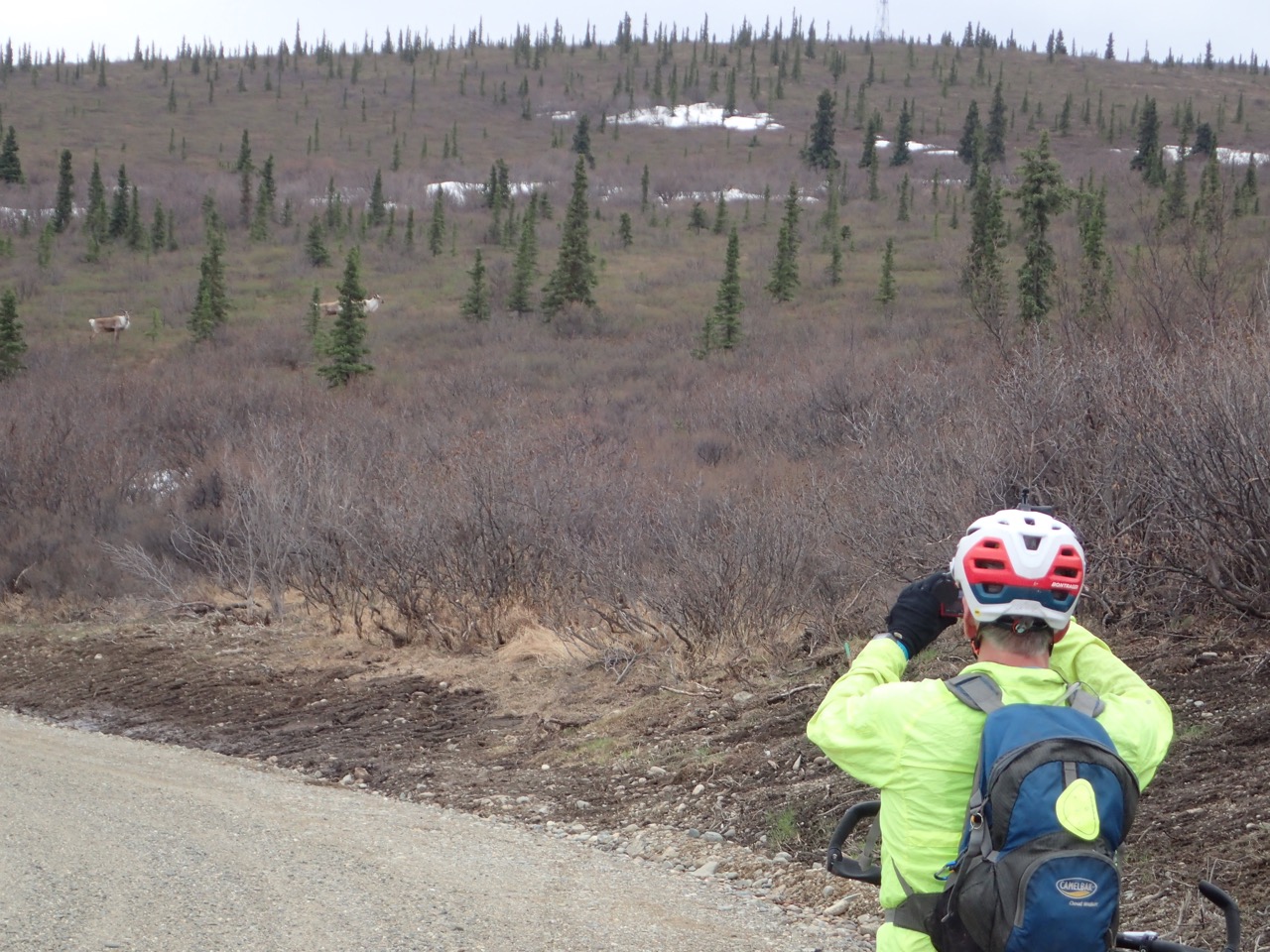

Eric takes photos of some caribou.

I was curious about where the Old Rich ends. At mile 243 of the Richardson Highway, south of the dome, an old 4WD trail leaves the highway. It’s obvious when driving north and I’ve often been curious about where it went. But that rough trail was not anything like the wide, smooth gravel road we were on.

The Old Rich finally ended in a cul-de-sac, where a rough but bike-able 4WD trail continued south.  The trail, which has extensive erosion, descends about a mile and comes out at Mile 243. Mystery solved! From there it was about four miles on the Richardson back to our car for a round-the-dome trip of about 30 miles.


Corrine bikes out of the trail to Mile 243 of the Richardson Highway.
Donnelly Dome bike circumnavigation map

Driving through Delta Junction we stopped at the Buffalo Center Drive-In and had halibut and fries. Mmmmm! (Cash only, but luckily we had enough.) The drive-in is take-out only due to the pandemic, but we found a nearby picnic table. A chilly wind encouraged us to eat quickly. (We never did get those warm temps!) We drove back to Fairbanks with full bellies and content to have solved some of the mysteries around Donnelly Dome.


If You Go

Donnelly Training Area
This area has recreational opportunities for hikers, bikers, fisherman, OHVers and lots more, but to use the area you need a Recreational Access Permit (RAP). The permit is free and easy to get. Go to the US Army Garrison Alaska iSportsman website (https://usartrak.isportsman.net/) and follow the instructions. The training area is sometimes closed, so make sure to read the website carefully and learn how to check in before you go. Then check out the rest of the website, which has maps and recreation information for the Donnelly Training area and other military lands in the interior that are open to civilian recreational use. 

Donnelly Dome
Most of the dome, including the summit, is in the Donnelly Training Area of Fort Greely so you need a RAP (above). 
The dome has two approaches. Neither has an official trail, but both have informal trails. The northern one has less elevation gain and is less steep, but snow lingers later in the year and parts of it can be muddy. The trail is a bit hard to find from the bottom, though it is sometimes marked. You should find it with a bit of poking around. 
The southern approach is drier but steeper. The trail braids many times, but keep to the main trail to the left on the way up you should be fine. If you plan to return the same way, pay attention to landmarks. It’s easy to get off trail. However, it’s easy to see the lower part of the trail and get back on the right path. The parking lot spot and lower flanks of the southern side of the dome are just outside of military land. 
Both approaches and getting to the respective parking areas is described in this guide: www.salchadeltaswcd.org/donnelly-dome/. For information on other trails in that area see the rest of that website from the Salcha-Delta Soil and Water Conservation District (www.salchadeltaswcd.org/trails/). 


Tuesday, May 12, 2020

Mount Margaret on Mother's Day

Corrine takes a photo of Denali while Eric takes a photo of Corrine.
Sometimes it’s good to try something on a whim. You might end up cold and with wet feet but a smile on your face.

For Mother's Day Corrine had suggested hiking the Savage Alpine Trail in Denali National Park. We had heard it was in pretty good shape, and neither of us had done that one in a while. It was a good plan.

We got an early start to beat the crowds we had heard had been collecting at Denali after the road recently opened. We arrived around 9 a.m., and already several cars were on the road. But when we neared the easternmost trailhead of the Savage Alpine Trail we were greeted with a sign: "Trail Closed Due to Dangerous Wildlife Activity." We had heard about a grizzly in the area a few days earlier, so we should have figured that might be a possibility.

We decided to check the trailhead at the Savage River parking lot, but that whole lot was closed. We kept driving and discussing, finally deciding to park at the Teklanika rest stop and walk along the river.

A couple of miles past Savage River, the road tops out and winds around the nose of a ridge. As we drove by I mentioned how I've often wanted to hike that ridge toward Mount Margaret. It's above treeline and is a mostly gentle climb to the top. Corrine pointed to a large pullout and said "We could park there." After a moment I realized she was suggesting we give it a try. I hesitated. The ridge had a lot of snow patches. But driving all the way to Teklanika trying to pass a lot of really poky drivers didn't appeal to me. Doing something new did. We parked.

Within 10 minutes we had wet feet! While trying to cross a small meltwater stream, I stepped on what appeared to be a solid bump of tundra and got a wet foot when it sunk like a sponge. Corrine decided to cross the snow patch above the stream. That worked. Until it didn't. She sunk into the snow and the stream hidden below! We forged on, still trying to keep to dry ground despite our wet feet. We still had to cross several snow patches until we finally attained the steeper slope, which had less snow.

Corrine gets her feet wet!
Corrine hikes on the steeper part of the ridge with Denali just visible in the background.
Signs of life were here and there. We saw several birds but no other wildlife.
As we climbed, the breeze picked up. We finally crested one hill and got a view of a vast plateau atop Mount Margaret. The higher part of the mountain to the east was blocked by large snowfields. We headed west, picking our way through snow patches and across wet ground, aiming for a rock outcropping. A strong wind blew at our backs, so we sought shelter behind the outcropping. No luck! The wind swirled around everything. Places that might offer shelter were still covered in a lot of snow. We were both getting a bit cold and put on extra top layers.

Little color this early, but there was a bit if you looked for it.
The plateau had snow patches and a lot of wet ground, but you could pick your way around it.
"Let's head back and we can eat at the car," Corrine said. I agreed.

We climbed over the rock outcropping and suddenly we could see a sheep trail, free of snow, heading along the ridge toward the higher part of Mount Margaret. We had walked right over it, oblivious!

"Look at that," I said, pointing.

"Let's do it," Corrine said.

The heck with the cold. Destiny called!

We headed up the dry, snow-free trail, climbing higher on the mountain. We could see the valleys to the north and south of the mountain. Denali rose off to the southwest, the top obscured by clouds.

Corrine hiking on the sheep trail.
We stopped before what appeared to be the last pitch to the top. It looked doable, but steep and rocky. I found a mostly sheltered spot behind the ridge, where we had just room enough to sit and eat our lunches. Still a bit windy there, but much better than atop the ridge.

A winderful lunch spot! The last pitch is in the background.
We discussed what to do next.

"I'm ready to head back," Corrine said.

I was a little surprised, as Corrine usually has hotter summit fever than I do, but I agreed. I had forgotten my gloves back at the car, and my hands were cold. I was fine with going back. As soon as we got back to the ridge Corrine looked up at the last pitch.

"We should do it, or at least give it a try," she yelled over the wind.

I immediately agreed. It doesn’t take much to spark my summit fever.

We threaded our way up the steep face and were soon on top of Mount Margaret, wind blowing hard. Corrine and I had climbed part of this mountain several years earlier, using a steep approach from the northern end of the Savage River Loop Trail. On that trip the wind howled so strong we had a hard time walking, so we headed down quickly without summiting. This time we stayed long enough on top for a couple of selfies.

Corrine on the last pitch before the summit.
Corrine on top. (She hates how her headband looks in this photo, but the selfies are still on her phone!)
Now we had a choice: head back the way we came or attempt to cross the large snowfield below us and see if we could descend the ridge to the east of the one we had ascended. We both love loops, but we weren't sure how the firm the snow would be.

"Look, there are some people down there crossing the snow," Corrine said, pointing. "They aren't having any problems."

I never did see these so-called people, but that decided it for us. We headed down and stepped out onto the snowfield. And it worked. Until it didn't.

We would walk along on top of the snow for a few steps, then one leg would suddenly sink knee- or thigh-deep. Maybe a couple more postholes, then more surface walking, then another plunge step into the saturated snow. Our shoes were soon soaked with freezing cold water. But it was funny, too. I smiled as I watched Corrine daintily walk across the top of the snow, suddenly break through, and then wallow around until she was walking on the surface again. I’m sure I looked just as silly.

Corrine wallowing in the snowfield.
We finally got to dry ground and wrung out our socks. Down lower it was less windy and warmer, so we each peeled a layer.

Feet are happier when the socks are drier!
We followed a sheep trail down the ridge and soon ran into a group of people hiking up the lower part of the trail, which looks like it has become a human social trail. (Back home I found that route was mentioned by Ike Waits in his book “Denali National Park: Guide to Hiking, Photography and Camping.”)

We lost the trail amid snow patches and thick alders, but the park road was visible in front of us. We thrashed our way down, finding bits and pieces of game trails, until we got to the road. From there it was a little over a half-mile to our car.

We sealed the hike with a kiss and decided that despite the wind and cold feet, the outing had been much better than what we had planned.

Sunday, May 3, 2020

Moose Creek Cabin fatbike overnighter...in May!

Conditions were great in early May for a fatbiking overnighter into the Moose Creek Cabin. Lots of snow, temps were getting into the 40s and 50s but still below freezing at night, so the trails were solid earlier in the day. The trail to Moose Creek doesn't cross any streams, so no big overflow to worry about. 

Corrine checked on the cabin early in the week and found it was free Saturday. We made plans and packed up. We knew we had to be on the trail early both days or else suffer from too-soft snow in the afternoons (and rut up the trail for others).

It worked great! The first part of the Wickersham Creek Trail was a bit rough from people using it later in the day when the snow was soft. But after a couple of miles it got much better. The crusty snow around us tempted a ride through the trees, but we wanted to get to the cabin early. And we were a little leery of breaking through with our fully loaded bikes. We did do a little crust riding to get a view from Four-Mile Hill, but that was about it.

The trail out to the cabin had some challenging parts, but it was all rideable. We got to the cabin, in about three hours. We started a fire, and collected snow and more firewood. The great thing was that when we were done with all that, the sun was still shining down gloriously! We've been to Moose Creek Cabin several times in the winter, but we've never been there with the sun so high in the sky! We took turns hanging out on the porch to read or do puzzles. The thermometer was reading 70 degrees in the reflected heat. Eventually, the porch was shaded and cool, so inside was the more comfortable place to be.

We got an early start the next morning. The trail was a bit more challenging this time. A couple of  snowmachiners from the previous afternoon had chewed up the soft snow on the trail a bit, but it was still rideable. (And no complaints, since snowmachine traffic is mostly what packs these trails for other uses.)

We rode out, meeting several other fatbikers closer to the trailhead as they headed out for the day. The day previously we met several other fatbikers out early, most of them we knew.

At the car Corrine traded her fatbike for her gravel bike (stored in the car) and rode back home in order to get a longer training ride it. (She's still hoping to do either or both the Trans-South Dakota bikepacking race or the 350-mile DKXL gravel bike race, pandemic willing.)

I was content to drive the car back and get some work done at home. Very nice weekend!

An early start but still with lots of sunshine!
Corrine enjoying some nice trail about 3 miles in.
Eric enjoying the view of the Whites from atop Four-Mile Hill.
The descent past Lee's Cabin. Corrine is a speck down there!
Peter Delamere was one of several fatbikers we knew out on the trails Saturday morning. Peter said he gingerly played around on the crust a bit. 
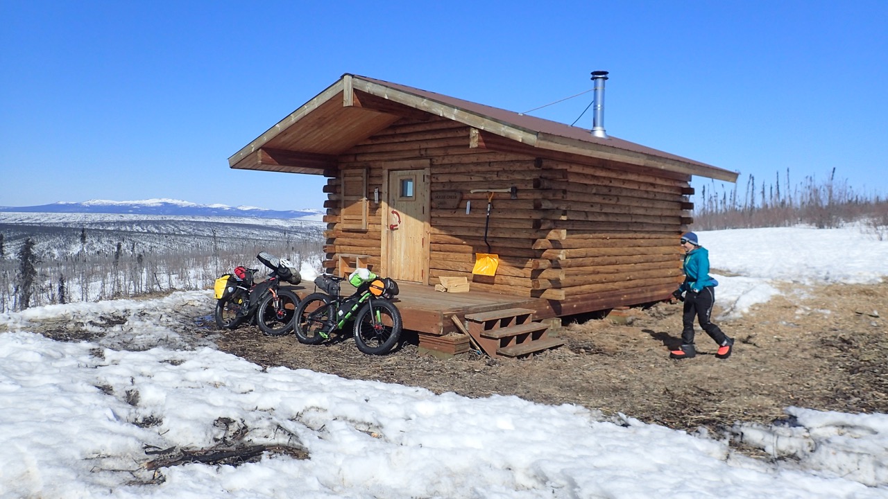
The Moose Creek Cabin! And our bikes, waiting to be unpacked. 
Corrine collected snow to melt for water, but she found the crust was deteriorating in the sun.
Corrine reads on the front porch of the cabin. Notice that she has to shade her eyes. 
The view from the cabin with pussy willows and a crossbill. I think it was a crossbill. Didn't think to bring binocs. (You never bring binocs in the winter!) 
The sun setting at almost 10:30 p.m.
Tom Moran (and Jay Cable) were heading out Sunday morning. They planned a bike-packraft-bike trip, but bailed because the trail was too slow. They ended up staying at Moose Creek Cabin after us. Jay booked it online from the cabin! 
Corrine mostly enjoyed her long road bike ride home. Strong side winds made things a bit hairy for a while. 
The ride out to the cabin. Back to the cabin is just the reverse. 


Friday, March 27, 2020

Virtual Sonot Kkaazoot

Due to the pandemic, the Sonot Kkaazoot couldn't be held as normal. Instead, it was held "virtually," with each person doing their own version. Corrine and Eric both did a version.


Corrine's version:
Leisurely 20K virtual Sonot
Corrine having a good time during her virtual 20k Sonot Kkaazoot.
Barb skied with Corrine for part of Corrine's Sonot. 
Corrine's route.
The Chena River was fine at the start. 
Tom Helmers took a photo of me in my colorful garb. (I decided to dress up for this special occasion!)
The Chena River was quickly deteriorating.
After just a couple of days, the virtual Sonot could no longer be held on the river. 


Half with Barb. Decided to at least do the 20K Sonot. Might try to do 50K on Saturday but will need to see what happens at work. Glad to get out a little early today.


Eric's version:

I finished the Denali State Bank Virtual 50k Sonot Kkaazoot today! 

It took me 6 hours, 17 minutes. Classic skiing. (This was my classic year, so I wanted to classic ski the Sonot.)

The trails were generally in great shape. Thanks to Bad Bob Baker for grooming the Chena River and the Birch Hill grooming crew for grooming the Birch Hill trails. A bit of snow over night covered some parts of the route, but those weren’t bad. The newly groomed sections at Birch Hill were outstanding! 
Things went pretty smooth. Of course, I had a couple problems at the start. Despite taking a leak at Birch Hill (when I dropped off some emergency water at the Warming Hut), I still needed to tinkle when I started! I had to ski several kilometers before I had enough privacy. 

The other thing I noticed right away was that I brought my skate skiing poles! Oh well. I decided to channel my SCUMbuddies Bill Husby and Frank Soos. (SCUM = Susan’s Class of Untrainable Men.) I channeled Bill, aka “Poles” because he double poles a lot, in the flats, and I channeled Frank, the tallest SCUM, the rest of the time.

I saw several people skiing the trails near the Birch Hill Stadium, including NSCF Head Groomer Tom Helmers. (Yes, he does ski!) It was good to see several people out skiing in these stressful times. I didn’t see too many farther out on the course, though I did run into fellow SCUM Don Pendergrast and partner on the river. They were doing the 20k portion of the Sonot. Awesome! Oh, I also saw a coyote cross the river in the morning. That was fun to see! 


All in all, a great way to spend the day! I encourage everyone to get out and ski if time and weather permit! 

Eric followed the traditional route, which uses the Chena River, because he did it early enough.
He was one of the few who were able to use the river. 


Friday, February 28, 2020

Winter Trails Challenge in a Day 2020


Here’s a challenge. How do you make the Winter Trails Challenge really challenging? Find all 13 signs in one day!

My wife, Corrine Leistikow, and I love the Trails Challenge, but we needed to incorporate it into our endurance training. We are both signed up for several upcoming winter endurance races. Doing the Trails Challenge in one day, we realized, would make for good training.

Hosted by the Fairbanks North Star Borough Parks and Recreation Department, the Trails Challenge encourages people to get out on local trails. Signs are posted on a variety of borough-area trails and directions are published that show generally where they are. To participate, people take a selfie with each one they find. Anyone who finds at least 10 of the signs by the deadline gets a Trailblazer Award.

Last summer we did the Summer Trails Challenge in one day and that was definitely challenging! It took us just over 11 hours from the first sign to the last. We drove just over 300 miles and spent about 30 miles on the trails, most of it biking.

But finding all the signs in one winter day? Less daylight. Colder temperatures. That seemed more, well, challenging. But Corrine said let’s do it, and I’m usually game for silly stuff.
We walked to the sign on the Chena River Walk (in the background), but there was enough snow to ski.

Part of this challenge is the preparation. We downloaded a list of the sign directions (https://fairbanksak.myrec.com/forms/6019_20192020_wintertrailslist.pdf) and Corrine mapped out an efficient itinerary that started with the signs in Goldstream Valley, where we live. We considered biking to some signs, but several trails are ski only. After some quick mental calculations, we decided against biking. We would ski to most of the signs and walk to the rest.

During the preparation phase, Corrine learned that one sign is on the Big Dipper Ice Arena walking track and that walking is allowed on Sundays but not Saturdays. We set the date for Sunday, February 23.

We watched the Trails Challenge Facebook page, looking for clues on where to find the signs from other people’s posts, and communicated with friends also doing the challenge. We learned that some people were having trouble finding the Eldorado Creek Trail sign. Corrine looked for it on a couple of her bike commutes but didn’t see it. We began to worry. The forecast also called for the temperature to start dropping Saturday night. We worried more. We were facing failure and freezing! So, we took action.

We had never been on the Retriever Pond Loop in the Tanana Lakes Recreation Area. (Ester Dome in the background.)
On the Friday before, Corrine found that while the Big Dipper is closed to walking on Saturdays, the building would be open, and we could access the sign. Hurray! We rescheduled our challenge day for Saturday, which would be warmer.

Also on Friday, I went skiing with my buddy Mike Mathers and we searched for the Eldorado Creek Trail sign. We found the Tanana Valley Railroad Trail sign, but not the other. I thought I knew where it was based on information I got from another sign nabber, but no luck. Mike and I searched several possible trails for 2 hours, but no luck. We finally gave up and headed back to the cars. And then there it was! We had skied right by it earlier! (Hint: It’s definitely on the official Eldorado Creek Trail south of Goldstream Road [https://tinyurl.com/ufwqa2r] and it’s a lot easier to see heading south than north.)

Mike Mathers helped Eric find the Lower Eldorado Creek Trail sign.
Friday night Corrine and I packed everything we might need and estimated the time our endeavor would take. If we left our house by 8 a.m. we figured we could be done by 6 or 7 that evening. We packed our gear and set the alarm for Saturday morning.

We got out the door right at 8 a.m. and snagged the Tanana Valley Railroad and El Dorado signs with no problem. (Well, as the designated photographer, my hands got cold right away, but I had brought hand warmers just in case and I used them. Be prepared!)

Then we ticked off the signs according to Corrine’s itinerary. We walked to three – Chena River Walk, Big Dipper Ice Arena, and Moose Creek Dam – but were able to ski to the rest.  (The walking ones were fairly challenging, because ski boots are definitely NOT made for walking.) We ended up skiing about 18 miles and driving about 170 miles. (We walked a mile or less.) The temperature stayed a consistent 10-13 degrees all day, no matter the elevation. (And it started dropping right after we finished.)

The challenge was a good reason to get out and ski on the River Trails at Chena Lake Recreation Area.
We grabbed the last sign (East Ramp, Birch Hill Recreation Area) at about 4:30 p.m., well ahead of our estimated finish time. (Thanks in large part to wonderfully groomed trails!) We changed clothes at the Birch Hill Warming Hut and headed out for a nice Thai dinner to celebrate.

We had a great time skiing all these trails. In fact, we often wished we could spend more time on some of the trails, but we stayed focused! Doing the challenge on skis made us realize how lucky we are in Fairbanks to have so many wonderful trails and trail systems that are groomed for winter use. Thank you to all the different groups and agencies that take care of trails in the borough!
We met another Trails Challenge couple at the Colorado Creek Trail sign.


Corrine rockin' a jump after snagging the Birch Hill sign (in the background).
While driving between trails we thought of other ways people can make the Trails Challenge more challenging without necessarily doing them all in one day:
--Do all the signs in a month
--Do all the signs in 9 days (a week and two weekends)
--Do all the signs in a week
--Come up with different silly faces for each selfie (we tried!)
--Snag one sign and then explore more of that trail or trail system
--Do as many signs as you can in order of their numbering

Or, of course, just grab whatever signs you can when you can. The Trails Challenge is a great way to get outside and share the fun with others through selfies, out on the trails, and at the awards party at the end of the challenge.
Gotta be silly when doing a selfie! 
The challenge took us all over the place!