Post by Corrine
Bike Red Rock Canyon. Check.
Bike Coal Mine Lakes Road. Check.
Hike to the Castner Glacier ice cave. Check.
Many of us have Bucket Lists. Epic things that we want to do before we die. Things like go on a bike safari in Africa. Hike in Patagonia in Chile. Or float the Colorado River through the Grand Canyon (we did that last year.) But I also have a list of several smaller, closer-to-home activities that I want to do. Call it my Little Bucket List. This past weekend, I got to check off a few Little Bucket List activities. Nothing epic but still satisfying.
 |
| Photo from our Grand Canyon trip - a trip of a lifetime |
Smoke helped provide motivation for this weekend’s trip. This spring our fire season had been record-level quiet. Then late July was hot. And windy. Wildfires blew up, especially in the Interior. Now we have fires north, south, and east of Fairbanks. Smoke rolled in and didn’t leave. Our air quality plummeted. No fun! So, I started looking for places to get away from the smoke.
 |
| AQI reading from Purple Air website. Above 300 is hazardous! |
South of Delta Junction, in the Alaska Range, looked to be less smoky for the weekend. The state cabin at Donnelly Creek State Recreation Site was available Friday and Saturday so I booked it. Eric, feeling pressure to finish some home and other projects, wasn’t sure if he would come. Plus, the weather and smoke forecasts for that area were iffy and changing by the hour. There was a good chance of rain in the Alaska Range. Heading down just to hang out in a cabin didn’t sound fun. And what if it was just as smoky there as home? I waffled all week. I considered canceling the reservation, but I waited too long and lost my chance. It was ours if we wanted it.
 |
| Donnelly Creek State Recreation Site cabin |
Then Eric changed his mind. He had made more progress on his projects than expected. On Friday the weather and smoke forecast looked OK for south of Delta Junction. Not great, but better than Fairbanks. Friday morning at breakfast we agreed to go for it. We hurriedly packed up our camping gear and bikes and took off by 9:30 AM.
We saw a lot of smoke on the drive down, especially between Salcha and Delta Junction. That got us worried, but we were committed to at least checking out the cabin, one of the few road-accessible state cabins in the Interior we hadn’t stayed at (another first!). When we turned south on the Richardson Highway from Delta Junction, we saw skies clear of smoke! And it was mostly sunny!
 |
| Very smoky skies out our car window on the drive down |
We hadn’t planned any specific activities, so we talked about that on the drive. I had several things in that area on my Little Bucket List that I wanted to do. Since we were getting to the cabin just after midday, we had time for one in the afternoon. We dumped our stuff and the cabin and headed just 25 miles down the road!
Biking the Red Rock Canyon Mining Road

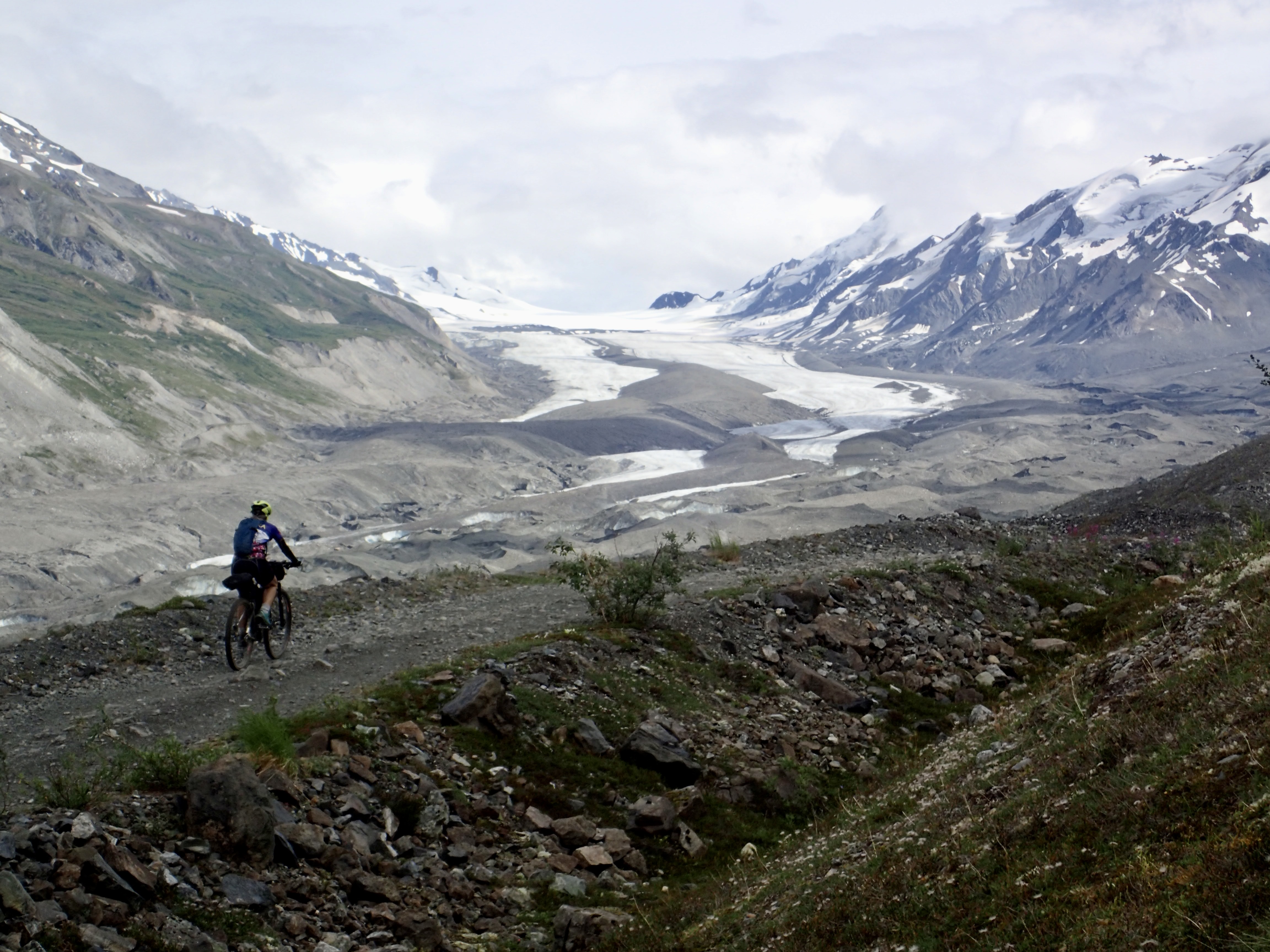
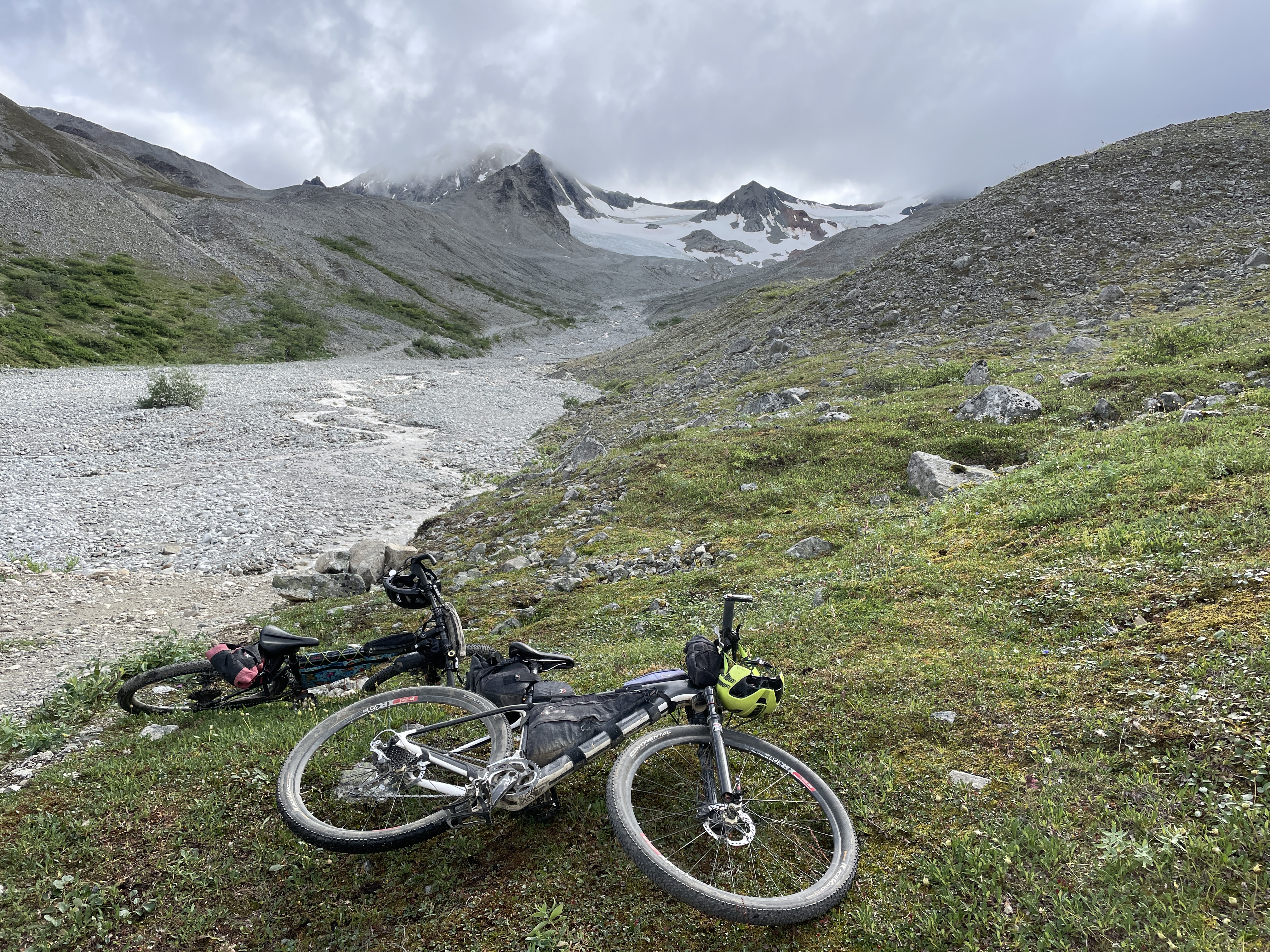
We decided on this activity first, since the weather was good in that area and neither of us had done it. Red Rock Canyon Road is the informal name for a mining road that heads east from the Richardson Highway at about Mile 213.5. It has been used by Fairbanksans and others for many years to access alpine country, the north side of Rainbow Ridge, and south side of Canwell Glacier, which had a nice, mostly gentle trail heading up the lateral moraine. We had been in the area a few times for different adventures. Then, quite a few years ago, a mining company pushed in a road up the lateral moraine, crisscrossing the old trail. People were sad about the loss of the trail, but it opened a new possibility: biking up the mining road.
The road starts as smooth gravel as it leaves the highway, but when it heads into the narrow canyon (the whole canyon is not red, just some rocks at the eastern end) it gets really rocky. We knew about the stream crossing about 3.5 miles in, so we brought sandals. I walked the stream, but Eric tried to bike across and almost made it.
 |
| Walking through the stream on the way back down. Eric rode through it. It was very rocky. |
After the stream, we changed back into shoes and socks and had to push our bikes up a couple of very steep, rocky pitches. But then the trail leveled out and we were able to bike a few miles along the lateral moraine of the Canwell. There you have unimpeded views of the glacier and into the heart of the Alaska Range. On the way up we met some friends from Fairbanks, who were backpacking into Rainbow Basin and happy to be out of the smoke. (On the way down, we ran into another group of hikers from Fairbanks escaping the smoke.)
 |
| The trail was steep and rocky in places |
After biking about 6 miles, the mining road forks. We chose the one heading east, but soon stopped at another stream crossing. We could see the road continue, zigzagging up the next hill, but it would be a lot of hike-a-bike. Instead, we dropped our bikes and hiked up the side of the stream. After about a mile we got to a nice viewpoint where we could see the head of the valley, rimmed with high, sharp peaks and sporting a couple of small hanging glaciers. We made a loop by coming down an old moraine.
 |
| We dropped our bikes here and hiked up this side valley |
 |
| We hiked up from the stream down below |
Heading back on bike was much faster than going up, and it was a great fun! This time Eric successfully biked the stream crossing! We raced some dark clouds back to our car, and only got sprinkled on. As we drove back to our cabin, the rain started. Perfect timing!
 |
| Racing the rain clouds back to our car |
Biking Red Rock Canyon. Checked off my list! (Though we can go back and explore more!)
Biking Coal Mine Lakes Road

That evening, while on a longish after-dinner walk along the Delta River dike that extends from the recreation site, we talked about Saturday and decided on Coal Mine Lakes Road (officially it’s just Coal Mine Road). Eric had biked it years ago, but I hadn’t done it yet. Eric remembered it being 11 to 13 miles long and all bikeable. (He was wrong on the first – it’s about 13 miles roundtrip – but right on the second.)
We got going right after breakfast, since it was supposed to rain in the afternoon. We decided to bike from the cabin since the Coal Mine Road, which heads east from the Richardson at Mile 242.1, is only about 4.5 miles north of the Donnelly Creek State Recreation Site (though almost all uphill). The morning was beautiful though chilly, but the climb quickly warmed us.
 |
| Great views while climbing uphill on the Richardson Highway |
Coal Mine Road is much less rocky than the Red Rock Canyon mining road. However, it has puddles. Lots of them. Many took up the whole road. Fortunately, I had been ready for this and wore my waterproof socks. That was a good choice, since some puddles were fairly deep, and my shoes got very wet. Eric’s bike is a couple of inches taller than mine. He didn’t have waterproof socks but was able to avoid a complete foot-soaking, though his feet did get damp.
 |
| One of many, many puddles on the Coal Mine Road |
Coal Mine Road climbs steadily toward the foothills of the Alaska Range. At the beginning it goes under the Alaska Pipeline, then it passes by several small lakes (many that are stocked by the Alaska Department of Fish and Game) before finally breaking out in alpine country at the end. Years earlier we had camped at one of the first lakes with our kids.
 |
| One of many lakes along the Coal Mine Lakes Road |
As we biked up the road, the views just kept getting better. No wind, no bugs, no smoke, no rain, great views, what could be better?! This would be a perfect place for an overnight bikepack, especially if you wanted to fish.
The road peters out about 6 miles in at the old coal mine. There’s not much left of the mine. A couple of old shot up vehicles. A few pieces of rusted equipment. Since we were almost at the end, we left our bikes so we could avoid a deep puddle. We bushwhacked around the puddle, then hiked on the road a bit and crossed a stream. On the other side we looked at coal from the seam that had been mined. A four-wheeler trail continues from there, but it stays low in a swampy saddle to cross over into the Jarvis Creek drainage. We didn’t have much desire to poke further, so we turned around.
 |
| Old machinery and vehicles at the mine site |
 |
| The road peters out into a soggy, tundra 4-wheeler trail |
 |
| There is still some coal left in the area |
The return trip was quick and fun, though we didn’t do quite as well with the puddles. I took the wrong line through a puddle, got bogged down in some soft muck, and had to step off in the deepest part that went up to mid shin. Eric just laughed and took a photo. Then, just before the last of the puddles, Eric’s karma caught up. He was skirting a puddle when he hit his handlebars on a branch and crashed into the water! He skinned up his knee and soaked his gloves and one foot, but otherwise only his ego was bruised. The ride down the Rich back to the cabin was a fun, fast zoom and helped dry out our soggy parts a bit.
 |
| I should've gone left! |
 |
| Eric's knee gets a little skinned up from his fall in a puddle |
Biking Coal Mine Lakes Road. Checked off my list!
Hiking to the Castner Glacier Ice Cave

After lunch, we still had energy, so we decided to hike to the Castner Glacier ice cave. Eric had been to it a couple of times years before. But I hadn’t done it even though it’s only a mile hike in from the highway. In the past couple of years, it has become very popular, especially in winter. It seems like everybody we know – and many we don’t – has been there except me. (BLM and DOT have put up signs and added parking to deal with all the people.)
We knew it wouldn’t be quite the experience that has been drawing flocks of people. This past spring, part of the cave collapsed. And in summer Castner Creek runs much higher and faster than in winter, plus the glacier is melting, so it’s not safe to go into what’s left of the cave.
But I figured it would be a nice hike for the afternoon. Despite knowing about its popularity, we were still surprised how many people were there. A couple of the small parking lots were full, and we must have seen close to 25 people on our hike. That seems like a lot for an undeveloped Richardson Highway hike on a weekend with so-so weather.

The cave is still interesting, but it’s clearly not like it was before the collapse. And in summer it’s gray and dirty, with mud, dirt, and rocks – some fairly large – tumbling from the top. Nonetheless, we were glad we had hiked back in to see it. The sky drizzled off and on during the hike, but it never turned to rain until we got back into our car. Once again, we really lucked out!
 |
| Stream-hopping on the way to the glacier |
Hiking to the Castner Glacier ice cave. Checked off my list!
Calling It Good
 |
| Relaxing in the small, funky Donnelly Creek cabin |
After getting back to our cabin and relaxing a bit, we decided that we would rather just head home that night instead of in the morning. We could have climbed Donnelly Dome in the morning, but we have both done that several times and the day wasn’t going to be glorious according to the forecast. We didn’t feel a need to sleep a second night in a cabin. Plus, according to Purple Air, the smoke had cleared out of Fairbanks and the air quality was good. And as a bonus, we could stop at the Buffalo Diner for dinner on our way home. Yum!
Our weekend wasn’t epic, but it was fun. (And I didn’t even mention the near total lack of mosquitoes! We never had to put on bug dope!) We escaped the smoke for a couple of days, and I got to mark a few things off my Little Bucket List! I still have a few things down there and in other places within driving distance of Fairbanks that are on by Little Bucket List. If the smoke comes back, I might check off a few more things before summer is over.

All nice places.
ReplyDeleteI love that area of the Alaska Range. So many places to explore
Delete