Friday, February 28, 2020

Winter Trails Challenge in a Day 2020


Here’s a challenge. How do you make the Winter Trails Challenge really challenging? Find all 13 signs in one day!

My wife, Corrine Leistikow, and I love the Trails Challenge, but we needed to incorporate it into our endurance training. We are both signed up for several upcoming winter endurance races. Doing the Trails Challenge in one day, we realized, would make for good training.

Hosted by the Fairbanks North Star Borough Parks and Recreation Department, the Trails Challenge encourages people to get out on local trails. Signs are posted on a variety of borough-area trails and directions are published that show generally where they are. To participate, people take a selfie with each one they find. Anyone who finds at least 10 of the signs by the deadline gets a Trailblazer Award.

Last summer we did the Summer Trails Challenge in one day and that was definitely challenging! It took us just over 11 hours from the first sign to the last. We drove just over 300 miles and spent about 30 miles on the trails, most of it biking.

But finding all the signs in one winter day? Less daylight. Colder temperatures. That seemed more, well, challenging. But Corrine said let’s do it, and I’m usually game for silly stuff.
We walked to the sign on the Chena River Walk (in the background), but there was enough snow to ski.

Part of this challenge is the preparation. We downloaded a list of the sign directions (https://fairbanksak.myrec.com/forms/6019_20192020_wintertrailslist.pdf) and Corrine mapped out an efficient itinerary that started with the signs in Goldstream Valley, where we live. We considered biking to some signs, but several trails are ski only. After some quick mental calculations, we decided against biking. We would ski to most of the signs and walk to the rest.

During the preparation phase, Corrine learned that one sign is on the Big Dipper Ice Arena walking track and that walking is allowed on Sundays but not Saturdays. We set the date for Sunday, February 23.

We watched the Trails Challenge Facebook page, looking for clues on where to find the signs from other people’s posts, and communicated with friends also doing the challenge. We learned that some people were having trouble finding the Eldorado Creek Trail sign. Corrine looked for it on a couple of her bike commutes but didn’t see it. We began to worry. The forecast also called for the temperature to start dropping Saturday night. We worried more. We were facing failure and freezing! So, we took action.

We had never been on the Retriever Pond Loop in the Tanana Lakes Recreation Area. (Ester Dome in the background.)
On the Friday before, Corrine found that while the Big Dipper is closed to walking on Saturdays, the building would be open, and we could access the sign. Hurray! We rescheduled our challenge day for Saturday, which would be warmer.

Also on Friday, I went skiing with my buddy Mike Mathers and we searched for the Eldorado Creek Trail sign. We found the Tanana Valley Railroad Trail sign, but not the other. I thought I knew where it was based on information I got from another sign nabber, but no luck. Mike and I searched several possible trails for 2 hours, but no luck. We finally gave up and headed back to the cars. And then there it was! We had skied right by it earlier! (Hint: It’s definitely on the official Eldorado Creek Trail south of Goldstream Road [https://tinyurl.com/ufwqa2r] and it’s a lot easier to see heading south than north.)

Mike Mathers helped Eric find the Lower Eldorado Creek Trail sign.
Friday night Corrine and I packed everything we might need and estimated the time our endeavor would take. If we left our house by 8 a.m. we figured we could be done by 6 or 7 that evening. We packed our gear and set the alarm for Saturday morning.

We got out the door right at 8 a.m. and snagged the Tanana Valley Railroad and El Dorado signs with no problem. (Well, as the designated photographer, my hands got cold right away, but I had brought hand warmers just in case and I used them. Be prepared!)

Then we ticked off the signs according to Corrine’s itinerary. We walked to three – Chena River Walk, Big Dipper Ice Arena, and Moose Creek Dam – but were able to ski to the rest.  (The walking ones were fairly challenging, because ski boots are definitely NOT made for walking.) We ended up skiing about 18 miles and driving about 170 miles. (We walked a mile or less.) The temperature stayed a consistent 10-13 degrees all day, no matter the elevation. (And it started dropping right after we finished.)

The challenge was a good reason to get out and ski on the River Trails at Chena Lake Recreation Area.
We grabbed the last sign (East Ramp, Birch Hill Recreation Area) at about 4:30 p.m., well ahead of our estimated finish time. (Thanks in large part to wonderfully groomed trails!) We changed clothes at the Birch Hill Warming Hut and headed out for a nice Thai dinner to celebrate.

We had a great time skiing all these trails. In fact, we often wished we could spend more time on some of the trails, but we stayed focused! Doing the challenge on skis made us realize how lucky we are in Fairbanks to have so many wonderful trails and trail systems that are groomed for winter use. Thank you to all the different groups and agencies that take care of trails in the borough!
We met another Trails Challenge couple at the Colorado Creek Trail sign.


Corrine rockin' a jump after snagging the Birch Hill sign (in the background).
While driving between trails we thought of other ways people can make the Trails Challenge more challenging without necessarily doing them all in one day:
--Do all the signs in a month
--Do all the signs in 9 days (a week and two weekends)
--Do all the signs in a week
--Come up with different silly faces for each selfie (we tried!)
--Snag one sign and then explore more of that trail or trail system
--Do as many signs as you can in order of their numbering

Or, of course, just grab whatever signs you can when you can. The Trails Challenge is a great way to get outside and share the fun with others through selfies, out on the trails, and at the awards party at the end of the challenge.
Gotta be silly when doing a selfie! 
The challenge took us all over the place!

Sunday, January 12, 2020

Fairbanks Skiers Take on Idaho Race During a Huge Snow Dump

This story ran in the February edition of the Alaska Nordic Skier.


Happy to be finished!
The day before the race!
Where is our nice corduroy?
At the aid station together.
Corrine on part of the long uphill climb.


There is such a thing as too much snow! Well, that and all the paddletracks.

Island Park, Idaho, gets a lot of snow, over 200 inches a year. Three Fairbanks skiers headed there in January to compete in the Fat Pursuit, a fatbike race that just opened this year to skiers and runners.

We knew Island Park had a reputation for tons of light, fluffy snow, but Oh My. The weekend of the race saw a series of storms that had locals and weather forecasters using words like “epic” and “unprecedented.” During the weekend of the race the area had about 3 feet of snow, probably more in higher elevations.

Thank goodness for the groomers! These trails are groomed mainly for snowmachines, as snowmachine fees--in-state registration and out-of-state permits--pay for the grooming. The trails are groomed wide, as they are on forest service roads. In fact, they use PistenBullies to groom, like the ski club’s big rig up at Birch Hill.

The race has several distances with the courses overlapping in places. My wife, Corrine Leistikow, and I had signed up for the 60-kilometer version (which was closer to 40 miles). Shalane Frost signed up for the 200-kilometer version.

The 200-milers, all bikers, started on Friday, and we wished we could have started with them. It was a bluebird day and the trail was groomed with glorious, nearly untouched corduroy. No classic tracks, but otherwise delicious skiing. Corrine and I enjoyed a 6-mile ski that day and cheered on some friends who were doing a 100-mile version on foot.

Then night came. With a lot of snow! At least 6-8 inches. The race directors groomed the course again, but with a smaller v-plow groomer pulled behind a snowmachine. Still, at race start the next morning, conditions were pretty good.

Corrine and I were 2 of seven skiers. We classic skied, but the rest skated. After a couple of miles, racers got themselves sorted out and we were toward the back of the pack, where we figured we would be. As we skied along, conditions started getting more challenging.

Snowmachiners, almost always paddletrack mountain machines, would come by and churn up the snow on the trail, which made it softer. We usually could find a solid base, but it became a bit more difficult. And more snow started coming down. Not a heavy snowfall, but consistent and almost never-ending.

Our course was a lollipop loop, with a single aid station where the loop connected about 9 miles from the start. Just after leaving the aid station for the first time we started seeing bikers who had turned back. They were really struggling in the conditions. It was still snowing.

Between miles 10 and 15 we had a long climb. A couple 200k bikers passed us (they started earlier and had to do our loop and continue on), but several more 60k bikers passed us after bailing. We even passed one of the skate skiers, struggling up the hill, who looked longingly at our classic gear. She turned around, too, exhausted from skating in the deep snow, which continued to fall.

Once we got on top, things got a little easier, but more snowmachine traffic meant more chewed-up snow. But it would have been silly to get mad about that. The trails wouldn’t be groomed at all without the snowmachiners. And all of them were very polite. Still, it made things more challenging. And the snow kept coming down

We followed forest service roads as they contoured along slopes with slight ups and downs. We rarely got any relax-and-glide downhills. Maybe a half-mile worth. Most of the time we had to double-pole to keep gliding downhill in the soft conditions.

We kept skiing back and forth across the trail, searching for a sold base. And the snow kept coming. We were getting tired and were happy to see the aid station again. As seems usual for these wilderness races, it was staffed by a great group of very helpful volunteers. We fueled up, made gear adjustments and took off for the last 9 miles. We turned on our headlights and taillights, particularly important for trails heavily used by snowmachines.

The last section had been heavily used by the paddletrack machines during the day. We had a bit of good base for a while, but it quickly was lost to a wide swath of mashed potato snow. We passed a couple of bikers and runners on that section.

Corrine and I hadn’t planned to ski the race together, but we kept leapfrogging each other, so it eventually become obvious that we would finish together. And we did, crossing the finish line side-by-side after 10 hours, 41 minutes of skiing. Corrine finished as the second woman and I finished as the fourth man. (Oh, we were also both last place.)

Shalane, not surprisingly, had a much more epic time than we did. She skied through the night, sleeping hardly at all. She chose to skate ski the course, but with all the snow she was often wishing for her classic gear. There were times Shalane was skating but couldn’t see her skis because the snow was too deep! She figured it snowed about 85 percent of the 35 hours, 11 minutes she was out on the course.

Fortunately, groomers would periodically open up the trail for her. For a while. Because it kept snowing! And since the race groomers had much narrower machines than the PistenBullies, Shalane had to do a lot of marathon skating. The heavy snowmachine traffic also kept softening up the trail almost as soon as the groomers would pass.

“I was surprised, though I shouldn’t have been surprised, that almost everybody here rides paddle tracks,” she said.

Shalane skiing the course. 


Despite the epic conditions, Shalane finished with a smile on her face. The only skier of the 200-kilometer race. She finished sixth in the field, beating five bikers. Another 16 bikers dropped out. At the West Yellowstone checkpoint she also got to experience something not seen in Alaska wilderness racers. Racers who were dropping out were trying to arrange Uber rides that could transport riders and bikes.

And along much of the course racers had cellphone reception.

“You can check out your competition while you pee,” Shalane said.

Shalane is considering going back, hoping for better conditions.

“I was bummed that I didn’t get to see the views,” she said. “So, I guess I’ll have to come back next year.”

Corrine is also considering going back.

I am good with one and done. I love snow, but there can be too much of a good thing!


Sunday, October 27, 2019

New Non-Motorized Trail in Chena Rec Area Ready for Use

Story written for the November 2019 Interior Trails Newsletter

The Mastodon Trail, the newest trail in the Chena River State Recreation Area, is open and ready for use.
The non-motorized trail will be groomed and maintained by the Division of Parks and Outdoor Recreation, including during the winter.
      “The plan is to routinely drag a tire and cut out blow downs over the winter,” Superintendent Brooks Ludwig wrote in an email. “With all the fire scars we anticipate a lot of trees falling into the trail.”
      Much of the trail goes through recently fire-scarred land. As of October 26, it was mostly cleared of fallen trees, but a few covered or partially covered the trail near its far end. The trail has incredible views due to the burns.
      “Mastodon Trail stays high contouring the hillside offering many scenic views of the valley and surrounding hills,” Jon Underwood, the contractor who built the trail, wrote in an October 11 post on the Alaska State Parks Facebook page.
Corrine riding the ridge on the way to the Nugget Creek Cabin. 
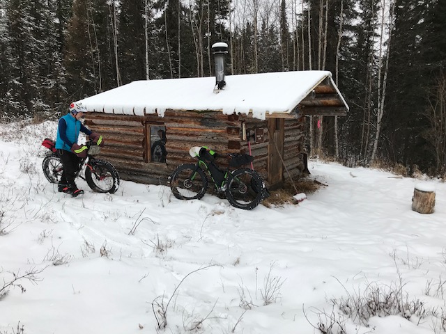
Eric arriving at the Nugget Creek Cabin.
Corrine walking her bike down a section that Eric foolishly tried to ride.
The last mile or so to the cabin had quite a bit of tree-fall.

      The Fairbanks Daily News-Miner recently had a story on the trail: https://tinyurl.com/y53pljbh
      The trail, which begins at mile 38.6 Chena Hot Springs Road, is about 13 miles long and ends at the Nugget Creek Cabin. Previously that cabin had been accessible only via the South Fork Winter Trail or the little-known and difficult Mist Creek Trail. Now the cabin will be accessible year-round. (See more on the cabin at: https://tinyurl.com/y2yuxrg9.) State Parks is partnering with The Folk School Fairbanks to build a new cabin that will be placed near the old cabin, but a little higher on the hillside. The old cabin is slowing sinking and will eventually be torn down, but for a while there should be two cabins available there. The News-Miner also had a story on the cabin project: http://tinyurl.com/y6e4z2vq

      Winter trail users should be aware that the trail has some icy spots about a quarter-mile on either side of the bridge over Mastadon Creek, at about 3 miles.

      One of the challenges for state parks will be to educate motorized users that the trail is for non-motorized use only. The trail is in a section of the recreation area designated for non-motorized use and the funds used to build the trail require that it remain non-motorized. The recreation area has several motorized trails, including the winter-only South Fork Winter Trail, which also accesses the Nugget Creek Cabin. Most other motorized trails are north of Chena Hot Springs Road.
      The addition of the trail adds a new possibility for non-motorized winter users. By connecting the Mastodon Trail and the South Fork and Chena Hot Springs winter trails, a loop of about 30 miles can be created, though it includes a couple of short road sections to connect trailheads. An even longer loop could be made by adding the Stiles Creek Trail.


Monday, September 23, 2019

Caribou Creek Cabin Trip (Nabesna Road, Wrangell-St. Elias National Park and Preserve)

Awesome weekend with Michael Mathers and Sam Bishop. We hiked into the Caribou Creek Cabin off the Nabesna Road in Wrangell St. Elias. The cabin is only 3 miles from the road on a good trail. We spent Sunday doing a circumnavigation of the ridge surrounding the cabin. Awesome weather, awesome views. Absolutely amazing weekend. On the way home we stopped at the Eagle Trail State Recreation Site and hiked to another gorgeous overlook. We live in an incredible state!


The Caribou Creek Trailhead.


The first part of this 3-mile trail is easy peasy. The trail had been damaged by ATV use, so 
the park service is armoring it with gravel.

You cross Caribou Creek after a couple of miles. 


A muddier portion of the trail. 


The cabin sits at brushline in the Caribou Creek valley.

Corrine snuck up behind Sam and gave him a start!

View from the outhouse!

An evening hike was steep! But most everything around the cabin is steep.
(See the ridge behind? We went up that the next morning.)
The next morning we headed up the ridge to the west of the cabin. 
Attaining the ridge-line made things a little easier.
The weather was gorgeous!
Ridge hiking in Alaska is a favored activity!
We eventually stopped for lunch and a rest.
Friends, hiking, and great views! What could be better?!
How about a dose of silliness?!
A flat spot on the ridge.
And then the final descent to the cabin. (See it way down there?)


Saturday, September 14, 2019

Biking the Back Way to Hutlinana Hot Springs


Who knew you could bike to Hutlinana Hot Springs?! I always thought it was a hike through boggy trails or a ski in the winter.  

Our friend Brian told us there was a back way to get in on old mining roads and that it was bikeable. He sent us a GPX track. Eric and I decided to find out if it really was bikeable with a quick overnight micro-adventure.  We left home Saturday afternoon and got home Sunday by dinner time. 

It WAS all bikeable. There were several creek crossings but only 2 that I had to walk. I did walk down and up one steep loose gravelly section but otherwise it was 11 bikeable miles to the hot springs with 1400 feet elevation gain. Great trail, great weather, awesome hot springs. 

Nice four-wheeler trail. Colors a bit past prime but sunny skies both days.

There were some steep areas but all doable, 
even on a loaded bike. This was near the start.

Riding through a burn area

Pushing up a steep section


Bikeable stream crossing

More bikeable stream crossings. We criss-crossed this stream 3 times!


Next to last stream crossing on the way to the hot springs. 
This one was a bit too deep to try and ride. About knee deep. And cold!


Last stream crossing.  You can see the hot springs and it's full of leaves.  I stepped in to warm up my feet immediately after crossing the stream.

After a soak and dinner we went for a hike.  We followed the other trail for a ways and then bushwhacked uphill to get a view.


Nice views from up high but there was some bushwhacking 

I did have a little adventure later that night.  I was sitting in the hot springs alone after dark watching the moon rise and warming up to go to bed. Eric was already in the tent and didn't want to soak one more time.  While I was enjoying my soak, I heard some splashing in the creek.  It was dark so I couldn't see anything but it sounded like something fairly big.  I started yelling thinking it was probably a moose.  Instead a black bear came running out of the creek, literally 5 FEET FROM ME and headed up the hill. He stopped somewhere uphill of me and started growling. I had no idea how close or far he was from me.

And of course I had left the bear spray at the tent! I yelled for Eric and he came, but by then the bear had continued up and over the hill. I felt a little vulnerable sitting naked in a hot spring in the dark with no bear spray!  I grabbed some rocks to throw just in case the bear came back wanting to share the hot springs with me.  Luckily he didn't.  I think the bear was just as startled as I was.  That was pretty much our only wildlife sighting except for lots of grouse.

Nice camp site. I'm walking toward the hot springs pool.

The next morning we woke up to temperatures below freezing.
A bit of frost on everything!

It was a bit chilly crossing the streams in sandals but we quickly warmed up once we started biking. It didn't take too long to get back to our car. Then just 3 hours to get back home.

Eric about to get cold feet crossing the creek

Nice trails for biking

I would totally recommend this bike adventure to anybody wanting a quick get away to an amazing hot springs.  Note - we did have to clean out the hot springs of algae and leaves before soaking.

The white line is the Elliott Highway. We started just up the turnoff to Eureka.